
Refine your search
Sale Section
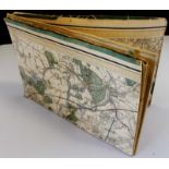
Remove filter- EPHEMERA INCLUDING POSTCARDS, 19TH CENTURY PHOTOGRAPH ALBUMS, ITEMS OF (13)
- MAPS & PRINTS (16)
- MIXED SUBJECT INCLUDING: PERIODICALS, BIBLES AND ANTIQUARIAN MILITARY, (2)
- TRAVEL, TOPOGRAPHY AND LOCAL INTEREST (7)
Estimate
Category
Remove filter- Maps (38)
Filtered by:
- Sale Section,
- Category
- List
- Grid
A subscription to the Price Guide is required to view results for auctions ten days or older. Click here for more information
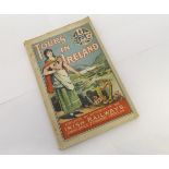

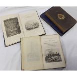
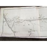
G K TURNHAM: THROUGH ERIN'S ISLE, AN OFFICIAL GUIDE TO ALL PLACES OF INTEREST AND BEAUTY IN IRELAND,
G K TURNHAM: THROUGH ERIN'S ISLE, AN OFFICIAL GUIDE TO ALL PLACES OF INTEREST AND BEAUTY IN IRELAND, Walter Hill for The Irish Railways 1903, fold...
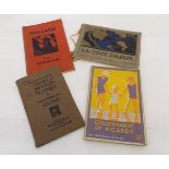
THE SOUTHERN RAILWAY OF ENGLAND (PUB): THE GOLDEN SANDS OF PICARDY... A HOLIDAY GUIDE TO THE NORTH
THE SOUTHERN RAILWAY OF ENGLAND (PUB): THE GOLDEN SANDS OF PICARDY... A HOLIDAY GUIDE TO THE NORTH COAST OF FRANCE INCLUDING PARIS AND THE PRINCIP...
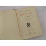
J G BARTHOLOMEW (ED): HANDY REFERENCE ATLAS OF THE WORLD, London, John Walker & Co 1904, original
J G BARTHOLOMEW (ED): HANDY REFERENCE ATLAS OF THE WORLD, London, John Walker & Co 1904, original quarter calf gilt worn, top edges gilt, A/F
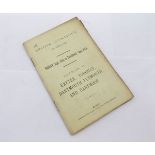
COVER TITLE: BRITISH ASSOCIATION BRISTOL 1898 FRIDAY SEPTEMBER 16TH TO TUESDAY SEPTEMBER 20TH
COVER TITLE: BRITISH ASSOCIATION BRISTOL 1898 FRIDAY SEPTEMBER 16TH TO TUESDAY SEPTEMBER 20TH EXCURSION TO EXETER, TORQUAY, DARTMOUTH, PLYMOUTH, A...
THOMAS DUGDALE: 2 TTLS: ENGLAND AND WALES DELINEATED, L, T Tallis circa 1850, divs 1 and 2, engrd
THOMAS DUGDALE: 2 TTLS: ENGLAND AND WALES DELINEATED, L, T Tallis circa 1850, divs 1 and 2, engrd vig ttls, 29 plts, 14 double pge col'd maps, ori...
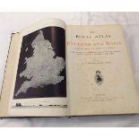
J G BARTHOLOMEW (ED): THE ROYAL ATLAS OF ENGLAND AND WALES REDUCED FROM THE ORDNANCE SURVEY ...,
J G BARTHOLOMEW (ED): THE ROYAL ATLAS OF ENGLAND AND WALES REDUCED FROM THE ORDNANCE SURVEY ..., London, George Newnes, circa 1900, folio original...
THE UNIVERSAL ATLAS, Cassell 1893, fo, hf cf v worn and soiled, inner joints split, + JOHN OGILVY:
THE UNIVERSAL ATLAS, Cassell 1893, fo, hf cf v worn and soiled, inner joints split, + JOHN OGILVY: BRITANNIA..., Alexander Duckham, 1939 facs edn,...
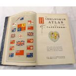
THE HARMSWORTH ATLAS AND GAZETTEER ... FIVE HUNDRED MAPS AND DIAGRAMS IN COLOUR ..., London circa
THE HARMSWORTH ATLAS AND GAZETTEER ... FIVE HUNDRED MAPS AND DIAGRAMS IN COLOUR ..., London circa 1907, folio old half calf gilt worn
J G BARTHOLOMEW, W EAGLE CLARKE AND PERCY H GRIMSHAW: ATLAS OF ZOOGEOGRAPHY, 1911, fo, rebnd two-
J G BARTHOLOMEW, W EAGLE CLARKE AND PERCY H GRIMSHAW: ATLAS OF ZOOGEOGRAPHY, 1911, fo, rebnd two-tone cl
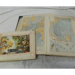
One Box: large quantity vintage folding maps circa 1920s and later
One Box: good quantity vintage folding maps, mainly Ordnance Survey and Bartholomew's

One Box: good quantity vintage folding maps circa Edwardian and later, including Ordnance Survey and
One Box: good quantity vintage folding maps circa Edwardian and later, including Ordnance Survey and Bartholomew's
One Box: good quantity mainly Ordnance Survey War Revision Maps
One Box: assorted Ordnance Survey folding maps, mainly Norfolk
One Box: Ordnance Survey 1" maps circa 1960s
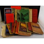
Packet: approx 15 vintage folding maps
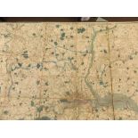
A NEW MAP OF THE COUNTRY 25 MILES AROUND LONDON, PUBLISHED BY J WYLD, SUCCESSOR TO MR FADEN, 1836,
A NEW MAP OF THE COUNTRY 25 MILES AROUND LONDON, PUBLISHED BY J WYLD, SUCCESSOR TO MR FADEN, 1836, folding engraved map 130 x 108cm, 48 sections, ...
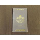
GEOLOGICAL MAP OF SCOTLAND BY ARCHIBALD GEIKIE, John Bartholomew & Co, The Edinburgh Geographical
GEOLOGICAL MAP OF SCOTLAND BY ARCHIBALD GEIKIE, John Bartholomew & Co, The Edinburgh Geographical Institute 1910 2nd edition, folding map, 24 sect...
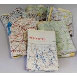
Two 1953 war office colour printed on silk maps, OSLO - STOCKHOLM/STOCKHOLM - RIGA AND AMSTERDAM -
Two 1953 war office colour printed on silk maps, OSLO - STOCKHOLM/STOCKHOLM - RIGA AND AMSTERDAM - HAMBURG - BERLIN; WARSAW/VILMA - MINSK, both "r...
ORDNANCE SURVEY MAP OF SURREY, circa 1840s, 100 x 63cm, folding engraved map, 16 sections, mounted
ORDNANCE SURVEY MAP OF SURREY, circa 1840s, 100 x 63cm, folding engraved map, 16 sections, mounted on linen, contemporary colour, worn
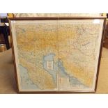
Framed "Escape Map", double sided and depicting Sheet E - Germany Protectorate Slovakia, Poland,
Framed "Escape Map", double sided and depicting Sheet E - Germany Protectorate Slovakia, Poland, Hungary and Sheet F - Croatia, Montenegro, Hungar...
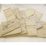
One box 25+ Norwich vell documents circa 1870 - 1909 including 1885 conveyance Lt Col J E J Harvey
One box 25+ Norwich vell documents circa 1870 - 1909 including 1885 conveyance Lt Col J E J Harvey to Joseph Stanley Esq, Thorpe Hamlet and Thorpe...
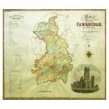
C & J GREENWOOD: MAP OF THE COUNTY OF CAMBRIDGE, engraved hand coloured map 1834, approx 580 x
C & J GREENWOOD: MAP OF THE COUNTY OF CAMBRIDGE, engraved hand coloured map 1834, approx 580 x 720mm, framed and glazed
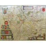
JOHN CARY: A NEW MAP OF SUFFOLK ..., engraved hand coloured map, approx 495 x 535mm, framed and
JOHN CARY: A NEW MAP OF SUFFOLK ..., engraved hand coloured map, approx 495 x 535mm, framed and glazed
BLAEU: BERCHERIA VERNACULE BARKSHIRE, engraved hand coloured map circa 1654, approx 375 x 395mm,
BLAEU: BERCHERIA VERNACULE BARKSHIRE, engraved hand coloured map circa 1654, approx 375 x 395mm, framed and glazed
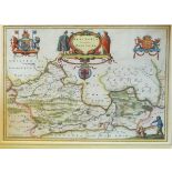
JOAN BLAEU: LEICESTENSIS COMITATUS, engraved hand coloured map circa 1648, approx 375 x 495mm,
JOAN BLAEU: LEICESTENSIS COMITATUS, engraved hand coloured map circa 1648, approx 375 x 495mm, framed and glazed
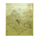
J CARY: A MAP OF LEICESTERSHIRE FROM THE BEST AUTHORITIES, engraved part coloured map circa 1806,
J CARY: A MAP OF LEICESTERSHIRE FROM THE BEST AUTHORITIES, engraved part coloured map circa 1806, approx 480 x 430mm, framed and glazed
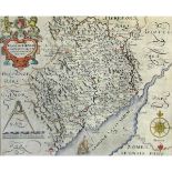
SAXTON/HOLE: MONUMETHENSIS COMITATUS, hand coloured map approx 270 x 330mm, framed and glazed (A/F)
SAXTON/HOLE: MONUMETHENSIS COMITATUS, hand coloured map approx 270 x 330mm, framed and glazed (A/F)
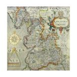
SAXTON/HOLE: LANCASTRIAE COMITATUS, engraved hand coloured map circa 1637, approx 288 x 305mm,
SAXTON/HOLE: LANCASTRIAE COMITATUS, engraved hand coloured map circa 1637, approx 288 x 305mm, framed and glazed
T KITCHIN/J BARBER: ROXBURGSHIRE, engraved hand coloured map, circa 1772, approx 250 x 180mm, framed
T KITCHIN/J BARBER: ROXBURGSHIRE, engraved hand coloured map, circa 1772, approx 250 x 180mm, framed and glazed

P BERTIUS: BURGUNDIE COM, engraved part hand coloured map circa 1584, approx 83 x 122mm, framed
P BERTIUS: BURGUNDIE COM, engraved part hand coloured map circa 1584, approx 83 x 122mm, framed and glazed
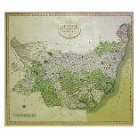
CREIGHTON/WALKER: LEICESTERSHIRE, engraved part coloured map circa 1844, approx 230 x 245mm,
CREIGHTON/WALKER: LEICESTERSHIRE, engraved part coloured map circa 1844, approx 230 x 245mm, framed and glazed
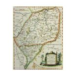
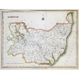
J CARY: A MAP OF SUFFOLK FROM THE BEST AUTHORITIES, engraved hand coloured map circa 1789, approx
J CARY: A MAP OF SUFFOLK FROM THE BEST AUTHORITIES, engraved hand coloured map circa 1789, approx 400 x 410mm, framed and glazed
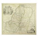
![R MORDEN: SUFFOLK, engraved hand coloured map [1695], approx 355 x 415mm, framed and glazed](https://portal-images.azureedge.net/auctions-2016/srkey10101/images/781f7b98-c6d3-4501-adda-1207ae2b8bd5.jpg?w=155&h=155)
R MORDEN: SUFFOLK, engraved hand coloured map [1695], approx 355 x 415mm, framed and glazed
R MORDEN: SUFFOLK, engraved hand coloured map [1695], approx 355 x 415mm, framed and glazed
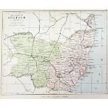
CREIGHTON/WALKER: SUFFOLK, engraved part coloured map circa 1844, approx 225 x 305mm, framed and
CREIGHTON/WALKER: SUFFOLK, engraved part coloured map circa 1844, approx 225 x 305mm, framed and glazed, plus three other engraved Suffolk maps, a...
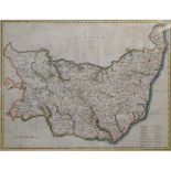
C & J GREENWOOD: MAP OF THE COUNTY OF SUFFOLK, engraved hand coloured map 1831, approx 600 x 700mm, plus seven other Suffolk maps mainly 19th cent...
COVENS & MORTIER: CARTE DE LA TERRE SAINTE ... D'ISRAEL, engraved outline hand coloured map circa
COVENS & MORTIER: CARTE DE LA TERRE SAINTE ... D'ISRAEL, engraved outline hand coloured map circa 1766, stout paper, approx 395 x 462mm
A BELL: PLAN OF THE GREAT CANAL FROM FORTH TO CLYDE WITH THE EXTENSIONS AT BOTH ENDS, engraved
A BELL: PLAN OF THE GREAT CANAL FROM FORTH TO CLYDE WITH THE EXTENSIONS AT BOTH ENDS, engraved plan circa 1767, 2 conjoined sheets, approx 250 x 7...