Refine your search
Filtered by:
- Category,
- Item Type
- List
- Grid
A subscription to the Price Guide is required to view results for auctions ten days or older. Click here for more information
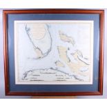

A 19th century map of Bedfordshire, a map of Florida and a print of a Pope, all framed and glazed
A 19th century map of Bedfordshire, a map of Florida and a print of a Pope, all framed and glazed
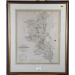
A 19th century hand-coloured map of Buckinghamshire, in strip frame
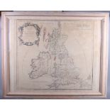
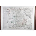
An 18th century hand-coloured map, Britannicae Insulae, dated 1760, in washed strip frame
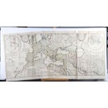
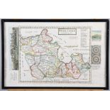
A French late 18th/early 19th century hand-coloured map, Le Royaume D'Angleterre, in oak strip
A French late 18th/early 19th century hand-coloured map, Le Royaume D'Angleterre, in oak strip frame
An 18th century hand-coloured map "An Historical Map of the Roman Empire and the Neighbouring
An 18th century hand-coloured map "An Historical Map of the Roman Empire and the Neighbouring Nations" by William Del Isle, dated 1709, unframed
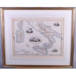
Two hand-coloured maps of Italy, in strip frames, and a 19th century map of Berkshire, in Hogarth
Two hand-coloured maps of Italy, in strip frames, and a 19th century map of Berkshire, in Hogarth frame
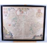
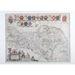
Johannes Janson: a 17th century hand-coloured map, Leicestresis Comitatus cum Rutlandiae, in black
Johannes Janson: a 17th century hand-coloured map, Leicestresis Comitatus cum Rutlandiae, in black frame glazed both sides
Moll: a 17th century hand-coloured map of Berkshire, in strip frame