Filtered by:
- Category
- List
- Grid
A subscription to the Price Guide is required to view results for auctions ten days or older. Click here for more information
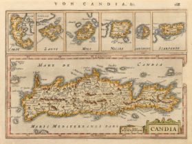

A hand coloured map of Candia (Crete), probably 17th Century, Mercator/Hondius, 6.25" x 8.25" (16
A hand coloured map of Candia (Crete), probably 17th Century, Mercator/Hondius, 6.25" x 8.25" (16 x 21cm), along with a hand-coloured Thomas Gardn...
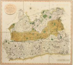
A New Map of Surry by John Cary, hand coloured, linen backed, 20.5" x 23.5" (52 x 60cm).
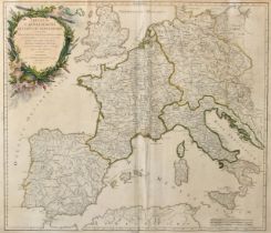
Imperium Caroli Magni Occidentis Imperatoris..., Robert de Vaugondy, an outline-coloured 18th Century map, 19" x 22.5" (48 x 57cm).
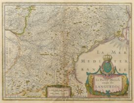
La Partie Meridionale du Languedoc, a hand-coloured 17th Century map, Janssonius, 16" x 20.5" (41
La Partie Meridionale du Languedoc, a hand-coloured 17th Century map, Janssonius, 16" x 20.5" (41 x 52cm).
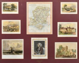
A 19th Century hand colourd engraved map of Hampshire, 8.75" x 6.75", (22.5x17.5cm) surrounded by
A 19th Century hand colourd engraved map of Hampshire, 8.75" x 6.75", (22.5x17.5cm) surrounded by 18th and 19th Century hand coloured views in the...
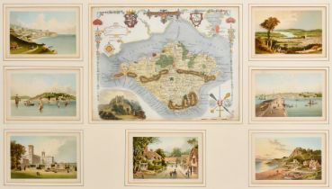
A 19th Century hand colourd engraved map of the Isle of Wight, 8" x 10.5", (20.5x26.5cm) surrounded by 7 lithographic colour views of towns on the...
An 18th Century hand-coloured map of 'Glocester & Monmouth', engraved forJ. Harrison, 15" x 18" (
An 18th Century hand-coloured map of 'Glocester & Monmouth', engraved forJ. Harrison, 15" x 18" (38 x 46cm), an outline coloured map of Suffolk, 7...
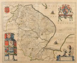
A map of Lincolnshire, sheet size 19.5" x 22.75", (49.5x48cm).
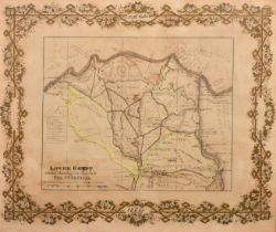
N M Calder, Circa 1882, a map of Lower Egypt and The Suez Canal, ink and watercolour heightened in
N M Calder, Circa 1882, a map of Lower Egypt and The Suez Canal, ink and watercolour heightened in gilt, 13" x 15" (33 x 38cm).
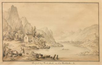
A pair of German views, 'The Island below, Rudera Wohnau, in Lowerzer See' and 'Prospect near
A pair of German views, 'The Island below, Rudera Wohnau, in Lowerzer See' and 'Prospect near Mertischoch, on the Waldstetten lake, ink and wash, ...