Filtered by:
- Creator / Brand
- List
- Grid
A subscription to the Price Guide is required to view results for auctions ten days or older. Click here for more information
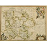

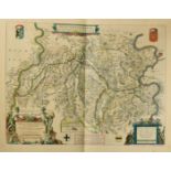
Herefordia Comitatus vernacule Hereford Shire, by Jan Jansson, outline coloured engraving, probably 17th Century, 15" x 20".
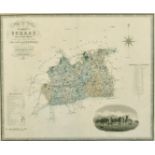
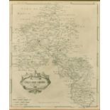
Map of the County of Surrey from an actual survey made in the years 1822 & 1823, published by
Map of the County of Surrey from an actual survey made in the years 1822 & 1823, published by Greenwood & Co, hand coloured engraving, 19th Centur...
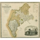
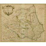
Map of the County of Cumberland from an actual survey made in the years 1821 & 1822, published by
Map of the County of Cumberland from an actual survey made in the years 1821 & 1822, published by Greenwood & Co, hand coloured engraving, 19th Ce...
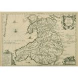
Cambriae typus, Auctore Humfredo Lhuydo, Jan Janssons, engraving, 17th Century, 14" x 19".
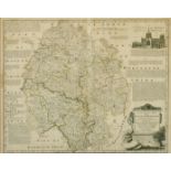
An accurate map of the county of Hereford...., by Emanuel Bowen, outline coloured, engraving, 18th
An accurate map of the county of Hereford...., by Emanuel Bowen, outline coloured, engraving, 18th Century, 17" x 20.5".
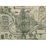
Cestria vulgo Chester, Angliae Civitas, by Braun and Hogenberg, engraving, probably 16th Century,
Cestria vulgo Chester, Angliae Civitas, by Braun and Hogenberg, engraving, probably 16th Century, 12.75" x 17.25".
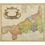
Cornwall, by Robert Morden, hand coloured engraving, 18th Century, 14.75" x 17". ...[more]
The County Palatine of Chester, by Robert Morden, outline coloured, engraving, 18th Century, 14" x
The County Palatine of Chester, by Robert Morden, outline coloured, engraving, 18th Century, 14" x 16.5". ...[more]
Oxfordshire, by Robert Morden, engraving, 18th Century, 17" x 14.25". ...[more]
Episcopatus Dunelmensis, vulgo the Bishoprick of Durham, by Robert Morden, outline coloured, 18th
Episcopatus Dunelmensis, vulgo the Bishoprick of Durham, by Robert Morden, outline coloured, 18th Century, 14.5" x 17".
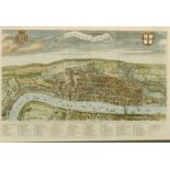
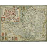
A View of London about the year 1560, by William Maitland, hand coloured engraving, 18th Century,
A View of London about the year 1560, by William Maitland, hand coloured engraving, 18th Century, 12.5" x 19". ...[more]
The Road from London to Chichester, by John Ogilby, sheet 39, hand coloured engraving, 17th Century,
The Road from London to Chichester, by John Ogilby, sheet 39, hand coloured engraving, 17th Century, 14" x 19". ...[more]
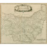
Suffolk, by Robert Morden, engraving, 18th Century, 14.5" x 17". ...[more]
Glocestria Ducatus Vulgo Glocestershire, by Blaeu, hand coloured engraving, 17th Century, 17" x
Glocestria Ducatus Vulgo Glocestershire, by Blaeu, hand coloured engraving, 17th Century, 17" x 20". ...[more]
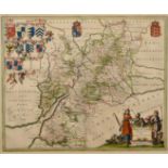
Somerset-Shire Described, by John Speed, hand coloured engraving, 17th Century, 15" x 20".
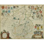
Comitatus Cantabrigiensis; vernacule Cambridgeshire, by Jan Jansson, hand coloured engraving, 17th
Comitatus Cantabrigiensis; vernacule Cambridgeshire, by Jan Jansson, hand coloured engraving, 17th Century, 16.5" x 20".
A group of 4 Kenyan maps published circa 1972 and one other of locations of coal mines in the UK,
A group of 4 Kenyan maps published circa 1972 and one other of locations of coal mines in the UK, rolled. ...[more]
A group of 5 18th Century maps of Ancient European States, published by Laurie and Whittle,
A group of 5 18th Century maps of Ancient European States, published by Laurie and Whittle, outline coloured, 22" x 29.5", rolled.
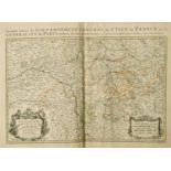
Alexis-Hubert Jaillot, 'Le Gouvernement General de Picardie' and 'Le Gouvernement General de L'
Alexis-Hubert Jaillot, 'Le Gouvernement General de Picardie' and 'Le Gouvernement General de L'Isle de France', two 17th/18th Century outline-colo...
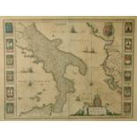
A 17th Century map 'Regno di Napoli', outline coloured, 15" x 19.5", along with 11 other maps, all
A 17th Century map 'Regno di Napoli', outline coloured, 15" x 19.5", along with 11 other maps, all unframed, a/f, (unframed) (12).
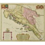
Johannes Blaeu, 'Illyricum Hodiernum Quod Scriptores communiter Sclavoniam', a hand-coloured 17th
Johannes Blaeu, 'Illyricum Hodiernum Quod Scriptores communiter Sclavoniam', a hand-coloured 17th Century map, 21" x 24", (unframed).
'Namurcum Comitatus Auctore Iohann Surhonio', after Blaeu, a 17th Century outline coloured map,
'Namurcum Comitatus Auctore Iohann Surhonio', after Blaeu, a 17th Century outline coloured map, 16" x 20.5", (unframed).
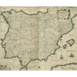
John Speed, 'Spaine', 17th Century, 16" x 21", (unframed).
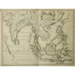
John Speed engraved by F. Lamb, 'A New Map of East India', 17th Century,17.5" x 22", (unframed).
John Speed engraved by F. Lamb, 'A New Map of East India', 17th Century,17.5" x 22", (unframed).
Willem Blaeu, 'Fossa Sanctae Mariae, quae et Eugeniana Dicitur vulgo de Nieuwe Grift', a hand-
Willem Blaeu, 'Fossa Sanctae Mariae, quae et Eugeniana Dicitur vulgo de Nieuwe Grift', a hand-coloured 17th Century map, 15" x 20", (unframed).
Pieter van den Keere, 'Argonautica' published by Jan Jansson, outline coloured 17th Century
Pieter van den Keere, 'Argonautica' published by Jan Jansson, outline coloured 17th Century engraving, 15" x 20", (unframed).
William Blaeu, 'Tabula Castelli ad Sandflitam, qua simul inundati agri, alluviones, fos , alvei,
William Blaeu, 'Tabula Castelli ad Sandflitam, qua simul inundati agri, alluviones, fos , alvei, qu Bergas ad Zomam et Antverpiam interjacent', a ...

Andrea Bolzoni, 'Taviola Geografica del Padovano e Romagna', a hand-coloured 18th Century map, 19" x
Andrea Bolzoni, 'Taviola Geografica del Padovano e Romagna', a hand-coloured 18th Century map, 19" x 14.5", unframed but mounted.

Johannes Blaeu, 'Calatia vulgo Caiazo. Ville du Royaume de Naples', 17th/18th Century, 16.5" x 20.
Johannes Blaeu, 'Calatia vulgo Caiazo. Ville du Royaume de Naples', 17th/18th Century, 16.5" x 20.5", (unframed).

William and Johannes Blaeu, 'Flandriae Teutonicae Pars Orientalior', a hand-coloured 17th Century
William and Johannes Blaeu, 'Flandriae Teutonicae Pars Orientalior', a hand-coloured 17th Century map, 15" x 19.5", (unframed).

Frederik de Wit, 'Zelandiae', a hand-coloured 17th Century map, 18.5" x 21.5", (unframed). ...[more]

A Group of five 19th Century maps of Australia, 3 of them of NSW, 12.5" x 15.5".

William Blaeu, 'La Principaut d'Orange et Comtat de Venaissin', a hand coloured 17th Century map,
William Blaeu, 'La Principaut d'Orange et Comtat de Venaissin', a hand coloured 17th Century map, 15" x 19.5", (unframed).

20th Century, A head study of a young man, pastel, 12" x 16". ...[more]

Ortelius, 'Regni Neapolitani Verissima Secundum Antiquorum et Recentiorum Traditionem Descriptio,
Ortelius, 'Regni Neapolitani Verissima Secundum Antiquorum et Recentiorum Traditionem Descriptio, Pyrrho Ligorio Acut', a hand-coloured map, proba...

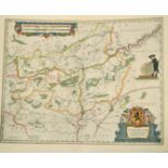
Map of the Empire of Germany, by Delarochette and published by Laurie and Whittle, an outline-
Map of the Empire of Germany, by Delarochette and published by Laurie and Whittle, an outline-coloured two-part wall map, each sheet 21" x 46", (u...

Frederik de Wit, 'Dominii Veneti in Italia, a hand-coloured 17th/18th Century map, trimmed, 19" x
Frederik de Wit, 'Dominii Veneti in Italia, a hand-coloured 17th/18th Century map, trimmed, 19" x 23.5", along with a Frederik de Wit map of Itali...

Moses Pitt, 'Typus Generalis Ukrainae sive Palatinatuum Podoliae, Kioviensis et Braczlaviensis
Moses Pitt, 'Typus Generalis Ukrainae sive Palatinatuum Podoliae, Kioviensis et Braczlaviensis terras nova delineatione exhibens', a hand-coloured...

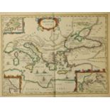
Gerard Mercator, 'Asiae Taprobanam repraesentans ...', plate XII of 'Geography', probably late
Gerard Mercator, 'Asiae Taprobanam repraesentans ...', plate XII of 'Geography', probably late 17th Century, 13.5" x 14", along with 'Indiam Extra...

Bellin, 'Carte de L'Ocean Meridional Dressee pour Servir a l'Histoire Generale des Voyages', outline
Bellin, 'Carte de L'Ocean Meridional Dressee pour Servir a l'Histoire Generale des Voyages', outline coloured 18th Century French map, 13.75" x 18...

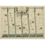
Edmond Halley, 'Nova & Accuratissima Totius Terrarum Orbis Tabula Nautica Variationum Magneticarum
Edmond Halley, 'Nova & Accuratissima Totius Terrarum Orbis Tabula Nautica Variationum Magneticarum Index Juxta Observationes Anno 1700 Habitas Con...

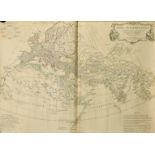
Henry Chatelain, 'Nouveaux Mappemonde ou Globe Terrestre avec des Tables et des Remarques pour
Henry Chatelain, 'Nouveaux Mappemonde ou Globe Terrestre avec des Tables et des Remarques pour Conduire a la Connoissance de la Geographie et de l...

Guillaume Del'Isle, 'Hemisphere meridional pour voir plus distinctement les Terres Australes', a
Guillaume Del'Isle, 'Hemisphere meridional pour voir plus distinctement les Terres Australes', a hand coloured early 18th Century map, 18.75" x 18...

Guillaume Del'Isle, published by Ottens, a pair of maps of the Northern and Southern Hemisphere,
Guillaume Del'Isle, published by Ottens, a pair of maps of the Northern and Southern Hemisphere, hand coloured 18th Century, each 18.5" x 18.5", (...

Will Berry, 'A New Map of the World Projected upon the Poles of the Equator', engraved by Rich, hand
Will Berry, 'A New Map of the World Projected upon the Poles of the Equator', engraved by Rich, hand coloured late 18th Century map, 17" x 18.5", ...

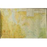
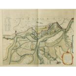
William James Stone, 'Chart of the head of navigation of the Potomac River shewing the route of
William James Stone, 'Chart of the head of navigation of the Potomac River shewing the route of the Alexandria Canal', circa 1838, 24" x 37.5", li...

Battles of Mexico. Survey of the Line of Operations of the U.S. Army under Command of Major
Battles of Mexico. Survey of the Line of Operations of the U.S. Army under Command of Major General Winfield Scott, on the 19th & 20th August & on...

Military Reconnaissance of the Arkansas Rio del Norte and Rio Gila, circa 1848, a panoramic map,
Military Reconnaissance of the Arkansas Rio del Norte and Rio Gila, circa 1848, a panoramic map, lithograph, drawn by Joseph Welch, published by C...
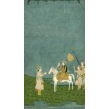
19th Century Indian School, a female figure on a horse with a hawk, 11.5" x 8.5".
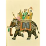
20th Century Indian School, figures on an elephant, mixed media, 7.75" x 5.75".
20th Century Indian School, erotic figures in a walled gun, 20" x 14".

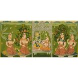
19th Century Indian School, Krishna dancing with his ladies in waiting, 10 x 6.25", unframed.
19th Century Indian School, Krishna dancing with his ladies in waiting, 10 x 6.25", unframed.

School, Krishna and Parvati, 11" x 8", unframed.
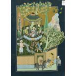
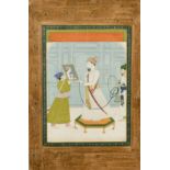
Indian Pahari School of Maharajas at leisure, 6.25" x 4", unframed.
Pahari School, Sri Nath Ji with his maidens, 4.5" x 9", unframed.
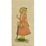
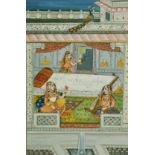
Udaipur School, portrait of Maharaja set within a border of flowers, 12.5" x 9", unframed.
An Indian miniature painting of Guru Hargovindji, 11" x 8". ...[more]
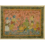
An Early Puri or Rachrajpur School scene from Puranus Mythology, mixed media on linen, 15.25" x 20.
An Early Puri or Rachrajpur School scene from Puranus Mythology, mixed media on linen, 15.25" x 20.25".

M F Hussain, a serigraph of a female figure in three positions, signed and numbered 238/300 in
M F Hussain, a serigraph of a female figure in three positions, signed and numbered 238/300 in pencil, 14" x 20", (unframed).

M F Hussain, a serigraph of dancing figures, signed and numbered 238/300 in pencil, 14" x 20", (
M F Hussain, a serigraph of dancing figures, signed and numbered 238/300 in pencil, 14" x 20", (unframed).