Filtered by:
- Category
- List
- Grid
This auctioneer has chosen to not publish their results. Please contact them directly for any enquiries.

Robert Morden (1650-1703) British. "Hertford Shire", Map, 14.25" x 17.5".
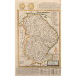
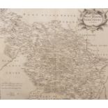
Herman Moll (1654-1732) British. "Lincolnshire", Map, 12.75" x 7.75".
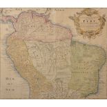
Homanianos Heredes (18th Century) South American. "Tabula Americae Specialis Geographica Regni Peru,
Homanianos Heredes (18th Century) South American. "Tabula Americae Specialis Geographica Regni Peru, Brasilae Terrae Firmae et Reg. Amazonum", Map...
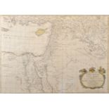
John Blair (1722-1782) British. "Palestinae, Seu Terrae Promissionis in duo de cim Tribus Partitae
John Blair (1722-1782) British. "Palestinae, Seu Terrae Promissionis in duo de cim Tribus Partitae Facies Antiqua", Map, Engraved by Thomas Kitchi...
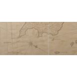
18th Century English School. "A Plan of the East End of the Island of Quibo" (Coiba Island, Panama),
18th Century English School. "A Plan of the East End of the Island of Quibo" (Coiba Island, Panama), Map, 8.5" x 19.5".
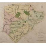
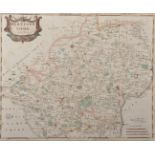
Charles Smith (18th-19th Century) British. "A New Map of the County of Rutland", 1801, Engraved Map,
Charles Smith (18th-19th Century) British. "A New Map of the County of Rutland", 1801, Engraved Map, 17.25" x 19.25".
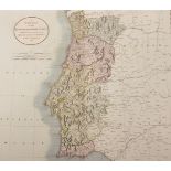
John Cary (1754-1835) British. "A New Map of the Kingdom of Portugal", Map, Unframed, 18" x 20.25".
John Cary (1754-1835) British. "A New Map of the Kingdom of Portugal", Map, Unframed, 18" x 20.25".
Robert Morden (1650-1703) British. "The West Riding of Yorkshire", Map, Unframed, 14" x 16", and
Robert Morden (1650-1703) British. "The West Riding of Yorkshire", Map, Unframed, 14" x 16", and another Map, "The North Riding of Yorkshire", Two...
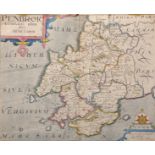
Willem Kip (16th - 17th Century) British. "Penbrok", Map, Unframed, 10.75" x 13.25", and another
Willem Kip (16th - 17th Century) British. "Penbrok", Map, Unframed, 10.75" x 13.25", and another Map, by J Harrison (18th Century) British "Egypt"...
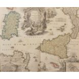
Johann Baptista Homann (1664-1724) German. "Regnorum Sicilliae et Sardiniae", Map, Unframed, 19" x
Johann Baptista Homann (1664-1724) German. "Regnorum Sicilliae et Sardiniae", Map, Unframed, 19" x 22.25".
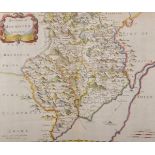
Robert Morden (17th-18th Century) British. "The County of Monmouth", Map, Unframed, 13.5" x 16".
Robert Morden (17th-18th Century) British. "The County of Monmouth", Map, Unframed, 13.5" x 16".
Thomas Kitchen (1718-1784) British. "Middlesex", Map, 7.25" x 7.5" and 20th Century English School. "Pitts Cottage, Westerham, Kent", Photogravure...