Filtered by:
- Category
- List
- Grid
A subscription to the Price Guide is required to view results for auctions ten days or older. Click here for more information
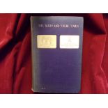

The XIXth and Their times - The 19th Alexandra, Princess of Wales's Own (Yorkshire Regiment) Historical Reference book of the Regiment by; Col Joh...
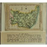
Antique Maps - 1759 Miniature map from 'New and Accurate Maps of Countries of England and Wales',
Antique Maps - 1759 Miniature map from 'New and Accurate Maps of Countries of England and Wales',12cmx8cm,very fine, scarce.
Antique Maps - 1830 Small maps from S.Leighs 'New Atlas of England and Wales,12cmx19cm.
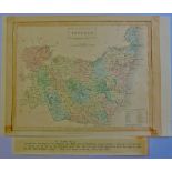
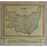
Antique Maps - 1846 Map from 'parliamentary Gazetteer of England and Wales'24cmx19cm, very fine,
Antique Maps - 1846 Map from 'parliamentary Gazetteer of England and Wales'24cmx19cm, very fine, some toning.
Antique Maps - 1834 Map from the 'New British Atlas' very fine. 24cmx19cm.
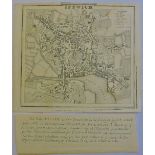
Antique Maps - 1817 Map Ipswich Town, from Excursions in Suffolk' folding crease, very fine.
Antique Maps - 1817 Map Ipswich Town, from Excursions in Suffolk' folding crease, very fine.
Antique Maps - 1818 Map from 'Excursions through Suffolk' very fine, folding crease.
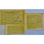
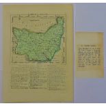
Antique Maps - 1812 map from 'New and Improved County Atlas, 26x18mm, very fine, hundreds listed
Antique Maps - 1812 map from 'New and Improved County Atlas, 26x18mm, very fine, hundreds listed inset.
Antique Maps - 1810 Map from Wallis 'New Edition of the English Counties' miniature, 12cmx14cm,
Antique Maps - 1810 Map from Wallis 'New Edition of the English Counties' miniature, 12cmx14cm,very fine, with excessive misspelling for the perio...
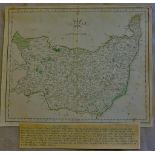
Antique Maps - 1807 Map from 'Universal Magazine' the Laurie and Whittles New and Improved Atlas
Antique Maps - 1807 Map from 'Universal Magazine' the Laurie and Whittles New and Improved Atlas 24cmx18cm very fine, some edge paper toned.
Antique Maps - 1787 Map from English Atlas or Concise View of England and Wales, 13cmx12cm, very
Antique Maps - 1787 Map from English Atlas or Concise View of England and Wales, 13cmx12cm, very fine(page 37)
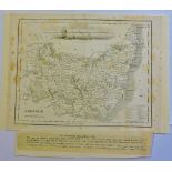
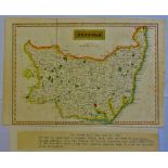
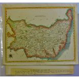
Suffolk 1787-A map of Suffolk by John Cary, from the 'New and Correct Atlas' (26cmx22cm) very fine.
Suffolk 1787-A map of Suffolk by John Cary, from the 'New and Correct Atlas' (26cmx22cm) very fine.
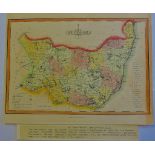
Antique Maps - 1828 Map from 'Encyclopaedia Londinensis' with many misspellings e.g. Hawkstead/
Antique Maps - 1828 Map from 'Encyclopaedia Londinensis' with many misspellings e.g. Hawkstead/Harkstead, Nedham/Needham, Eastrohoel/East Bergholt...
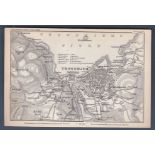
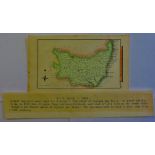
Trondhjems fjord - A map of the Trondhjem area in Norway dated around 1899 Produced by Wagner and
Trondhjems fjord - A map of the Trondhjem area in Norway dated around 1899 Produced by Wagner and Debes, Leipzig.
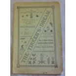
Atkinson Mrs S Phillis "The Tinker's Dream" a ballad rendering an old legend of Swaffham printed &
Atkinson Mrs S Phillis "The Tinker's Dream" a ballad rendering an old legend of Swaffham printed & pub. William Gould Swaffham 1891 ...[more]