Filtered by:
- Category
- List
- Grid
This auctioneer has chosen to not publish their results. Please contact them directly for any enquiries.

Navigational chart; engraved by J & C Walker, new edition published 9th Jan 1915, being British North America Nova Scotia S E Coast C.Sable to Sam...
Navigational chart; engraved by J & C Walker, Large Corrections published 25th October 1929, being North America Nova Scotia S.E. Coast Country Is...
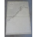
Navigational chart; engraved by Edward Weller, Small Corrections published 1937, being Coast of Labrador, Cape St Charles to Sandwich Bay, compile...
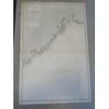
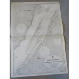
Navigational chart; engraved by J & C Walker, Small Corrections published 1919, being British North America Nova Scotia S.E. Coast, C Sable to Sam...
Navigational chart; engraved by J & C Walker, Small Corrections published 1919, being British North America Nova Scotia S.E. Coast, C Sable to Sam...
Navigational chart; engraved by J & C Walker, new edition published 9th Jan 1917, being North America, Bay of Fundy, East Coast, Pubnico to Yarmou...
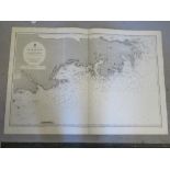
Navigational chart; engraved by J & C Walker, Small Corrections published 1917, being Nova Scotia Gut of Canso compiled from surveys of Captain H ...
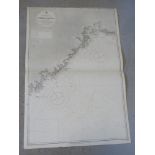
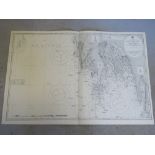
Navigational chart; engraved by J & C Walker, new edition published 1919, being British North America Nova Scotia S.E. Coast Sambro I to C. Canso,...
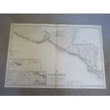
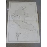
Navigational chart; engraved by Davies & Co, Small Corrections edition published 1925, being Central America West Coast Burica Point to Mangrove B...
Navigational chart; engraved by J & C Walker, new edition published 1915, being North America East Coast Pemaquid Pt to Fletchers Neck, compiled f...
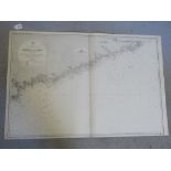
Navigational chart; Small Corrections 1936, being British North America Nova Scotia SE Coast, Sambro I to C.Canso, compiled from surveys of Captai...
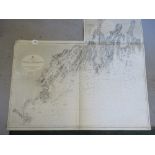
Navigational chart; engraved by Edward Weller, Small Corrections edition published 1924, being Canada River St Lawrence below Quebec Orignaux Poin...
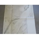
Navigational chart; engraved by Weller and Addison, Corrections published 1926, being Canada River St Lawrence Below Quebec Saguenay River to Camo...
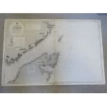
Navigational chart; engraved by J & C Walker, Small Corrections edition published 1923, being Central American Coiva or Quibo Island compiled from...
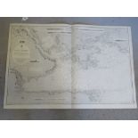
Navigational chart; engraved by Edward Weller, Small Corrections edition published 1930, being West India Islands and Banks between San Salvador a...
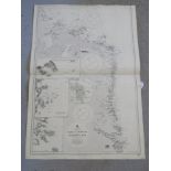
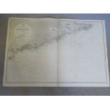
Navigational chart; engraved by Malby & Sons, Small Corrections 1915, being North America North East Coast of Newfoundland approach to Strait of B...
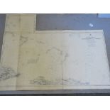
Navigational chart; engraved by J & C Walker, new edition published 18 June 1915, being United States East Coast Delaware River from Cohamsey to P...