Refine your search
Filtered by:
- Sale Section,
- Category
5 items
- List
- Grid
This auctioneer has chosen to not publish their results. Please contact them directly for any enquiries.
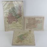

Maps; three printed maps, being Northampton, Northamptonshire, and Essex.
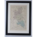
Map; Buckinghamshire reduced from the Ordnance Survey, hand tinted, 50 x 33cm.
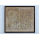
Lot 495
A 17th Century map of Leicester With Its Hundreds by Richard Blome, hand coloured, 32 x 27.5cm.
A 17th Century map of Leicester With Its Hundreds by Richard Blome, hand coloured, 32 x 27.5cm.
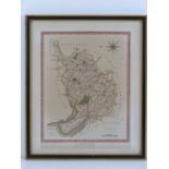
A 19th Century map of Cheshire published by Wilkes, hand coloured, 25 x 19cm.