Filtered by:
- Category,
- Item Type
4 items
- List
- Grid
This auctioneer has chosen to not publish their results. Please contact them directly for any enquiries.
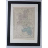

Map; Buckinghamshire reduced from the Ordnance Survey, hand tinted, 50 x 33cm.
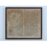
A 17th Century map of Leicester With Its Hundreds by Richard Blome, hand coloured, 32 x 27.5cm.
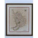
A 19th Century map of Cheshire published by Wilkes, hand coloured, 25 x 19cm.
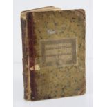
J.C. Russell; Russell's Atlas of Modern Geography c1832, containing twenty-three of the original twenty-five engraved and hand coloured fold-out m...