Refine your search
Filtered by:
- Sale Section
- List
- Grid
This auctioneer has chosen to not publish their results. Please contact them directly for any enquiries.
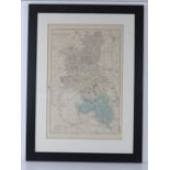

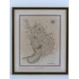
Map; Buckinghamshire reduced from the Ordnance Survey, hand tinted, 50 x 33cm.
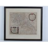
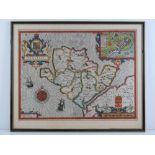
A 17th Century map of Leicester With Its Hundreds by Richard Blome, hand coloured, 32 x 27.5cm.
A 17th Century map of Leicester With Its Hundreds by Richard Blome, hand coloured, 32 x 27.5cm.
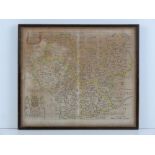
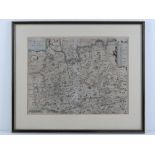
A map of Cheshire by William Tunnicliff, published by Woodman & Mutlow, hand coloured, 38.5 x 30.
A map of Cheshire by William Tunnicliff, published by Woodman & Mutlow, hand coloured, 38.5 x 30.5cm. ...[more]
A 19th Century map of Cheshire published by Wilkes, hand coloured, 25 x 19cm.
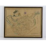
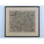
A late 17th/early 18th Century rare map of Northampton With Its Hundreds by Richard Blome, published in Britannia, hand coloured, 32 x 26cm.
A 17th Century map of Surrey by S Norden, printed by W. Kip (believed to be 1637 issue), hand coloured, 37 x 28cm.
A late 16th Century map of Dvnelmensis (Durham) by Christopher Saxton, hand coloured, published by W Kip, 35 x 29.5cm.
A 17th Century county map of Anglesey from 'Theatre of Great Britain' by John Speede, hand coloured,
A 17th Century county map of Anglesey from 'Theatre of Great Britain' by John Speede, hand coloured, published by Thomas Bassett and Richard Chisw...