Filtered by:
- Category,
- Item Type
- List
- Grid
A subscription to the Price Guide is required to view results for auctions ten days or older. Click here for more information
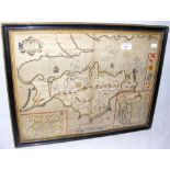

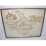
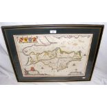
A 17th century John Speed hand-coloured map of the Isle of Wight - double sided with script to reverse - 38cm x 50cm
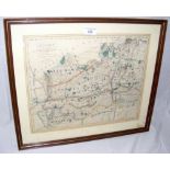
An antique map of Surrey by Walker
An antique map by John Speed of Hampshire with part of the Isle of Wight - 36cm x 48cm
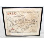
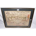
An early Johannes Blaeu hand coloured map of the Isle of Wight - 40cm x 50cm
Early hand coloured map of the Isle of Wight to the Rt Hon Edward Russell Admiral - 46cm x 57cm
Early hand coloured map of the Isle of Wight to the Rt Hon Edward Russell Admiral - 46cm x 57cm
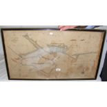
Early hand coloured map/sea chart of the Isle of Wight and Owers by Samuel Thornton - 46cm x 80cm
Early hand coloured map/sea chart of the Isle of Wight and Owers by Samuel Thornton - 46cm x 80cm
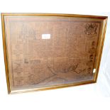
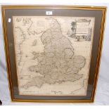
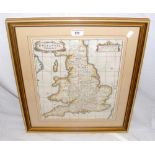
A 1794 hand coloured map by Thomas Kitchin - England and Wales divided into its counties - 62cm x
A 1794 hand coloured map by Thomas Kitchin - England and Wales divided into its counties - 62cm x 52cm
Johannes Blaeu - 17th century hand coloured map of the Isle of Wight with glazed back and scripture - Vectis Insula - 40cm x 50cm
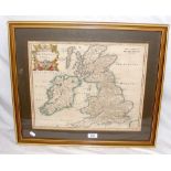
A 1695 hand coloured map by Morden - Britannia Saxonica - 38cm x 30cm
A 1611 John Speed hand coloured Isle of Wight map with glazed back and scripture - 40cm x 52cm
A 1611 John Speed hand coloured Isle of Wight map with glazed back and scripture - 40cm x 52cm
A 1695 Morden hand coloured map "Britannia Romana" - 35cm x 42cm