Filtered by:
- Category,
- Item Type
3 items
- List
- Grid
This auctioneer has chosen to not publish their results. Please contact them directly for any enquiries.

Lot 140
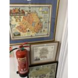
Maps: Framed and glazed, hand coloured map of Wiltshire from a survey which was carried out in
Maps: Framed and glazed, hand coloured map of Wiltshire from a survey which was carried out in 1820 by C & I Greenwood, with an inset of Salisbury...
Lot 141
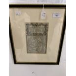
Maps: Wiltshire 18th cent. Copper line engraving on paper by Emanuel Bowen. Originally produced
Maps: Wiltshire 18th cent. Copper line engraving on paper by Emanuel Bowen. Originally produced for the 'Britannia Depicta' (London 1720, and late...
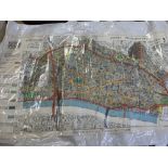
Maps: Town Planning Survey 1943 Corporation of the City of London 'Opportunities and considerations in the redevelopment of the City of London'. P...