Filtered by:
- Sale Section,
- Category,
- Item Type
- List
- Grid
A subscription to the Price Guide is required to view results for auctions ten days or older. Click here for more information

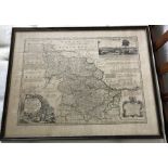
Map of the county of York by Emanual Bowen. 65 x 83cms.
Map of Lincolnshire by Emanual Bowen. 82 x 64cms.
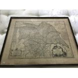
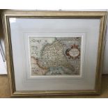
Map of the West Riding of Yorkshire by Emanual Bowen. 64 x 83cms.
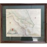
Large framed coloured map of River Humber presented to the Corporation of Trinity House by Captain
Large framed coloured map of River Humber presented to the Corporation of Trinity House by Captain Greenville Collins. 46 h x 58cms w.
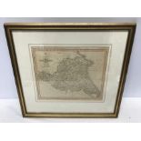
Framed coloured map of Yorkshire, published by Pigot and Co, London. 34 h x 36cms w. Condition
Framed coloured map of Yorkshire, published by Pigot and Co, London. 34 h x 36cms w. Condition ReportSome creasing to bottom center of map. ...[...
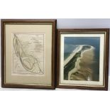
Framed coloured map, Cherry Cobb Sands, Keyingham Marshes, circa 1797, 24 h x 20cms w together
Framed coloured map, Cherry Cobb Sands, Keyingham Marshes, circa 1797, 24 h x 20cms w together with a framed photo, aerial view of Spurn Point. 25...
Framed early map, The road from London to York, drawn and engraved by J Gibson. 19 h x 30cms w.
Framed early map, The road from London to York, drawn and engraved by J Gibson. 19 h x 30cms w. Condition ReportCrease to left side. ...[more]
Framed map East Riding of Yorkshire, hand coloured, John Cary 1793. 23 h x 27cms w.
Framed map, hand coloured, East Riding of Yorkshire, 18thC. 21h x 26cms w.
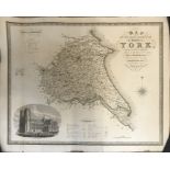
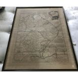
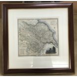
Unframed map of The East Riding County of York, 1831-32 by C Greenwood, published 1834, featuring
Unframed map of The East Riding County of York, 1831-32 by C Greenwood, published 1834, featuring engraving of Beverley Minster, 65 h x 81cms w.
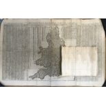
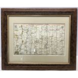
Unframed map of England and Wales, The Travellers Guide or Ogilby's Roads Epitomised, 18thC with
Unframed map of England and Wales, The Travellers Guide or Ogilby's Roads Epitomised, 18thC with table of direct and cross roads, 67 h x 106cms w....
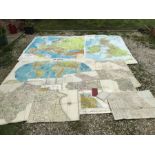
Collection of maps, most cotton backed. Philips large school maps. Europe, Great Britain and
Collection of maps, most cotton backed. Philips large school maps. Europe, Great Britain and World, other maps dated 1817-18 sections of Great Bri...