Filtered by:
- Category,
- Item Type
7 items
- List
- Grid
A subscription to the Price Guide is required to view results for auctions ten days or older. Click here for more information
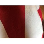

A 19thC Durham quilt, 221cms w x 232cms l approx.
Lot 874
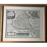
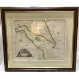
A framed reproduction map of an accurate map of the East Riding of Yorkshire by Emanuel Bowen. 39
874A framed reproduction map of an accurate map of the East Riding of Yorkshire by Emanuel Bowen. 39
A framed reproduction map of an accurate map of the East Riding of Yorkshire by Emanuel Bowen. 39 x 60cms.
Lot 875
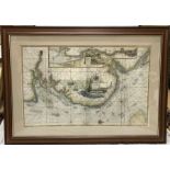
Grenville Collins framed map. The River Thames from London to the buoy of Noure. 60cms h x 95cms w.
Grenville Collins framed map. The River Thames from London to the buoy of Noure. 60cms h x 95cms w.
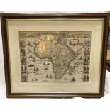
Framed 17thC coloured map, Africa. 42cms h x 55cms w.
Framed 18thC Grenville Collins map of The River Humber. 46cms h x 57cms w.
Lot 878
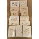
Collection of 13 gilt framed original maps of the World. 26cms h x 34cms w and 35cms h x 25cms w.
878Collection of 13 gilt framed original maps of the World. 26cms h x 34cms w and 35cms h x 25cms w.
Collection of 13 gilt framed original maps of the World. 26cms h x 34cms w and 35cms h x 25cms w.
Lot 879
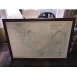
Morecambe Bay map from the latest information in the hydrographic dept to 1968. 70 x 102cms.
Morecambe Bay map from the latest information in the hydrographic dept to 1968. 70 x 102cms.