
Filtered by:
- Sale Section
- List
- Grid
A subscription to the Price Guide is required to view results for auctions ten days or older. Click here for more information
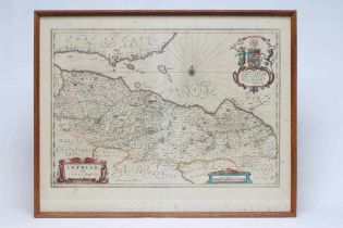

JOHANNES & CORNELIUS BLAEU (16/17th century) "Lothian and Linlitquo", hand coloured map with
JOHANNES & CORNELIUS BLAEU (16/17th century) "Lothian and Linlitquo", hand coloured map with decorative cartouches and scale, text to reverse, pla...
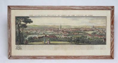
SAMUEL & NATHANIAL BUCK (17/18th century) "The South-East Prospect of Leeds in the County of
SAMUEL & NATHANIAL BUCK (17/18th century) "The South-East Prospect of Leeds in the County of York", coloured engraving with text, plate size 12 1/...
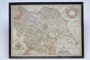
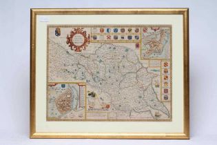
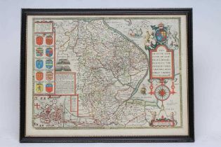
CHRISTOPHER SAXTON (1540-1610) "EBORACENSIS", hand coloured engraved map with decorative cartouches and scale, plate size 20 3/4" x 28 1/22, eboni...
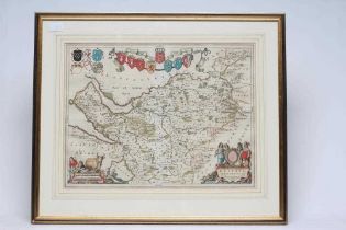
JOHANNES BLAEU (1650-1712) "EBORACENSIS", The North, West and East Ridings, set of three hand
JOHANNES BLAEU (1650-1712) "EBORACENSIS", The North, West and East Ridings, set of three hand coloured map with decorative cartouches, coats of ar...
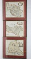
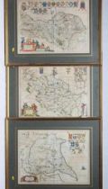
ROBERT MORDEN (c.1650-1703) Yorkshire, North, West and East Ridings, set of three hand coloured maps
ROBERT MORDEN (c.1650-1703) Yorkshire, North, West and East Ridings, set of three hand coloured maps with title cartouche and scale, plate size 14...
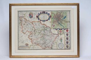
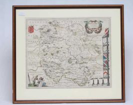
JOHN SPEED (1552-1629) The West Riding of Yorkshire, hand coloured engraved map, 1676 edition,
JOHN SPEED (1552-1629) The West Riding of Yorkshire, hand coloured engraved map, 1676 edition, with plan of York city, coats of arms and figural s...
JOHN SPEED (1552-1629) Westmorland, hand coloured engraved map, 1614/27(?) edition, with plan of
JOHN SPEED (1552-1629) Westmorland, hand coloured engraved map, 1614/27(?) edition, with plan of Kendal town, coats of arms and scale, plate size ...
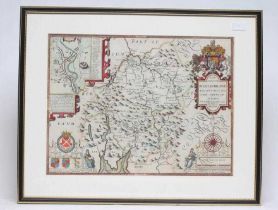
JOHN SPEED (1552-1629) The North and East Ridings of Yorkshire, hand coloured engraved map 1676
JOHN SPEED (1552-1629) The North and East Ridings of Yorkshire, hand coloured engraved map 1676 edition, with plans of Hull and Richmond towns, co...
JOHN SPEED (1552-1629) Lincolnshire, hand coloured engraved map, 1676 edition, with plan of Lincoln,
JOHN SPEED (1552-1629) Lincolnshire, hand coloured engraved map, 1676 edition, with plan of Lincoln, coats of arms and figural scale, text to reve...
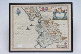
JOHANNES BLAEU (1650-1712) "Lancastria", hand coloured engraved map, 1667 edition, with figural
JOHANNES BLAEU (1650-1712) "Lancastria", hand coloured engraved map, 1667 edition, with figural title catrouche and scale, text to reverse, plate ...
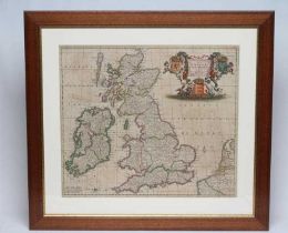
THEODORE DANCKERTS (c.1600-1717/27) England, Scotland and Ireland, hand coloured engraved map,
THEODORE DANCKERTS (c.1600-1717/27) England, Scotland and Ireland, hand coloured engraved map, 1690 edition, with figural title cartouche, plate s...
SAXON AND HOLE 16/17th CENTURY, YORKSHIRE WEST RIDING, hand coloured engraved map, 1610 edition,
SAXON AND HOLE 16/17th CENTURY, YORKSHIRE WEST RIDING, hand coloured engraved map, 1610 edition, 10 1/4" x 12 3/4", together with North (uncoloure...
JOHANNES BLAEU (1650-1712) Cheshire, hand coloured engraved map, 1662 edition, with coats of arms
JOHANNES BLAEU (1650-1712) Cheshire, hand coloured engraved map, 1662 edition, with coats of arms and figural title cartouche and scale, text to r...
JOHANNES BLAEU (1650-1712) Herefordshire, hand coloured engraved map, 1645/62 edition, with title
JOHANNES BLAEU (1650-1712) Herefordshire, hand coloured engraved map, 1645/62 edition, with title cartouche, coats of arms and figural scale, text...
JOHN OGILBY (1600-1676) York to Scarborough/Whitby, engraved map, ribbon form, c.1675, hand coloured, plate size 12 3/4" x 17 1/2", together with ...

JOHANNES BLAEU (1650-1712) Isle of Man, hand coloured engraved map, 1645/72 edition, with title
JOHANNES BLAEU (1650-1712) Isle of Man, hand coloured engraved map, 1645/72 edition, with title cartouche and coat of arms, text to reverse, plate...

MARTIN S.D., (early 19th century) Map of The County extending Ten Miles around Leeds, including
MARTIN S.D., (early 19th century) Map of The County extending Ten Miles around Leeds, including Wakefield, Bradford, Dewsbury, Otley…showing all t...
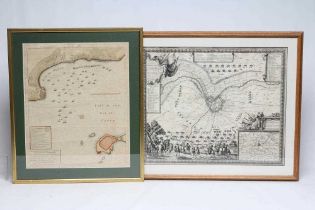
JOHN HARRISON, 18th century, Map of Bay Of Bulls Cadiz, (Showing fleet manoeuvres during the War
JOHN HARRISON, 18th century, Map of Bay Of Bulls Cadiz, (Showing fleet manoeuvres during the War of the Spanish Succession 1702) hand coloured eng...