Filtered by:
- Category,
- Item Type
- List
- Grid
A subscription to the Price Guide is required to view results for auctions ten days or older. Click here for more information

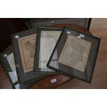
Three modern facsimile maps (Saxton & Kip Staffordshire; Mercator's British Isles; John Speed
Three modern facsimile maps (Saxton & Kip Staffordshire; Mercator's British Isles; John Speed Northumberland), framed (3) ...[more]
Early 18th century silk map, 'Kitchin's Enlarged map of the Roads of England and Wales' in antique
Early 18th century silk map, 'Kitchin's Enlarged map of the Roads of England and Wales' in antique gilt frame, glazed along with a collection of f...
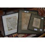
A collection of five printed maps of English Counties
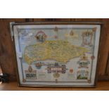
An antique map of Derbyshire from Bowen and Kitchen's 'Large English Atlas' c.1780, framed and
An antique map of Derbyshire from Bowen and Kitchen's 'Large English Atlas' c.1780, framed and glazed, 70 x 56 cm, some folding marks and peripher...
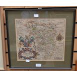
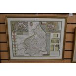
An Early 17th Century Saxton and Hole 'Universi Derbiensis Comitatus' by William Hole of Derbyshire,
An Early 17th Century Saxton and Hole 'Universi Derbiensis Comitatus' by William Hole of Derbyshire, hand-coloured, in good condition, framed and ...
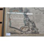
A late 18th/ Early 19th Century engraving of Derbyshire by John Cary 15 x 10cm along with ann
A late 18th/ Early 19th Century engraving of Derbyshire by John Cary 15 x 10cm along with ann 18th Century county map of Derbyshire with a decora...
A group of six maps, five of which are framed and glazed, comprising: an early 19th Century
A group of six maps, five of which are framed and glazed, comprising: an early 19th Century Greenwood map of Derbyshire by J and C Walker with key...
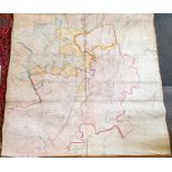
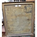
Large Victorian map of Rocester in Staffordshire, published by Ordnance Survey, 1882, hand-coloured,
Large Victorian map of Rocester in Staffordshire, published by Ordnance Survey, 1882, hand-coloured, linen-backed, with wooden hanging supports. 2...