Filtered by:
- Category,
- Item Type
- List
- Grid
A subscription to the Price Guide is required to view results for auctions ten days or older. Click here for more information
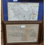

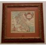
A small quantity of Framed maps
A small quantity of Framed maps
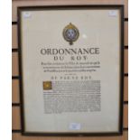
A framed copy of the Ordnance Du Roy, 1684, signed by Louis the Fourteenth ...[more]
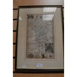
Collection of seven antique maps of Derbyshire, 17th to 19th century, including Van Den Keere,
Collection of seven antique maps of Derbyshire, 17th to 19th century, including Van Den Keere, Thomas Moule, Herman Moll, Owen & Bowen, all framed...
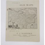
A catalogue of old maps offered for sale by P J Radford c1930s, and a map of Huntingdonshire
A catalogue of old maps offered for sale by P J Radford c1930s, and a map of Huntingdonshire taken from th Magna Britannia (folio double sheet). ...
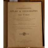
Comprehensive Atlas and Geography of the World, London; Blackie & Son, 1882, folio, publishers
Comprehensive Atlas and Geography of the World, London; Blackie & Son, 1882, folio, publishers half crushed Morocco ...[more]
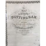
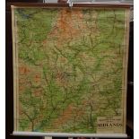
A scarce large-scale map of Nottingham by George Sanderson, engraved by J. & C. Walker, published 15
A scarce large-scale map of Nottingham by George Sanderson, engraved by J. & C. Walker, published 15 February 1836. Issued in four sheets, measuri...
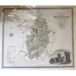
Collection of three antique maps of Nottingham: A New Map of Nottinghamshire, published by Henry
Collection of three antique maps of Nottingham: A New Map of Nottinghamshire, published by Henry Overton, 1714, with inset town plan of Nottingham...
17th-century map of Buckinghamshire, Saxton & Hole, hand-coloured copper engraving on laid paper,
17th-century map of Buckinghamshire, Saxton & Hole, hand-coloured copper engraving on laid paper, together with an engraved architectural view of ...