Filtered by:
- Sale Section,
- Item Type
- List
- Grid
A subscription to the Price Guide is required to view results for auctions ten days or older. Click here for more information

A mid 19th Century coloured map of Holland, published by John Tallis (with Harrods provenance)
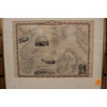
19th Century hand coloured steel engraved map of islands in the Indian Ocean by Winkles of Rapkin,
19th Century hand coloured steel engraved map of islands in the Indian Ocean by Winkles of Rapkin, featuring inset topographical views.
Collection of three framed antique maps: Jean Janvier 18th-century map of the southern part of the
Collection of three framed antique maps: Jean Janvier 18th-century map of the southern part of the Low Countries, an 18th-century map of Belgium (...
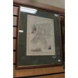
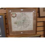
after Robert Morden Late 17th Century "DarbyShire"coloured engraved framed map, 27 x 34cm
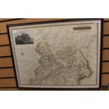
Robert Morden, hand colour copper engraving depicting Warwickshire, 1695 or later (1)
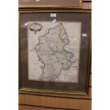
Robert Morden, hand colour copper engraving depicting Staffordshire, 1695 or later
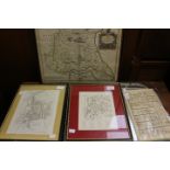
Early prints and original city plans of Leicester, Chester (ex Nichols) and a Nathaniel Palmer coaching map and map of East Riding - Robert Morden...
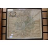
Morden, Robert (1650-1703).
Morden, Robert (1650-1703). Map of Warwickshire, hand-coloured copper engraving on laid/chain-lined paper [1695 or later], age toning, unexamined ...
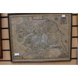
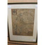
Speed, John (1552-1629).
Speed, John (1552-1629). Map of Yorkshire, Sudbury & Humble, age toning, unexamined out of frame, 40.5cm by 52cm ...[more]
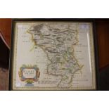
![Morden, Robert (1650-1703), map of Derbyshire [1695 or later],](https://portal-images.azureedge.net/auctions-2019/hanson10174/images/52c45f7a-0ff2-459c-b14d-a9f200fc40f5.jpg?w=155&h=155)
Morden, Robert (1650-1703), map of Derbyshire [1695 or later], hand-coloured copper engraving on laid paper, framed, 36cm by 43cm
Collection of maps: The Oarsman's and Angler's Map of the River Thames, Edward Stanford (lithographic folding map in buckram boards with publisher...