Refine your search
Lots with images only
Remove filter
Sale Section
Remove filter- Maps and Documents (7)
Estimate
Category
Filtered by:
- Lots with images only,
- Sale Section,
- Item Type
7 items
- List
- Grid
A subscription to the Price Guide is required to view results for auctions ten days or older. Click here for more information

Lot 2414
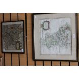
A Christopher Saxton, 1540-1610, map of Lanstriae (Lancashire) together with a Robert Morden,
A Christopher Saxton, 1540-1610, map of Lanstriae (Lancashire) together with a Robert Morden, 1650-1703 map of Darbyshire (Derbyshire)
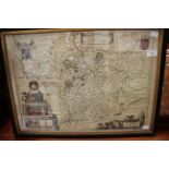
An 18th Century map of Leicestershire
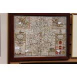
A framed and glazed map, John Speede dated 1610, the country of Warwickshire and Oxfordshire
Lot 2512
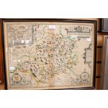
Eighteen antique maps, mainly 18th century. All framed & glazed, some glazed to verso of frame.
Eighteen antique maps, mainly 18th century. All framed & glazed, some glazed to verso of frame. Emanuel Bowen, J. Ellis, Thomas Moule, John Cary, ...
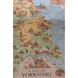
Railway poster, pictorial map of Yorkshire, Estra Clarke 1949. Produced by British Railways, published by the Railway Executive (Eastern and North...