Refine your search
Filtered by:
- Category,
- Item Type
- List
- Grid
A subscription to the Price Guide is required to view results for auctions ten days or older. Click here for more information
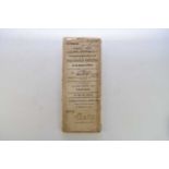

PARTICULARS OF SALE OF ESTATES in the parishes of Westbury, Pontesbury, Longdon, Bicton, Meole Brace, St Chad's and St Julian's in or near the tow...
ROBERT MORDEN, County maps circa 1695. Beds, Bucks, Chester, Cornwall, Cumberland, Derbys, Devon, Durham (2), Glos, Hants, Hereford, Herts, Huntin...
RICHARD BLOME, Map of the Holy land 1687; a French map of the Holy Land by Nicolas de Fer, 1705; Kitchen's map of the Roads of England and Wales 1...
SAXTON, Christopher and William Hole, Caernarvo (Caernarvonshire) circa 1607, 260mm x 315mm, hand coloured, framed and glazed ...[more]
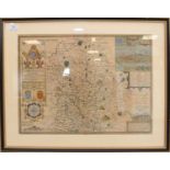
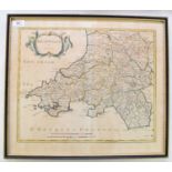
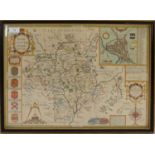
SPEED, John, Map of Shropshire. Bassett & Chiswell, 1676, 350mm x 510mm. Hand-coloured, English text to verso, glazed both sides. With Shropshire ...
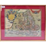
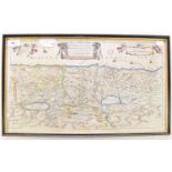
LHUYD, Humphrey, of Denbigh, map of England and Wales, 1573, 375mm x 470mm, hand-coloured, framed and glazed ...[more]
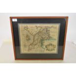
SPEED, John, Map of Devonshire, Sudburi and Humble, 1614 or later. 380mm x 510mm, English text to verso. Hand-coloured, unframed ...[more]
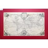
BOWEN, Emanuel, A New and Accurate Map of All The Known World, c1764, 315mm x 540mm; KITCHEN, Thomas, A Chart of The Globe, 285mm x 440mm, and a M...
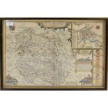
SPEED, John, Map of Worcestershire, Bassett & Chiswell, 1676. 380mm x 510mm, hand-coloured. English text to verso, framed and glazed ...[more]
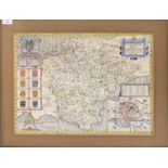
SPEED, John, Map of Herefordshire, Sudbury & Humbell, 1676 or later, 380mm x 510mm, hand-coloured. English text to verso. Framed and glazed ...[m...
WEM RURAL DISTRICT COUNCIL. Very large map of Wem and Whitchurch. 277cm x 220cm (nearly 9 feet by 7 feet), circa 1920s on a scale of 6 inches to t...
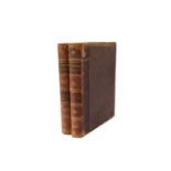
MORSE, Jedidiah, The American Geography; or a view of the Present Situation of the United States of
MORSE, Jedidiah, The American Geography; or a view of the Present Situation of the United States of America, Elizabeth Town, New Jersey, first edi...
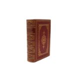
BOWDLER, Thomas. The Family Shakespeare, 1861. Full red morocco gilt, out of its covers. With RUSKIN, John, Roadside Songs of Tuscany, 4to, George...
PICTURESQUE EUROPE. The British Isles. 4to, Cassell circa 1870, 2 vols, worn half morocco (2) ...[more]
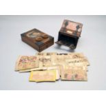
Two late Victorian 3D viewers, walnut construction (both at fault) together with a collection of 3D cards, mostly topographical. ...[more]
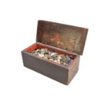
A large assembled collection of 19th and early 20th century buttons to a wooden box, including buckles and a small amount of military examples. ....