Filtered by:
- Category,
- Item Type
- List
- Grid
A subscription to the Price Guide is required to view results for auctions ten days or older. Click here for more information

ORDNANCE SURVEY and other maps (box)
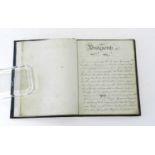
BRIDGNORTH MANUSCRIPT. Small 4to. Manuscript copy of the Bridgnorth and Wenlock parts of the Shropshire section of Thomas Cox's Magna Britannia, 1...
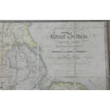
LARGE CANAL, RAILROAD and MINERAL MAP. Map of the Inland Navigation, Canals & Rail Roads with the
LARGE CANAL, RAILROAD and MINERAL MAP. Map of the Inland Navigation, Canals & Rail Roads with the situation of the various mineral productions thr...
CARY, John, A Map of North Wales from the Best Authorities, c. 1820, 400mm x 470mm, hand coloured,
CARY, John, A Map of North Wales from the Best Authorities, c. 1820, 400mm x 470mm, hand coloured, framed and glazed. ...[more]
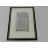
LEAF FROM AN EARLY GERMAN BOOK, late 16th or early 17th century. Small folio, black letter with
LEAF FROM AN EARLY GERMAN BOOK, late 16th or early 17th century. Small folio, black letter with woodcuts, framed and glazed to show both sides. Wi...
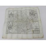
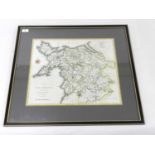
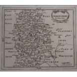
SPEED, JOHN & Henry Overton, Map of Shropshire c1715 with roads added, 380mm x 495mm. Several folds
SPEED, JOHN & Henry Overton, Map of Shropshire c1715 with roads added, 380mm x 495mm. Several folds ...[more]
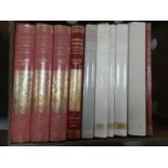
VCH CAMBRIDGE & the Isle of Ely, vols 1-9 with index to vols 1-4. Ex-library (10) (box) ...[more]
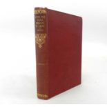
BURNE, Lieutenant, RN, With the Naval Brigade in Natal, 1899-1900. 1902. Publisher's red cloth
BURNE, Lieutenant, RN, With the Naval Brigade in Natal, 1899-1900. 1902. Publisher's red cloth gilt. ...[more]
A group of maps of Shropshire and Cheshire to include; John Seller map of Shropshire, measurements 13 x 14.5 cm (2), J Cowley An Improved map of S...
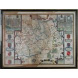
John Speed Map of Surrey 41 x 53 cm (SH), frame 44 x 57 cmPreviously sold at Thomas Bassett and Richard Chiswell 1975- original newspaper clipping...