Filtered by:
- Category,
- Item Type
- List
- Grid
A subscription to the Price Guide is required to view results for auctions ten days or older. Click here for more information
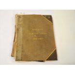

BETTS, John, Family Atlas. Folio 1852, corrected to January 1854. With circa 50 hand colour maps.
BETTS, John, Family Atlas. Folio 1852, corrected to January 1854. With circa 50 hand colour maps. Binding poor, sold with all faults.
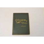
DOYLE, Richard, In Fairyland. Folio, 2nd edition 1875. With 16 plates, a few with marginal tears,
DOYLE, Richard, In Fairyland. Folio, 2nd edition 1875. With 16 plates, a few with marginal tears, one with a long tear. Neatly recased
John speed maps
John Speed, Map of Denbighshire, hand coloured engraving, 38 x 50cm (PL), together with a 19th century map of Shropshire (2)
Collection of seven maps of Shropshire to include a road map from London to Shrewsbury and a 17th
Collection of seven maps of Shropshire to include a road map from London to Shrewsbury and a 17th century map of the county by Petrus Kaerius (7)
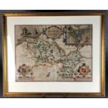
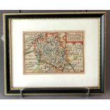
John Speed, map of Shropshire
John Speed, Map of Shropshire, hand coloured engraving, 38 x 51cm (PL)
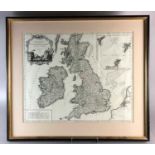
Collection of maps
After Robert De Vaugondy, Les Isles Britanniques, engraving, 48 x 58cm (PL), together with a further map after the same hand, a map of Chester by ...
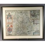
John Speed, Bedfordshire, map
John Speed, Map of Bedfordshire, hand coloured engraving, 39 x 50cm
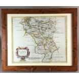
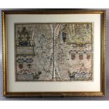
Robert Morden map
Robert Morden, Map of Derbyshire, hand coloured engraving, 36 x 41cm (PL)