Refine your search
Sale Section
- 19th/20th Century Prints (22)
- Affordable Paintings Prints Miniatures and Maps (23)
- Bijouterie (3)
- Collectables (10)
- Contemporary Oils (1)
- Continental Oils (3)
- Continental Watercolours (41)
- Figurative Watercolours (8)
- Jewellery Watches and Coins (39)
- Landscape Oils (16)
- Landscape Watercolours (73)
- Low value silver (61)
- lower value jewellery (79)
- Maps and printed plates (25)
- Medal (17)
- Miniatures (10)
- Old Master and Early English Oils (15)
- Prints (27)
- Silver (12)
- Sporting Oils (6)
- Sporting Watercolours (5)
- Still Life Oils (4)
- Watches (45)
Estimate
Category
- Coins (110)
- Fine Art & Antiques (96)
- Watercolours (85)
- Oil, Acrylic paintings & Mixed Media (84)
- Jewellery (82)
- Prints (62)
- Silver & Silver-plated items (55)
- Watches & Watch accessories (27)
- Maps (25)
- Arms, Armour & Militaria (10)
- Collectables (6)
- Drawings & Pastels (6)
- Photographs (3)
- Bank notes (2)
- Kitchenalia (2)
- Ceramics (1)
- Furniture (1)
- Glassware (1)
- Greek, Roman, Egyptian & Other Antiquities (1)
- Sporting Memorabilia & Equipment (1)
- Stamps (1)
- Taxidermy & Natural History (1)
- Writing Instruments (1)
Filtered by:
- Item Type
- List
- Grid
A subscription to the Price Guide is required to view results for auctions ten days or older. Click here for more information
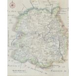

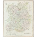
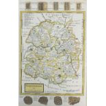
Rocque (John) Map of Shropshire, a plate from the Small British Atlas, 1753, reissued 1769, engraving, 20 x 16.5cm (SH)together with two maps of S...
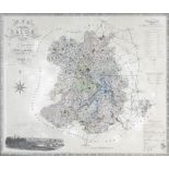
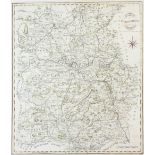
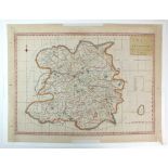
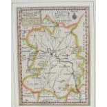
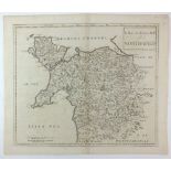
Greenwood and Co Map of the County of Salop from an actual survey made in the years 1826 and 1827,
Greenwood and Co Map of the County of Salop from an actual survey made in the years 1826 and 1827, published by Greenwood and co, London, Feb 24th...
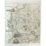
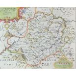
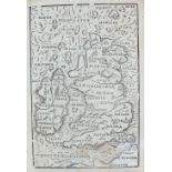
Hole (William) Salopie 1610, Engraving, 27.5 x 34cm, together with 'A General Mapp of Shropshire' by Richard Blome, engraving, both unframed (2)
Blaeu (J) Comitatus Salopiensis Anglice Shropshire 1645, text from Camdens Britannia on reverse,
Blaeu (J)Comitatus Salopiensis Anglice Shropshire 1645, text from Camdens Britannia on reverse, engraving, unframed, 38.5 x 50cm (PL)
Jansson J/ Schenk and Valk Salopiensis Comitatus cum Staffordiensi, engraving, unframed, 41.
Jansson J/ Schenk and ValkSalopiensis Comitatus cum Staffordiensi, engraving, unframed, 41.5 x 51cm (PL)
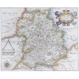
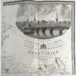
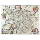
Bowen (Emmanuel) An accurate map of Shropshire divided into hundreds, circa 1765, reprint of first edition of 'Large English Atlas' 1751, engravin...
Bowen (Thomas) London to Shrewsbury and Welshpool in Montgomery, road map, published in the Gentleman's Magazine 1765-1775, engraving, unframed, 1...
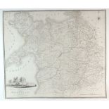
Cary (John) A map of Shropshire from the West Authorities, 1805, engraving, unframed, 50 x 43cm (PL)together with 'A New Map of Shropshire, Divide...
Rowe (R) Shropshire, engraving, 46 x 36cm (SH) together with a map of Shropshire bu S.Hall, a plan of the Ellesmere Canal by I Muslow, a map of Sh...
Rocque (John) Map of Salop, printed in 4 sheets, 1752, inscribed: 'To his Royal Highness George Prince of Wales & c. This Actual Survey of the Cou...
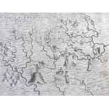
Drayton (Michael) The Parte of Shropshyre on the West of the Severne (song 8) and Parte of Shropshyre on the East of the Severne (song 12), 1612, ...
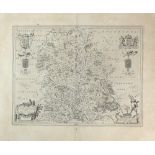
Morden (Robert) Map of Shropshire, 1722, engraving, unframed, 39.5 x 45cm (PL), together with an unframed 1708 map of Shropshire by Robert Morden ...
A collection of unframed engraved maps of Shropshire: H.Moll, Shropshire 1724, T.Hutchison, A Correct Map of Shropshire 1748, J.Cary, Shropshire 1...
Haywood A Map of Shropshire Engraved From an Actual Survey with Improvements, 1788/92, engraving,
HaywoodA Map of Shropshire Engraved From an Actual Survey with Improvements, 1788/92, engraving, unframed, 34 x 48cm (PL)together with 'A Map of t...
Dawson (Lt.R.
Dawson (Lt.R.K)A collection of four maps of Oswestry, Shropshire, Bridgnorth and Shrewsbury, unframed, various sizes, and a map of Ludlow after R....
Bill (J) Shropshire, 1626,
Bill (J)Shropshire, 1626, a rare map from an atlas printed only once and the earliest map of the county to show latitude and longitude, engraving,...
Seller (John)Map of Shropshire 1695, engraving, unframed, 12.5 x 15cm (PL), together with another unframed map of Shropshire 1695/1703 by John Sel...
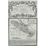
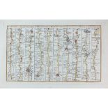
Bowen and Owen Shrewsbury to Holwell, small road strip map with Flintshire on the reverse, engraving, unframed, 19.5 x 13cm (SH), together with a ...
A Collection of unframed engraved Shropshire maps: Shropshire 1803/6 by J Luffman, Shropshire 1808 by G.Cole, Sjropshire 1816 by G.Cole, langley's...
Bowen (Eman) An Accurate Map of Shropshire Divided into its Hundreds 1760, engraving laid in linen,
Bowen (Eman) An Accurate Map of Shropshire Divided into its Hundreds 1760, engraving laid in linen, unframed in slip case, 54 x 72cm (SH)
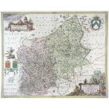
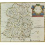
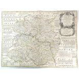
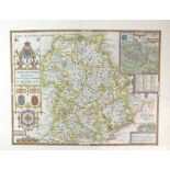
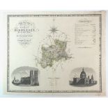
Baugh (Robert) Map of Shropshire 1808, with an engraved view and dedication to 'The Right Honourable Edward Earl of Powys, Lord Lieutenant and Cus...
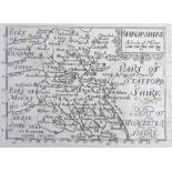
Overton (Henry) after Speed (John) Shropshire Described The Situation of Shrowsbury Shewed with
Overton (Henry) after Speed (John) Shropshire Described The Situation of Shrowsbury Shewed with the Armes of thos Earles, and other Memorable thin...
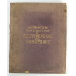
Bacon's New Survey Map of Staffordshire and Shropshire, laid on linen, 114 x 90cm (SH)
Saxton (Christopher) and Kip (William) Montgomery, 1610, engraving, 26 x 32cm (SH)
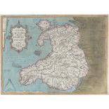
Llwyd (Humphrey) Map of Wales, 1574, text on reverse, engraving, 37.5 x 50cm
Morden (Robert) Britannia Romana for Camden's Britannia 1695, engraving, 36 42.5cm (I)
Mercator G, 1609Westmorlandia, Lancastria, Cestria, Caernarvan, Denbigh, Flint, Merionidh, Montgomery, Salopia, cum insulis Mania et Anglsey, engr...
Hole (William) circa 1610 Engalond Anglia Anglosaxonum Heptarchia, engraved for Camden's Britannia,
Hole (William) circa 1610 Engalond Anglia Anglosaxonum Heptarchia, engraved for Camden's Britannia, engraving, unframed, 28.5 x 33cm (SH)
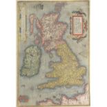
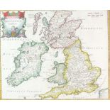
Ortelius (Abraham) Anglia, Scotia et Hibernia, sive Britannicar: Insurlarium Descripto, 1589,
Ortelius (Abraham) Anglia, Scotia et Hibernia, sive Britannicar: Insurlarium Descripto, 1589, engraving, unframed, 34.5 x 50cm (PL)
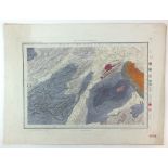
Colby (Lt-Col) RE A collection of five geological survey maps of Shropshire and suronding areas,
Colby (Lt-Col) REA collection of five geological survey maps of Shropshire and suronding areas, published at the ordance map office, Tower of Lond...
Cary (John)A New Map of the Principality of Wales Divided into Counties, 1811, engraving, unframed, 54 x 63.5cm (2)
Morden (Robert) A New and Correct map of North Wales, engraving, unframed,37 x 44cm (PL)
Blome (Richard) A General Mapp of North Wales wherein are county of Montgomery, Merioneth, Denbigh,
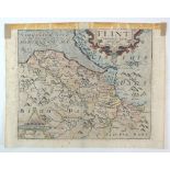
Blome (Richard)A General Mapp of North Wales wherein are county of Montgomery, Merioneth, Denbigh, FFlint, Carnarvan & Isle of Anglesey, 1673, eng...
William Kip after Christopher Saxton Cardigan Comitatus pars olim Dimetarum, engraving, unframed,
William Kip after Christopher Saxton Cardigan Comitatus pars olim Dimetarum, engraving, unframed, 27 x 32cm (PL) together with Flint Comitatus que...
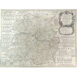
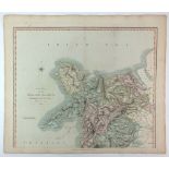
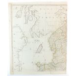
C and I Greenwood Map of the County of Middlesex from an actual survey made in the years 1819 and
C and I Greenwood Map of the County of Middlesex from an actual survey made in the years 1819 and 1820, engraving, unframed, 57 x 71cm (SH)
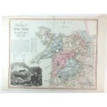
Evans (John), engraved by Robert BaughMap of North Wales, 1797, dedication to Sir William Watkin-Wynn beneath an engraved view of Vale Crucis Abbe...
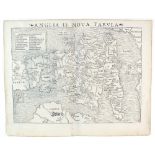
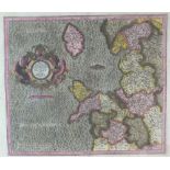
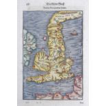
Munster (Sebastian) Anglia II, Nova Tabula, 1540, woodcut, verso latin text in an ornate frame,
Munster (Sebastian) Anglia II, Nova Tabula, 1540, woodcut, verso latin text in an ornate frame,unframed, 31 x 39cm (SH)
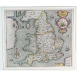
Rocque (John) England and Wales drawn from the Most Accurate Surveys, 1794, published by Laurie and Whittle for the 'New Universal Atlas' and firs...

Arrowsmith (John) The Inland Navigation, Rail Roads, Geology and Minerals of England and Wales,
Arrowsmith (John) The Inland Navigation, Rail Roads, Geology and Minerals of England and Wales, 1844, 65 x 55cm (SH)
Dix (T) after Darton (W) A New Map of North Wales Divided into Six Counties or Shires, engraving,
Dix (T) after Darton (W) A New Map of North Wales Divided into Six Counties or Shires, engraving, unframed, 58 x 81cm (SH)
Ogilby (John) Road from Chester to Cardiff 1698, engraving, unframed, 38.5 x 48.5cm (PL)
S.Munster/H Petri Von Den Britannischen Insulin 1578, woodblock with German text verso, 38 x 23.
S.Munster/H PetriVon Den Britannischen Insulin 1578, woodblock with German text verso, 38 x 23.5cm (SH)
Rosaccio (Giuseppe) 'Inghilterra' 1595, in a small atlas 'Il Mondo', woodcut, unframed, 15.5 x 9.
Rosaccio (Giuseppe) 'Inghilterra' 1595, in a small atlas 'Il Mondo', woodcut, unframed, 15.5 x 9.5cm (SH)

After James GilrayBritannia, restrike print originally published 1791, unframed, 27 x 18cm (I)

Evans (John) Six Counties of North Wales 1795, uncoloured copperplate, Nine engraved folio map sheets bound. Rebacked three quarter calf with ori...
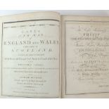
Cary (John)Cary's New Map of England and Wales with Part of Scotland 1794, a bound volume of 77maps covering Engalnd and Wales.
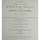
Cary (John) Cary's New and Correct English Atlas being a New Set of County Maps from Actual Surveys
Cary (John)Cary's New and Correct English Atlas being a New Set of County Maps from Actual Surveys 1793, Forty six county maps each with a descrip...
Walker (John & Charles) A Geological Map of england, Wales and Part of Scotland showing also the Inland Navigation by means of Rivers & Canals, wi...

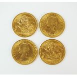
Four Elizabeth II sovereigns,
Four Elizabeth II sovereigns, each dated 1966 (4)

Four Elizabeth II sovereigns,
Four Elizabeth II sovereigns, each dated 1966 (4)
Four Elizabeth II sovereigns,
Four Elizabeth II sovereigns, each dated 1966 (4)

Four Elizabeth II sovereigns,
Four Elizabeth II sovereigns, each dated 1966 (4)

Four Elizabeth II sovereigns,
Four Elizabeth II sovereigns, each dated 1966 (4)

Four Elizabeth II sovereigns,
Four Elizabeth II sovereigns, each dated 1966 (4)

Four Elizabeth II sovereigns,
Four Elizabeth II sovereigns, each dated 1966 (4)

Four Elizabeth II sovereigns,
Four Elizabeth II sovereigns, each dated 1966 (4)

Four Elizabeth II sovereigns,
Four Elizabeth II sovereigns, each dated 1966 (4)

Four Elizabeth II sovereigns,
Four Elizabeth II sovereigns, each dated 1966 (4)

Four Elizabeth II sovereigns,
Four Elizabeth II sovereigns, each dated 1966 (4)

Four Elizabeth II sovereigns,
Four Elizabeth II sovereigns, each dated 1966 (4)