Filtered by:
- Sale Section,
- Item Type
- List
- Grid
A subscription to the Price Guide is required to view results for auctions ten days or older. Click here for more information
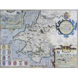

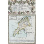
Speed (John) Map of Pembrokeshire, published by John Sudbury and George Humbell, 1610, engraving,
Speed (John) Map of Pembrokeshire, published by John Sudbury and George Humbell, 1610, engraving, text verso, 39 x 51cm (I)
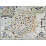
Speed (John) Map of Montgomeryshire, published by John Sudbury and George Humbell 1610, engraving, text verso, 39 x 52cm (PL)
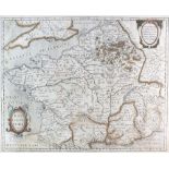
Jansson (Jan)Map of France 1657, engraving, text on verso, 40 x 49.5cm (PL) together with a Map of North East France by Dankerts (2)
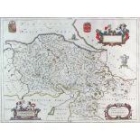
Blaeu (John) Denbigh et Flintshire circa 1648, engraving, with text verso, 38 x 51cm (PL)
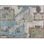
Speed (John) Map of Anglesey, published by John Sudbury and George Humbell in 1612, engraving,
Speed (John) Map of Anglesey, published by John Sudbury and George Humbell in 1612, engraving, with text verso, 38.5 x 50.5cm (I)
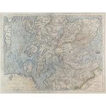
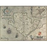
Hole (William) Scotia Regnum 1610, engraving, 27 x 31cm (PL)together with a late 16th century map of 'Scotia' after Gerard Mercator (2)
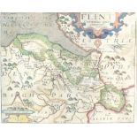
Saxton (Christopher) and Kip (William) Flint Comitatus, engraving, text verso, 26.5 x 32cm (PL)together with a map 'Caernarvo Comitatus' by Saxton...
Speed (John) Caernarvon Both Shyre and Shire towne with the ancient Citie Bangor deferibed, Anno Domini 1610, published by John Sudbury and George...
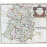
Morden (Robert) Map of Shrophsire, 17th century, engraving, unframed, 37 x 42.5cm (PL)
A collection of four English 17th century maps: The road from London to Aberistwith and Welshpool
A collection of four English 17th century maps: The road from London to Aberistwith and Welshpool to Carnarvan by Owen Bowen, together with two fu...