Filtered by:
- Category
- List
- Grid
Results for live webcast and timed auctions may not have been verified by the auctioneer. If you are in any doubt of the accuracy of the prices provided, please call the auction house to confirm.
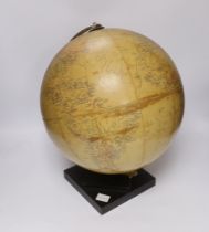

An early 20th century Philips Challenge 13 1/2 inch globe
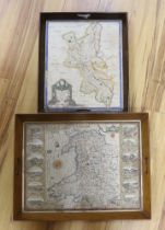
An 18th century hand coloured map of Wales, framed as a twin handled drink’s tray, together with
An 18th century hand coloured map of Wales, framed as a twin handled drink’s tray, together with another after Robert Morden, Buckinghamshire, lar...
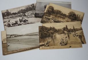
A collection of vintage topographical postcards including some local views
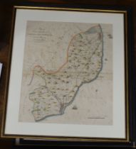
Four 18th / 19th century Map’s of the Hundreds including ‘Loningborough & Folkestone’ together
Four 18th / 19th century Map’s of the Hundreds including ‘Loningborough & Folkestone’ together with ‘The Road from London to Dover’, by John Ogilb...
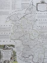
After Emanuel Bowen (1694-1767), hand coloured map of Buckinghamshire, printed for R Sayer, T Bowles
After Emanuel Bowen (1694-1767), hand coloured map of Buckinghamshire, printed for R Sayer, T Bowles and I Bowles, 1756, 72 x 56cm
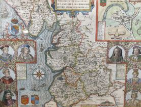
After John Speed (1552-1629), hand-coloured engraved map, ‘The Countie Palletine of Lancaster
After John Speed (1552-1629), hand-coloured engraved map, ‘The Countie Palletine of Lancaster Described and Divided into Hundreds’, 1610, text ver...