Filtered by:
- Category
- List
- Grid
A subscription to the Price Guide is required to view results for auctions ten days or older. Click here for more information
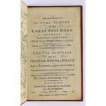

° ° Armstrong, Mostyn John - Armstrong's Actual Survey of the Great Post Road between London and
° ° Armstrong, Mostyn John - Armstrong's Actual Survey of the Great Post Road between London and Dover. With the country three miles on each side ...
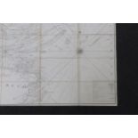
° ° Burn, George (and others) A New and Correct Chart of the Thames' Mouth, and c. from London
° ° Burn, George (and others) A New and Correct Chart of the Thames' Mouth, and c. from London Bridge to Orford Ness...and from the Nore to the No...
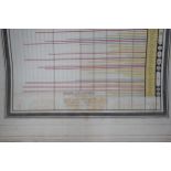
Playfair, William - A Newly Invented Chronological Chart of British Nobility. Engraved to accompany & illustrate a Work on British Family Antiquit...
° ° Farrer, Reginald - The Rainbow Bridge. 16 plates and folded map; publisher's cloth. 1921;
° ° Farrer, Reginald - The Rainbow Bridge. 16 plates and folded map; publisher's cloth. 1921; Farrer, Reginald - The Garden of Asia: impressions f...
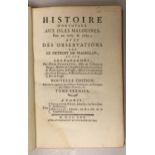
° ° Pernetty, Dom - Histoire d'un Voyage aux Isles Malouines, fait en 1763 & 1764; avec des
° ° Pernetty, Dom - Histoire d'un Voyage aux Isles Malouines, fait en 1763 & 1764; avec des Observations sur le Detroit de Magellan, et sur les Pa...

° ° Nansen, Fridtjof - Fram over Polhavet: den Norske Polarfaerd 1893-1896. 2 vols. photogravure
° ° Nansen, Fridtjof - Fram over Polhavet: den Norske Polarfaerd 1893-1896. 2 vols. photogravure portrait, 42 plates (3 coloured and folded) and 3...
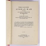
° ° Hanna, Col. H.B. - The Second Afghan War....its causes, its conduct and its consequences. 2
° ° Hanna, Col. H.B. - The Second Afghan War....its causes, its conduct and its consequences. 2 vols. 3 folded maps; publisher's gilt cloth (almos...
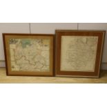
Henry Beighton (c.1687 – 1743), engraving, Map of Warwickshire together with a later reproduction of
Henry Beighton (c.1687 – 1743), engraving, Map of Warwickshire together with a later reproduction of a 16th century example, largest 42 x 38cm .....