Filtered by:
- Category,
- Item Type
- List
- Grid
A subscription to the Price Guide is required to view results for auctions ten days or older. Click here for more information
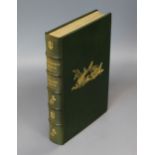

Adams, Richard (Novelist) - Watership Down, one of 250, illustrated by John Lawrence, full morocco
Adams, Richard (Novelist) - Watership Down, one of 250, illustrated by John Lawrence, full morocco by Sangorski and Sutcliffe, with folding map, s...
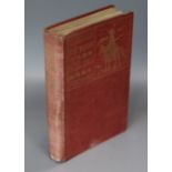
Prichard, Hesketh - Through The Heart of Patagonia, 1st edition, quarto, cloth, with 3 folded
Prichard, Hesketh - Through The Heart of Patagonia, 1st edition, quarto, cloth, with 3 folded maps, London 1902 ...[more]
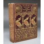
Kelly, Robert Talbot - Burma: Painted and Described by ..., cloth, with folded map and 75 colour
Kelly, Robert Talbot - Burma: Painted and Described by ..., cloth, with folded map and 75 colour illustrations, Adam and Charles Black, London 190...
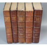
Stonham, Charles - The Birds of The British Islands, illustrated by Lilian Medland, 5 vols, quarto, with 2 folding coloured maps and 318 plates, L...
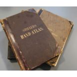
Migeon, J (editor) - Atlas Migeon - Historique, Scientifique, Industriel et Commercial, Paris
Migeon, J (editor) - Atlas Migeon - Historique, Scientifique, Industriel et Commercial, Paris 1883, Stieler, Adolf- Handatlas, partly disbound and...
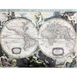
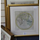
Pierre Vander. A coloured copper engraving, Map of the World, 35 x 26.5cm ...[more]
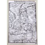
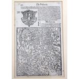
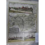
Beschreibung Engellands Und Schottlandts, Sebastian Munster (1489-1552). Woodcut map of Scotland,
Beschreibung Engellands Und Schottlandts, Sebastian Munster (1489-1552). Woodcut map of Scotland, England. Printed in Basle by Heinrich Petri in 1...
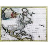
Pierre Vander Aa: L'Amerique Septentrionale Suivant les No. l'Academie de Sciences, etc. A coloured engraved map, c.1705 30 x 23cm ...[more]
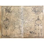
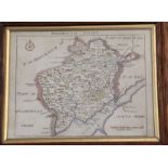
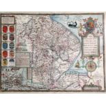
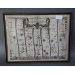
John Speed and Jodocus Hondius, The Counti of Warwick The Shire Town and Citie of Coventre Described, c.1623-1632 55 x 41cm ...[more]
Sebastian Munster (1489-1552). Uncoloured map of Moscovia c.1560, Latin text edition, 27.5 x 17.5cm
Sebastian Munster (1489-1552). Uncoloured map of Moscovia c.1560, Latin text edition, 27.5 x 17.5cm ...[more]
John Seller. Hartfordshire, a coloured engraved map, published London 1705 by John Wild in Camden'
John Seller. Hartfordshire, a coloured engraved map, published London 1705 by John Wild in Camden's "Brittania Abridged", ...[more]
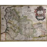
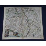
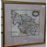
Gerard Mercator. Warwicun, Northamtonia, Huntingdonia, a coloured engraved map of the South East
Gerard Mercator. Warwicun, Northamtonia, Huntingdonia, a coloured engraved map of the South East Corner of England, 54 x 43cm ...[more]
Johannes Blaeu. Monmouthensis Comitatus Venacule Monmouthshire, a coloured engraved map, c.1663,
Johannes Blaeu. Monmouthensis Comitatus Venacule Monmouthshire, a coloured engraved map, c.1663, 51 x 39cm ...[more]
Johannes Janssonius. Artesia Comitatus - Artois, a coloured engraved map, c.1658, 51 x 39cm ...[more]
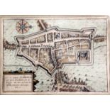
John Ogilby. The Road from Chester to Cardiff, a coloured engraved road map, 45 x 33cm ...[more]
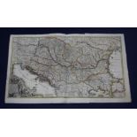
Guillaume De L'Isle. Theatrum Historicum ad annum Christi Quadringentesimi in quo to Imperii
Guillaume De L'Isle. Theatrum Historicum ad annum Christi Quadringentesimi in quo to Imperii Romani to Barbarorum, a coloured engraved map, Paris ...
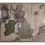
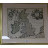
Homann, Johan Baptist. Magna Britannia Compleetens Angliae Scotiae et Hyberniae Regn, a coloured
Homann, Johan Baptist. Magna Britannia Compleetens Angliae Scotiae et Hyberniae Regn, a coloured engraved map 58 x 50cm ...[more]
Ludovico Guicciardi. Hol est Civitas Hellmonda, a coloured engraved map, c.1625 ...[more]
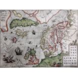
Ortelius, Abraham. Septentrionalium Regionum descrip, a coloured engraved map, c.1570 or later, 50 x
Ortelius, Abraham. Septentrionalium Regionum descrip, a coloured engraved map, c.1570 or later, 50 x 37cm ...[more]
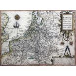
Ludovico Giuccardini. Belgiae Ineferiors descriptio emendata …, a coloured engraved map, 32.5 x
Ludovico Giuccardini. Belgiae Ineferiors descriptio emendata …, a coloured engraved map, 32.5 x 24cm ...[more]
John Speede. The Countie and Citie of Lyncolne described, a coloured engraved map, c.1612-27, 53 x
John Speede. The Countie and Citie of Lyncolne described, a coloured engraved map, c.1612-27, 53 x 40cm ...[more]
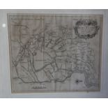
Sir William Dugdale, an uncoloured map of Marsh-land in Norfolk, 33 x 37cm, Henry Teesdale & Co.,
Sir William Dugdale, an uncoloured map of Marsh-land in Norfolk, 33 x 37cm, Henry Teesdale & Co., a coloured engraved map of Prussia with part of ...
A collection of ten unframed coloured maps:- Germany, NE of DresdenSeb. Munster - The Nile Delta c.
A collection of ten unframed coloured maps:- Germany, NE of DresdenSeb. Munster - The Nile Delta c.1550-75 (uncoloured)M.Bonne - Turkey, c.1760Arc...
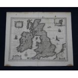
Blaeu, William - An unframed uncoloured map - Magnae Britannie et Hiberniae, c.1625-40, 41 x 54cm
Blaeu, William - An unframed uncoloured map - Magnae Britannie et Hiberniae, c.1625-40, 41 x 54cm ...[more]
A collection of ten unframed engraved maps:- Gigante, Joanne - Hildesiensis, 48 x 57cmJohann
A collection of ten unframed engraved maps:- Gigante, Joanne - Hildesiensis, 48 x 57cmJohann Homann - Provincia XVII.Infer.Germaniae, 52 x 60cmF. ...
A collection of seven unframed engraved maps:- Schenk and Valk - Nottinghamshire, 50 x 58cmBartholomew Sculteto - Lusatia Superior, 49 x 57cmHenri...
A collection of 23 small 17th to 19th century unframed maps and charts ...[more]
Edward Stanford - 6 folding pocket Ordnance Survey maps - one inch to one mile, for Sandhurst,
Edward Stanford - 6 folding pocket Ordnance Survey maps - one inch to one mile, for Sandhurst, Hungerford, Faringdon, High Wycombe, Haywards Heath...
John Ogilby - A coloured engrave map - The Road from Oxford to Coventry Continued to Darby, 36 x
John Ogilby - A coloured engrave map - The Road from Oxford to Coventry Continued to Darby, 36 x 47cm ...[more]
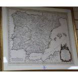
Nicolas Samson. A coloured engraved map, Hispana Antiqua, dated 1750, 50.5 x 59cm
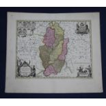
Robert Morden. A coloured engraved map of The West Riding of Yorkshire, 37 x 42cm
Jean Covens and Cornielle Mortimer. A coloured engraved map of Magnae Britannia, Sive Angliae
Jean Covens and Cornielle Mortimer. A coloured engraved map of Magnae Britannia, Sive Angliae Scotiae nec non Hiberniae, 50 x 59cm
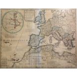
An 18th century coloured engraved map of The Eastern Hemisphere, from the Latest Discoveries c.
An 18th century coloured engraved map of The Eastern Hemisphere, from the Latest Discoveries c.1776 and 5 other coloured engraved maps
John Blaeu. A coloured engraved map of Sussex, 41 x 49cm
Sandrart, Jacobum de - an uncoloured map of Alsatiae, 44 x 124cm, R & J Ottens - an unframed
Sandrart, Jacobum de - an uncoloured map of Alsatiae, 44 x 124cm, R & J Ottens - an unframed coloured engraved map of Hungarie c.1740, 56 x 93cm a...
Moule, Thomas - The County Maps of Old England, reprint of 1990 and 35 other books on maps, in 2
Moule, Thomas - The County Maps of Old England, reprint of 1990 and 35 other books on maps, in 2 boxes ...[more]
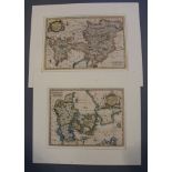
Thomas Kitchen, two unframed coloured engraved maps of 'Circle of Austria' and 'Map of Denmark',
Thomas Kitchen, two unframed coloured engraved maps of 'Circle of Austria' and 'Map of Denmark', together with 30 other unframed maps ...[more]
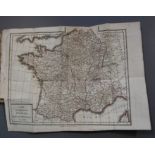
Atlas de la Geographie, Statistique, Hydraulique ... with hand coloured edged maps (incomplete),
Atlas de la Geographie, Statistique, Hydraulique ... with hand coloured edged maps (incomplete), Arthus Bertrand, Paris 1809, together with a coll...
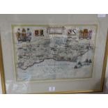
Three Robert Morden maps of South Wales, The Smaller Islands in the British Ocean, Dorsetshire
Three Robert Morden maps of South Wales, The Smaller Islands in the British Ocean, Dorsetshire together with a Christopher Saxton map of Somersett...