Filtered by:
- Category
- List
- Grid
A subscription to the Price Guide is required to view results for auctions ten days or older. Click here for more information
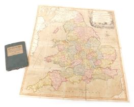

A late 18thC Bowles's New Travelling Map of England and Wales, exhibiting all the direct and princip
A late 18thC Bowles's New Travelling Map of England and Wales, exhibiting all the direct and principle cross roads: with the distances in measured...
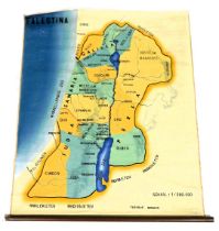
An early 20thC Dutch fabric school map of Palestine, scale 1/280.000, printed Tegyduc Wakken, 114cm
An early 20thC Dutch fabric school map of Palestine, scale 1/280.000, printed Tegyduc Wakken, 114cm x 99cm.
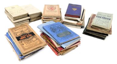
Victorian and later maps of Scotland, including Ordnance Survey, Black's, Bartholomew's, Gall & Ingl
Victorian and later maps of Scotland, including Ordnance Survey, Black's, Bartholomew's, Gall & Inglis, W & AK Johnston's, together with further m...
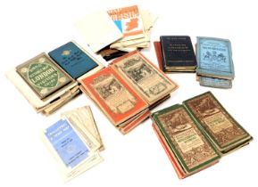
A group of England and Wales maps, including Ordnance Survey, Bartholomew's, Reynolds New Distance m
A group of England and Wales maps, including Ordnance Survey, Bartholomew's, Reynolds New Distance map of London and visitors guide, Geographia la...
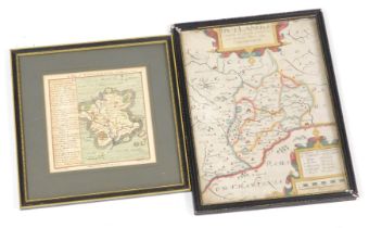
After Christopher Saxton. Map of Rutland (Rutlandiae), hand coloured engraving, by William Kip, 7cm
After Christopher Saxton. Map of Rutland (Rutlandiae), hand coloured engraving, by William Kip, 7cm x 21cm together with a map of Worcestershire, ...
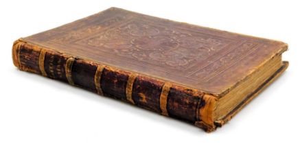
Teesdale (Henry). An early 19thC atlas, with forty seven engraved and coloured plates by J Dower, Pe
Teesdale (Henry). An early 19thC atlas, with forty seven engraved and coloured plates by J Dower, Pentonville London, folio, published by Henry Te...