Filtered by:
- Category
- List
- Grid
A subscription to the Price Guide is required to view results for auctions ten days or older. Click here for more information
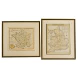

Two framed coloured maps, comprising England Fields, 27cm x 20cm, and France and It's Visions, 21cm
Two framed coloured maps, comprising England Fields, 27cm x 20cm, and France and It's Visions, 21cm x 23cm, framed and glazed. (2)
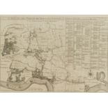
A map of the Parish of St Dunstons Stepney, divided into hamlets, c1920, 29cm x 42cm, framed and gla
A map of the Parish of St Dunstons Stepney, divided into hamlets, c1920, 29cm x 42cm, framed and glazed.
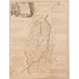
After Robert Morden. A framed map of Nottinghamshire, showing the Wapontakes and Divisions, 77cm x 5
After Robert Morden. A framed map of Nottinghamshire, showing the Wapontakes and Divisions, 77cm x 56cm, in oak frame.
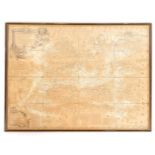
After Bowden. A framed map of the County of Surrey, later stained, 53cm x 72cm, framed.
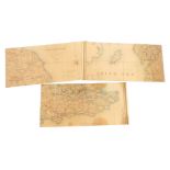
Three Victorian sectional maps of England, c1860, drawn by R Creighton, engraved by J Dower, and sol
Three Victorian sectional maps of England, c1860, drawn by R Creighton, engraved by J Dower, and sold by Edward Stanford., divided into Counties, ...
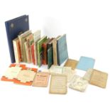
A group of Lincolnshire related books, comprising The Story of Clarabelle, The Spalding View Album,
A group of Lincolnshire related books, comprising The Story of Clarabelle, The Spalding View Album, Tattershall Castle, Guide Through Lincoln, Bon...