Filtered by:
- Category
- List
- Grid
A subscription to the Price Guide is required to view results for auctions ten days or older. Click here for more information
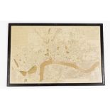

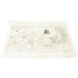
A New and Correct plan of The Cities of London, Westminster and Borough of Southwalk, circa 1790, by
A New and Correct plan of The Cities of London, Westminster and Borough of Southwalk, circa 1790, by Robert Sayer, 46cm x 72cm, framed and glazed....
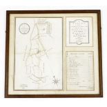
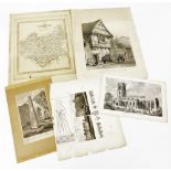
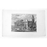
An 18thC engraving of a Survey of the Ashome Estate in the Parish of Newbold Pacey, in the county of
An 18thC engraving of a Survey of the Ashome Estate in the Parish of Newbold Pacey, in the county of Warwick belonging to Thomas Little Esq, taken...
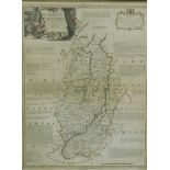
After Emanuel Bowen. An accurate map of Nottinghamshire, describing in Woapontakes and Divisions, la
After Emanuel Bowen. An accurate map of Nottinghamshire, describing in Woapontakes and Divisions, later coloured, commissioned by Duke of Newcastl...
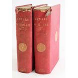
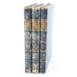
Tighe (Robert Richard) and J.E. Davies ANNALS OF WINDSOR... 2 vol, folding hand-coloured plan, publi
Tighe (Robert Richard) and J.E. Davies ANNALS OF WINDSOR... 2 vol, folding hand-coloured plan, publisher's cloth, 8vo, 1858. ...[more]
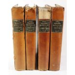
Lewis (Samuel) A TOPOGRAPHICAL DICTIONARY OF ENGLAND... 4 vol., engraved maps, foxed, later cloth, w
Lewis (Samuel) A TOPOGRAPHICAL DICTIONARY OF ENGLAND... 4 vol., engraved maps, foxed, later cloth, worn, large 4to, 1831. ...[more]
Roscoe (T.) VIEWS OF CITIES AND SCENERY IN ITALY, FRANCE AND SWITZERLAND 3 vol., additional engraved
Roscoe (T.) VIEWS OF CITIES AND SCENERY IN ITALY, FRANCE AND SWITZERLAND 3 vol., additional engraved titles, engraved plates, tissue-guards, conte...
Gould (John). Oiseaux, Editions du Chene, 1960 16inch x 12inch portrait with nineteen full page col
Gould (John). Oiseaux, Editions du Chene, 1960 16inch x 12inch portrait with nineteen full page colour plates: together with three Redoute plates...
Bartholomew (J.G Cartographer to the King) The Times ATLAS of the World, 1920 and The Times GAZETEER
Bartholomew (J.G Cartographer to the King) The Times ATLAS of the World, 1920 and The Times GAZETEER of the World, 1922. (2) ...[more]
Antiquarian maps of Leicestershire after John Cary, circa 1792, with later hand coloured decoration,
Antiquarian maps of Leicestershire after John Cary, circa 1792, with later hand coloured decoration, After John Flower, Old Blue Boar Inn Leiceste...
A silk map of Lincolnshire and Nottinghamshire by GW Bacon and Co, 127 Strand, 73cm x 48cm, together
A silk map of Lincolnshire and Nottinghamshire by GW Bacon and Co, 127 Strand, 73cm x 48cm, together with a black and white book page, of St Mary'...
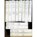
Banaman and Lodge. The Birds of The British Isles, illustrated by George E Lodge, twelve volumes, fi
Banaman and Lodge. The Birds of The British Isles, illustrated by George E Lodge, twelve volumes, first published 1953, with various colour bird p...
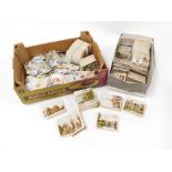
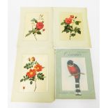
A group of loose cigarette, trade and tea cards, to include Views of Interest, Will's and other card
A group of loose cigarette, trade and tea cards, to include Views of Interest, Will's and other cards. (2 boxes) ...[more]
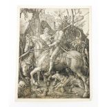
An antiquarian engraving after Albrecht Dürer. Knight, Death and the Devil, engraving, 24.5cm x 19cm
An antiquarian engraving after Albrecht Dürer. Knight, Death and the Devil, engraving, 24.5cm x 19cm. (margins trimmed and laid on paper) ...[mor...
An antiquarian engraving by Johann Georg Hertel after Teniers. No 68, a castle with river and figure
An antiquarian engraving by Johann Georg Hertel after Teniers. No 68, a castle with river and figures, 25cm x 40cm. ...[more]
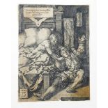
An antiquarian engraving after Heinrich Aldergrever (1502-1555). Judge Herkinbold cutting the throat
An antiquarian engraving after Heinrich Aldergrever (1502-1555). Judge Herkinbold cutting the throat of his nephew, 10.8cm x 8cm. (margins trimmed...
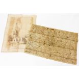
A 19thC engraved map of The Battlefield of Waterloo, in two parts (joined), and with later hand colo
A 19thC engraved map of The Battlefield of Waterloo, in two parts (joined), and with later hand coloured decoration, taken from a trigonometrical ...
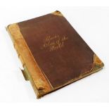
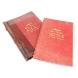
Black's General Atlas of The World, New Edition, published by Adam and Charles Black, Edinburgh 1865
Black's General Atlas of The World, New Edition, published by Adam and Charles Black, Edinburgh 1865, bound in red cloth and half leather. ...[mo...
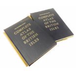
The Readers Digest Complete Atlas of The British Isles, published 1965, two copies. ...[more]
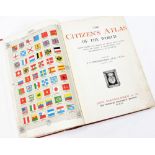
The Citizen's Atlas of The World, edited by J G Bartholomew, published 1912, in a red cloth binding.
The Citizen's Atlas of The World, edited by J G Bartholomew, published 1912, in a red cloth binding. ...[more]