Filtered by:
- Category,
- Item Type
5 items
- List
- Grid
A subscription to the Price Guide is required to view results for auctions ten days or older. Click here for more information

John Cary, Cary's New and Correct English Atlas, being a new set of county maps from actual surveys, London 1793, 4to, calf.
Leicestershire maps: A set of Ordinance Map Office sheets, cloth backed, published by Col. Colby, 1840, the eight sheets in a leather case. Footno...
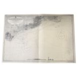
A collection of maritime charts, from the latest Admiralty surveys, mostly circa 1950.
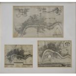
The City of London as in Elizabeth's Time, engraved plan, 19cm x 46cm; and a collection of eight other plans of London, mounted and framed as thre...
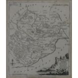
William Kipp, Rutlandiae, hand-coloured county map, visible, 28cm x 20cm; and four other maps of Rutland. (Qty: 5)