Refine your search
Filtered by:
- Category,
- Item Type
- List
- Grid
A subscription to the Price Guide is required to view results for auctions ten days or older. Click here for more information
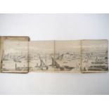

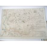
(London, Panorama, Henry Vizetelly) 'The Grand Panorama of London from the Thames', circa 1845,
(London, Panorama, Henry Vizetelly) 'The Grand Panorama of London from the Thames', circa 1845, wood engraved, linen backed, folding continuous pa...
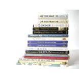
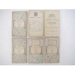
Sixteen titles on maps and atlases, including Howgego 'Printed Maps of London c.1553-1850', 'Britain's Tudor Maps - John Speed', Boyle 'London - 2...
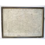
Solar eclipse. Cave (E. & Smith G.), 'The Geography of the Great Solar Eclipse of July 14 MDCCXLVIII Exhibiting an Accurate Map of all parts of th...
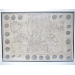
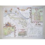
Robert Morden: 'Britannia Romana', hand coloured engraved map, circa 1695, framed and glazed,
Robert Morden: 'Britannia Romana', hand coloured engraved map, circa 1695, framed and glazed, the whole approx size 50 x 57cm
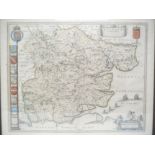
John Speed: 'Kent with her Cities and Earles described and observed', published G. Humble, engraved map, circa 1627, inset town plans of Canterbur...
(Dorset) John Speed: 'Dorsetshyre', engraved hand coloured map, 1676, Bassett & Chiswell, county map with inset plan of Dorchester, coats of arms ...
(Staffordshire) John Speed: 'Stafford Countie and Towne with the ancient Citie Lichfeild described',
(Staffordshire) John Speed: 'Stafford Countie and Towne with the ancient Citie Lichfeild described', engraved hand coloured map, circa 1627, John ...
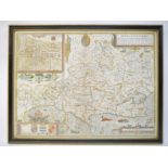
(Somerset) Johannes Blaeu: 'Somersetensis Comitatus - Somerset Shire', hand coloured engraved map,
(Somerset) Johannes Blaeu: 'Somersetensis Comitatus - Somerset Shire', hand coloured engraved map, Amsterdam, circa 1645, framed and double glazed...
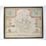
John Speed: 'Flintshire', hand coloured engraved map, published Thomas Bassett & Richard Chiswell,
John Speed: 'Flintshire', hand coloured engraved map, published Thomas Bassett & Richard Chiswell, [1676], inset town views of Flint and Saint Asa...
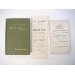
Harleston - 'Notes on the Parish of Redenhall with Harleston', by Charles Candler, 1896, 1st edition, Loosely inserted a letter of 1894 asking abo...
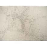
Nine early 20th Century rolled Ordnance Survey large sheet maps, including Diss 1927, plus others Palgrave, Needham/Shotford, Needham/Weybread, Br...
(Norfolk) Four 19th Century Ordnance Survey engraved folding maps, all New 1 Inch series and retailed Edward Stanford, comprising sheets 175 (Diss...
Six linen-backed 19th Century folding sheet maps for Suffolk, Essex & Norfolk, including 1805 hand coloured in outline sheet depicting area from R...
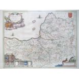
Johannes Blaeu: 'Essex - Essexia Comitatus', engraved hand coloured map, circa 1645, framed and double glazed, the whole approx 51 x 62cm