Refine your search
Filtered by:
- Category,
- Item Type
- List
- Grid
A subscription to the Price Guide is required to view results for auctions ten days or older. Click here for more information
![John Speed, engraved hand coloured map of Suffolk, [1611], "George Huble [Humble]",](https://portal-images.azureedge.net/auctions-2020/srtw10211/images/5a6f626e-a662-47a9-a8b2-ac5d0119f169.jpg?w=155&h=155)

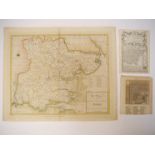
John Speed, engraved hand coloured map of Suffolk, [1611], "George Huble [Humble]", inset town plan of Ipswich, trimmed to strapwork margins on ve...
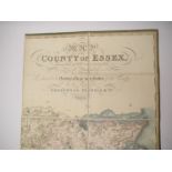
C. & J. Greenwood: 'Map of the County of Essex, from an Actual Survey Made in the Year 1824',
C. & J. Greenwood: 'Map of the County of Essex, from an Actual Survey Made in the Year 1824', London, Greenwood, Pringle & Co., 1825, large engrav...
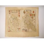
Michael Drayton: 'Parte of Suffolk.
Michael Drayton: 'Parte of Suffolk. Essex', scarce engraved map, [1622], professionally repaired/restored at centrefold, approx. 25 x 32cm
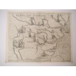
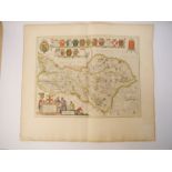
![Greenville Collins: 'Norfolk Pars [Cley and Blakeney]',](https://portal-images.azureedge.net/auctions-2020/srtw10211/images/13090d93-6cc3-4176-b29b-ac5d011a1540.jpg?w=155&h=155)
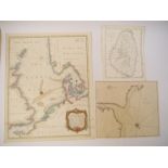
Greenville Collins: 'Norfolk Pars [Cley and Blakeney]', engraved sea chart/plan depicting Blakeney Point, circa 1690, approx. 45 x 57cm ...[more]

Bower: 'Plan of the Town and Harbour of Kingston upon Hull 1791', engraved hand coloured plan,
Bower: 'Plan of the Town and Harbour of Kingston upon Hull 1791', engraved hand coloured plan, published 1792, close trimmed at right hand margin ...
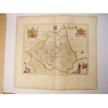
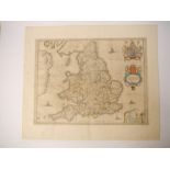
John Speed: 'Norfolk', engraved hand coloured map, circa 1631, trimmed at margins (close trimmed at left hand margin), hand colouring dark, repair...
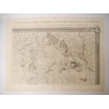
Gerard Mercator: 'Eboracum, Lincolnia, Derbia, Staffordia, Nottinghamia, Lecestria, Rutlandia et Norfolcia', engraved hand coloured map depicting ...
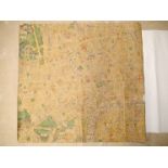
London. John Rocque.
London. John Rocque. [An Exact Survey of the citys of London Westminster ye Borough of Southwark and the Country near ten miles round, begun in 17...
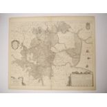
Henricus Hondius: 'A General Plott of the Fennes and Surounded grounds in the sixe counties of
Henricus Hondius: 'A General Plott of the Fennes and Surounded grounds in the sixe counties of Norfolke, Suffolke, Cambridge, with in the Isle of ...
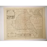
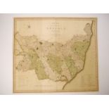
Emanuel Bowen: 'An Accurate Map of the East Riding of York Shire divided into its Wapontakes &c...
Emanuel Bowen: 'An Accurate Map of the East Riding of York Shire divided into its Wapontakes &c...', engraved map, circa 1765, published C & J Bow...

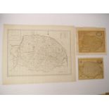
John Chapman & Peter Andre: 'A map of the county of Essex, From an Actual Survey made in MDCCLXXII,
John Chapman & Peter Andre: 'A map of the county of Essex, From an Actual Survey made in MDCCLXXII, MDCCLXXIII & MDCCLXXIV', engraved hand coloure...
Robert Morden: 'Norfolk', engraved hand coloured map, circa 1695, close trimmed at margins; plus Haywood/Sudlow 'A Map of Norfolk', engraved map, ...
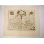
![Cary: 'Suffolk', coloured engraved map, 1807; Saxton/Kip: 'Suffolciae Comitatus [Suffolk]',](https://portal-images.azureedge.net/auctions-2020/srtw10211/images/bb55a698-6fd4-4c8e-9ca0-ac5d011a2005.jpg?w=155&h=155)
Cary: 'Suffolk', coloured engraved map, 1807; Saxton/Kip: 'Suffolciae Comitatus [Suffolk]',
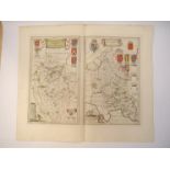
Cary: 'Suffolk', coloured engraved map, 1807; Saxton/Kip: 'Suffolciae Comitatus [Suffolk]', engraved hand coloured map, circa 1610; George Bickham...
Haywood/Sudlow: 'A New Accurate & Correct Map of Essex', engraved hand coloured map, 1787; plus Owen/Bowen early 19th Century hand coloured small ...
John Stockdale: 'Great Britain and Ireland with ye Judges Circuits', engraved map, 1805, inset maps of the Shetland Islands and The Hebrides. Larg...
Johannes Blaeu: 'Bedfordshire and Buckinghamshire', engraved hand coloured map, circa 1650
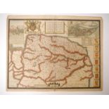
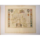
![John Speed: 'Essex', engraved map, [1611], "solde by G.](https://portal-images.azureedge.net/auctions-2020/srtw10211/images/7a123a41-aae8-406c-a521-ac5d011a24a4.jpg?w=155&h=155)
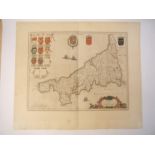
John Speed: 'Essex', engraved map, [1611], "solde by G. Humble", inset town plan of Colchester
Johannes Blaeu: 'Cornwall', engraved hand coloured map, circa 1645, plus H. Moll: 'Somerset', ngraved map, circa 1720 (2)
Johannes Blaeu: 'The Bishoprike of Durham', engraved hand coloured map, circa 1645
Johannes Blaeu,
Johannes Blaeu, suite of four Yorkshire maps: 'West Riding; East Riding; North Riding; Anglice Yorkshire', set of four engraved hand coloured maps...
Johannes Blaeu: 'Berkshire', engraved hand coloured map, circa 1645

Johannes Blaeu: 'Cambridgeshire', engraved hand coloured map, circa 1645
Johannes Blaeu: 'Oxfordshire', engraved hand coloured map, circa 1645
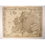
John Speed: 'Europ, and the cheife Cities contaned therin, described; with the habits of most Kingdoms now in use [Europe]', engraved map, circa 1...
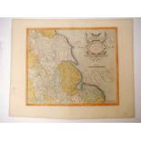
![John Speed: 'Barkshire Described [Berkshire]', engraved map, circa 1611, "I.](https://portal-images.azureedge.net/auctions-2020/srtw10211/images/56a2a29c-28d6-45c8-b615-ac5d011a2e6a.jpg?w=155&h=155)
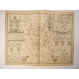
John Speed: 'Barkshire Described [Berkshire]', engraved map, circa 1611, "I. Sud and Georg Humble", panorama of Windsor Castle, English text verso
Christopher Saxton/William Hole: 'Buckinghamshire', engraved map, circa 1610
John Speed: 'Bedfordshire and the situation of Bedford described', engraved map, circa 1611,
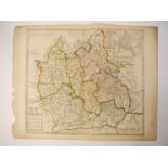
John Speed: 'Bedfordshire and the situation of Bedford described', engraved map, circa 1611, "George Humbel", inset town plan of Bedford, English ...
Philip Lea: 'Oxford, Buckingham and Berkshire', engraved hand coloured map, circa 1720, inset plan of Oxford
Willem Janszoon Blaeu: 'Anglia Regnum', engraved hand coloured map of England and part of Scotland and Ireland, circa 1635
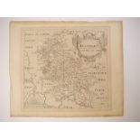
John Cary: 'A New Map of the County of Suffolk, engraved hand coloured map, 1801, toned
Collection assorted Oxfordshire, Buckinghamshire & Berkshire maps and prints, including R. Blome maps of Buckinghamshire and Oxfordshire c.1673 (2...
MacDonald 'Max' Gill (1884-1947): 'Map of Central London, Clash of Arms', lithograph in colours,
MacDonald 'Max' Gill (1884-1947): 'Map of Central London, Clash of Arms', lithograph in colours, 1932 printed by Waterlow & Sons Ltd, London, back...
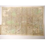
James Reynolds: 'Reynolds' Map of London witht the Recent Improvements, 1875. Divided into Quarter Mile Sections for Measuring Distances.', engrav...
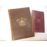
'The Times Atlas', London, 1895, 117 pages of engraved coloured maps as called for, folio, original full calf gilt (rubbed and slightly worn, iner...
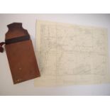
Six Ordnance Survey engraved sectional folding maps of Worcestershire and Herefordshire, all 1905/
Six Ordnance Survey engraved sectional folding maps of Worcestershire and Herefordshire, all 1905/1906 Second Edition, six inches to one mile scal...
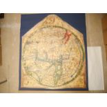
'Mappa Mundi (The Hereford World Map)', limited edition facsimile numbered 381 of 1000, produced for members of The Folio Society, 2010, printed o...