Refine your search
Filtered by:
- Sale Section,
- Category
5 items
- List
- Grid
A subscription to the Price Guide is required to view results for auctions ten days or older. Click here for more information
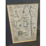

A 17th Century coloured map by John Ogilby. London, Croydon East Grinstead, Lewes, Newhaven, Brighton, Shoreham 19cm x 13cm
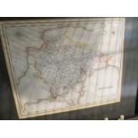
A late 19th Century/early 20th Century coloured map of Devonshire, engraved for Lewis "Topographical Dictionary" drawn by R Creighton, 25cm x 30cm...
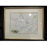
Environs of Plymouth and Devonport by Thomas Moule 19cm x 25cm
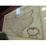
A 17th Century Robert Morden coloured map of Kent 35cm x 64cm
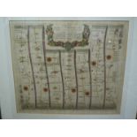
Circa 1675 a JOHN OGILBY coloured map 'The Road From London to Norwich'