Filtered by:
- Category
3 items
- List
- Grid
A subscription to the Price Guide is required to view results for auctions ten days or older. Click here for more information
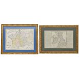

Lot 909
French 18th century atlas map of France, 1740, 28" x 27"; together with an 18th century French atlas
French 18th century atlas map of France, 1740, 28" x 27"; together with an 18th century French atlas map of the British Isles, 22" x 13.5" both wi...
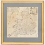
Lot 936
After Kitchin, Thomas (1718-1784) - Kitchin's Most Accurate Map of the Roads of England and Wales,
After Kitchin, Thomas (1718-1784) - Kitchin's Most Accurate Map of the Roads of England and Wales, coloured engraving, 13" x 13.5", framed 19" x ...
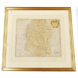
Lot 1031
Robert Morden (c. 1675-1703) - Map of Wiltshire inscribed within a decorative cartouche with the
1031Robert Morden (c. 1675-1703) - Map of Wiltshire inscribed within a decorative cartouche with the
Robert Morden (c. 1675-1703) - Map of Wiltshire inscribed within a decorative cartouche with the cartographers name together with the date 1695, i...