Refine your search
Estimate
Category
- Prints (71)
- Maps (69)
- Books & Periodicals (20)
- Classic Cars, Motorcycles & Automobilia (4)
- Furniture (4)
- Arms, Armour & Militaria (3)
- Models, Toys, Dolls & Games (3)
- Oil, Acrylic paintings & Mixed Media (2)
- Scientific Instruments (2)
- Stamps (2)
- Wines & Spirits (2)
- Drawings & Pastels (1)
- Metalware (1)
- Russian Works of Art (1)
- Salvage & Architectural Antiques (1)
- Textiles (1)
- Watches & Watch accessories (1)
- List
- Grid
A subscription to the Price Guide is required to view results for auctions ten days or older. Click here for more information

A quantity of Early 20th century Bartholomew's Revised 'Half Inch' maps together with a collection
A quantity of Early 20th century Bartholomew's Revised 'Half Inch' maps together with a collection of Popular Edition One-Inch Maps Scotland (a lo...
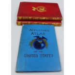
Charles Mackay, the History of The United States of America, 2 volumes to include Div II & VIII,
Charles Mackay, the History of The United States of America, 2 volumes to include Div II & VIII, Appletons' Atlas of the United States and United ...
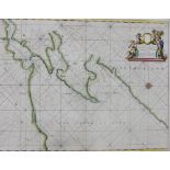
Sutherland coloured map for Collins Coasting Pilot, by Herman Moll, in a mount but unframed, 56 x
Sutherland coloured map for Collins Coasting Pilot, by Herman Moll, in a mount but unframed, 56 x 44cm
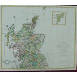
Early 19th century Charte von Scotland by August Stieler, Weimar 1804, in a mount but unframed 55
Early 19th century Charte von Scotland by August Stieler, Weimar 1804, in a mount but unframed 55 x 46.5cm
Two 19th century hand coloured maps to include La Scozia by F.C. Marmocchi, in a single mount but
Two 19th century hand coloured maps to include La Scozia by F.C. Marmocchi, in a single mount but unframed.
18th century coloured map Cart de L'Ocean Oriental ou Mer Des Indes for Prevosts History of voyages,
18th century coloured map Cart de L'Ocean Oriental ou Mer Des Indes for Prevosts History of voyages, in amount but unframed 48 x 35cm
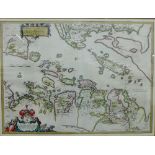
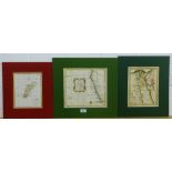
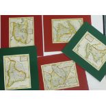
Scotland, three coloured maps by Timothy Pont and published by Blaeu, circa 1654 to include Strath-
Scotland, three coloured maps by Timothy Pont and published by Blaeu, circa 1654 to include Strath-Navern & Eskdail both in Spanish over Dutch, to...
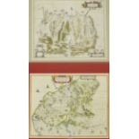
Scotland, two coloured maps by Timothy Pont and published by Blaeu, circa 1662 to include Strath-
Scotland, two coloured maps by Timothy Pont and published by Blaeu, circa 1662 to include Strath-Navern, Spanish over Dutch, together with Gallovi...
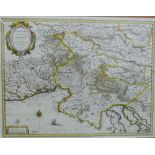
18th century coloured map of Saxoniae (North Germany) by Johann Baptise Homann, in a mount but
18th century coloured map of Saxoniae (North Germany) by Johann Baptise Homann, in a mount but unframed 57 x 48cm
Scotland - Sterlinensis a hand coloured map by Timothy Pont and published by Blaeu, circa 1654,
Scotland - Sterlinensis a hand coloured map by Timothy Pont and published by Blaeu, circa 1654, mounted but unframed 52 x 42cm
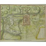
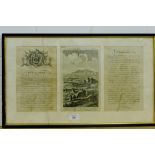
18th century colour engraved Plan of Turin as Besieged in 1706, for Mr Tindal's Continuation of Mr
18th century colour engraved Plan of Turin as Besieged in 1706, for Mr Tindal's Continuation of Mr Rapin's History of England, in a mount but unf...
The Upper Ward of Clyds-Dayl, coloured map by Timothy Pont, in a giltwood frame under glass, 53 x
The Upper Ward of Clyds-Dayl, coloured map by Timothy Pont, in a giltwood frame under glass, 53 x 38cm
Timothy Pont coloured map of Lorna cum insulis vicinis et provinciis eidem conterminis, published by
Timothy Pont coloured map of Lorna cum insulis vicinis et provinciis eidem conterminis, published by Johannes Blaeu, framed under glass 54 x 40cm
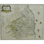
Comitatus Northvmbria, (Northumbria and Durham) coloured map, framed under glass 52 x 43cm
Timothy Pont hand coloured map of Nithia Vicecomitatus, framed under glass, 55 x 40cm
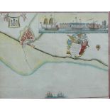
18th century hand coloured engraved chart, Prospect of Leith from the East for Capt Greenvile
18th century hand coloured engraved chart, Prospect of Leith from the East for Capt Greenvile Collins, framed under glass, 47 x 46cm
Karstia Carniola, Histria et Windorum Marchia, coloured map by Gerhard Mercatore, published by
Karstia Carniola, Histria et Windorum Marchia, coloured map by Gerhard Mercatore, published by Blaeu, framed under glass, 51 x 40cm
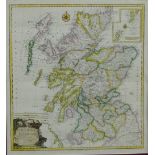
18th century colour engraved map Karte Von Scotland by Franz Schraembl, after J. Dorret, in a
18th century colour engraved map Karte Von Scotland by Franz Schraembl, after J. Dorret, in a mount but unframed, 55 x 60cm
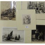
Five engraved prints to include Walpoole's British traveller, etc (in mounts but unframed (5)
Five engraved prints to include Walpoole's British traveller, etc (in mounts but unframed (5)
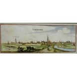
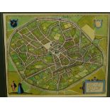
Levwarden, Holland, a 16th century hand coloured map by Braun & Hogenberg, in a mount but unframed
Levwarden, Holland, a 16th century hand coloured map by Braun & Hogenberg, in a mount but unframed 37 x 15cm ...[more]
Plan De Jedo (Tokyo), 18th century coloured engraved map by Bellin for Prevosts Ho story of Voyages,
Plan De Jedo (Tokyo), 18th century coloured engraved map by Bellin for Prevosts Ho story of Voyages, in a mount but unframed, 25.5 x 26cm
Tienen, Belgium, a 16th century hand coloured map by Braun & Hogenberg, in a mount but unframed 42 x
Tienen, Belgium, a 16th century hand coloured map by Braun & Hogenberg, in a mount but unframed 42 x 35cm ...[more]
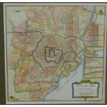
A Plan of London and its Environs, Creighton & Walker for Lewis Topographical Dictionary, in a mount
A Plan of London and its Environs, Creighton & Walker for Lewis Topographical Dictionary, in a mount but unframed 48 x 39cm ...[more]
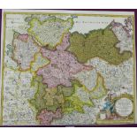
A New Map of the Circle of the Lower Rhine, circa 1780, Sarmatia (Western Russia / Ukraine), circa
A New Map of the Circle of the Lower Rhine, circa 1780, Sarmatia (Western Russia / Ukraine), circa 1830 and East Germany / Poland by Lobeck & Lott...
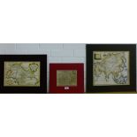
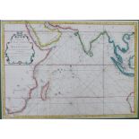
18th century coloured map of Asia engraved by J Beugo together with Carte de L'Inde (India & Goa) by
18th century coloured map of Asia engraved by J Beugo together with Carte de L'Inde (India & Goa) by Bellin, circa 1760 and Stiria, Atlas Minor, i...
Mappe-Monde, early 19th century coloured map by Blondeau, Carte de la Baye de Sainte Helene (Cape of
Mappe-Monde, early 19th century coloured map by Blondeau, Carte de la Baye de Sainte Helene (Cape of South Africa) circa 1745 and The map of the K...
Egypt with Lybia, coloured map by R.W Searle for Mr Rollins Ancient History circa 1780, A Bird's Eye
Egypt with Lybia, coloured map by R.W Searle for Mr Rollins Ancient History circa 1780, A Bird's Eye View of the situation of Carthage circa 1780 ...
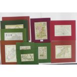
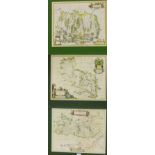
A quantity of English county coloured maps to include Middlesex by John Seller, Cambridgshire by
A quantity of English county coloured maps to include Middlesex by John Seller, Cambridgshire by Richard Blome and Pembrokshire by A. Bell, etc in...
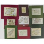
A quantity of English & Ireland county coloured maps to include Essex by Zatta together with Channel
A quantity of English & Ireland county coloured maps to include Essex by Zatta together with Channel Islands by S Hall, etc in mounts but unframed...
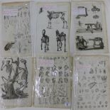
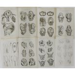
A quantity of copper engraved book plates to include human anatomical movements, wildlife and
A quantity of copper engraved book plates to include human anatomical movements, wildlife and insects, etc (a lot)
Set of eight copper engravings, The System of Midwifery by C. Cooke, circa 1795 (8)
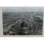
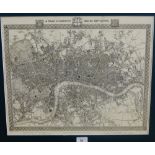
View of London From St Paul's, Looking Eastward, a coloured print by J Sulman for the Illustrated
View of London From St Paul's, Looking Eastward, a coloured print by J Sulman for the Illustrated News, 50 x 35cm
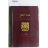
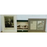
Windsor A Description of the Castle, Park, town & Neighbourhood by W.J. Loftie with illustrations by
Windsor A Description of the Castle, Park, town & Neighbourhood by W.J. Loftie with illustrations by Heywood Hardy & F. Slocombe etc, Seeley & Co,...
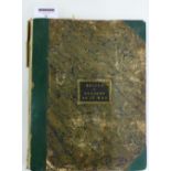
Relics of Ancient Architecture & Other Picturesque Scenes in Glasgow, Published and Lithographed
Relics of Ancient Architecture & Other Picturesque Scenes in Glasgow, Published and Lithographed by Miller & Buchanan, 1849 ...[more]

The Military Antiquities of the Romans in Britain by the Late William Roy F.R.S.F.S.A, published
The Military Antiquities of the Romans in Britain by the Late William Roy F.R.S.F.S.A, published by Order and at Expence of the Society of Antiqu...
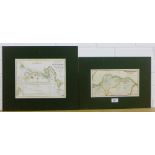
North British Railway (Edinburgh to Berwick) circa 1870 together with Reduced Plan of Reservoirs and
North British Railway (Edinburgh to Berwick) circa 1870 together with Reduced Plan of Reservoirs and Aqueduct near Greenock, circa 1827, in mounts...
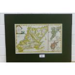
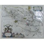
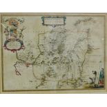
New Map of the Counties of Orkney, Cathness, Sutherland, Ross & Cromarty, 18th century coloured
New Map of the Counties of Orkney, Cathness, Sutherland, Ross & Cromarty, 18th century coloured map by T. Conder, published by Alex Hogg, in mount...
Coste Occidentale D'Afrique by Bellin, coloured map circa 1760, together with Aegyptus Antiqua by S.
Coste Occidentale D'Afrique by Bellin, coloured map circa 1760, together with Aegyptus Antiqua by S. J Neele circa 1815 and Lekeyo Isles (between ...
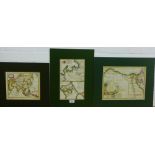
Two 18th century coloured maps by Moll to include Africa & Lybia, in mounts but unframed 23 x 16cm
Two 18th century coloured maps by Moll to include Africa & Lybia, in mounts but unframed 23 x 16cm ...[more]
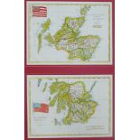
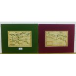
Scotland and it's Regions by Herman Moll, three 18th century coloured maps to include The West
Scotland and it's Regions by Herman Moll, three 18th century coloured maps to include The West Part of Galloway, The Middle Part of Galloway and A...
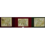
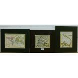
Three 18th century coloured maps of Asia to include Asia according to the Latest Observations,
Three 18th century coloured maps of Asia to include Asia according to the Latest Observations, John Senex, A New and Correct Map of Asia, R. Morri...
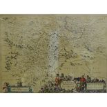
George Bickham engraved Birds Eye View of Dorsetshire with two pages of text, circa 1754, in
George Bickham engraved Birds Eye View of Dorsetshire with two pages of text, circa 1754, in glazed Hogarth frame, size overall 61 x 37cm

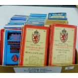
A quantity of rolled up maps and charts mainly of Scottish border towns, to include Edinburgh &
A quantity of rolled up maps and charts mainly of Scottish border towns, to include Edinburgh & Hawick Railway charts, circa 1844, etc (a lot) ....
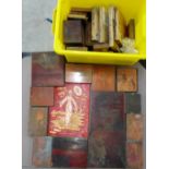
Quantity of engraved copper plates (a lot)
Quantity of coloured engraved prints to include Wm Daniel, Turner and Cassells etc., (a lot)
Quantity of coloured engraved prints to include Wm Daniel, Turner and Cassells etc., (a lot)
Quantity of copper and steel engraved prints to include Wilkie, etc., (a lot)
Four unframed etchings to include Orange Wharf, London, M.W. Ridley, (5)
Front View of the Royal Palace of Holyrood House, circa 1781, Somerville Land coloured print and '
Front View of the Royal Palace of Holyrood House, circa 1781, Somerville Land coloured print and 'Printers Proof' copper plate etching, circa 1908...
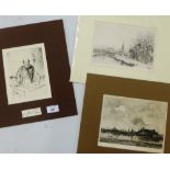
Dutch Scene copper plate etching, and two others to include 'A Winters Landscape' and 'A Scientist
Dutch Scene copper plate etching, and two others to include 'A Winters Landscape' and 'A Scientist by W. Hole', largest 22 x 15cm, (3)
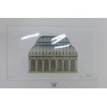
Calum Duncan McCafferty New Palm House, Royal Botanics, Edinburgh Ltd edition print No. 15/100,
Calum Duncan McCafferty New Palm House, Royal Botanics, Edinburgh Ltd edition print No. 15/100, signed in pencil, 38 x 23m ...[more]
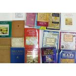
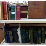
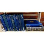
Quantity of hardback map reference books to include 'The Shape of the World and Victorian Britain
Quantity of hardback map reference books to include 'The Shape of the World and Victorian Britain and Ireland (a lot)
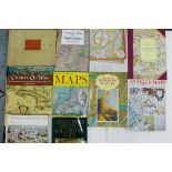
Quantity of hardback Map Reference Books, (a lot)
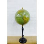
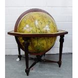
Geographical Institute of Brussels, Merzbacht and Falk, globe on ebonised column and circular
Geographical Institute of Brussels, Merzbacht and Falk, globe on ebonised column and circular foot, height 72cm ...[more]
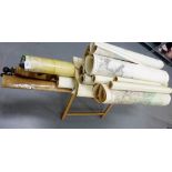
Quantity of rolled up maps and charts to include General Plan of Trinidad Estates etc., (a/f), (a
Quantity of rolled up maps and charts to include General Plan of Trinidad Estates etc., (a/f), (a lot)
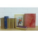
The National History of England by Benjamin Martin, circa 1763, together with The Domestic Habits of
The National History of England by Benjamin Martin, circa 1763, together with The Domestic Habits of Birds, Britain's Birds and their Nests, A. La...
Maitland's History of Edinburgh, Historical Geography of The Clans of Scotland, Black's Guide to
Maitland's History of Edinburgh, Historical Geography of The Clans of Scotland, Black's Guide to Scotland etc., (a lot)
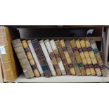
Scottish History Books to include Robertson's Works etc., (a lot)
Books of the Old Edinburgh Club, etc., (a/f), (a lot)
Quantity of 'Illustrations of the Antiquary', circa 19th century, (a lot), (a/f)
Globo Celeste, reproduction globe on stand, approx 52cm high