Refine your search
Filtered by:
- Category,
- Item Type
- List
- Grid
A subscription to the Price Guide is required to view results for auctions ten days or older. Click here for more information
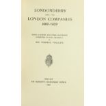

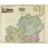
Co. Derry: Colby (Col. Thos.
Co. Derry: Colby (Col. Thos.) Ordnance Survey of the County of Londonderry, Part I [All Published] D. 1837, First Edn., hd. cold. map & other fold...
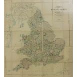
Maps: England & Wales: Faden (W.
Maps: England & Wales: Faden (W.) A Map of England, Wales & Scotland, describing all the Direct and Principal Cross Roads in Great Britain… L. 180...
Maps: Bellin (S.
Maps: Bellin (S.) Carte du Cours du Fleuve de Saint Laurent, Depuis Quebec Jusqúa la mer en deux feuilles dressee au Deposts des cartes et Plans d...
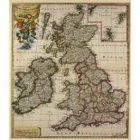
Maps - British Isles Schenk, Petrus.
Maps - British IslesSchenk, Petrus. Novissima Prae Caeteris aliis Accuratissima Regnorum Angliae, Scotiae, Hiberniae Tabula . . . 1706, Amsterdam...
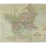
War Maps: Cary (John) A Map of the Present Seat of War on the Northern Part of France, including the Netherlands Part of Germany etc., Lg. engd. m...
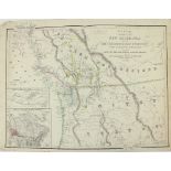
Very Large Hand-Coloured Map of IrelandMap: Thompson New General Atlas - Hewitt (N.R.) Northern and Southern Parts of Ireland, 2 large maps, toget...
American Map: Wyld (James) Map of the Colony of New Caledonia and the British & American Territory
American Map: Wyld (James) Map of the Colony of New Caledonia and the British & American Territory West of the Rocky Mountains including Vancouver...
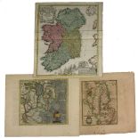
Maps - IrelandHomann (Johann Baptiste) Hiberniae Regnum tam in praecipuas, Ultoniae, Connaciaem Caceniae et Momoniae… etc. Nuremburg, c1740. 58cms...