Refine your search
Filtered by:
- Category
- List
- Grid
A subscription to the Price Guide is required to view results for auctions ten days or older. Click here for more information
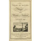

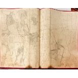
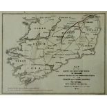
Maps: Taylor (George) & Skinner (Andrew) Taylor and Skinners Maps of the Roads of Ireland Surveyed
Maps: Taylor (George) & Skinner (Andrew) Taylor and Skinners Maps of the Roads of Ireland Surveyed 1778, 8vo D. (W. Wilson) 1778, First Edn., larg...
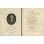
Wilson (Rob. Thomas) History of the British Expedition to Egypt, 4to L. 1803. Second Edn., port.
Wilson (Rob. Thomas) History of the British Expedition to Egypt, 4to L. 1803. Second Edn., port. frontis, 4 lg. fold. maps, with hand coloured hig...
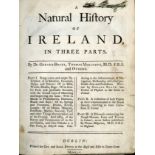
Boate (Dr. G.), Molineax (T.) & others, A Natural History of Ireland, In Three Parts, 4to D. 1755.
Boate (Dr. G.), Molineax (T.) & others, A Natural History of Ireland, In Three Parts, 4to D. 1755. First Edn. thus, 8 plts. & plans, maps etc., re...
India: Lyall (Sir A.) The Rise and Expansion of the British Dominion in India, L. 1894 maps; O'Malley (L.S.S.) The Indian Civil Service 1601 - 193...
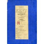
Map: Stanford's Library Map of London and its Suburbs, in 24 sheets, scale 6" to a mile, lg. fold.
Map: Stanford's Library Map of London and its Suburbs, in 24 sheets, scale 6" to a mile, lg. fold. linen backed map, London 1862, hand coloured th...
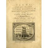
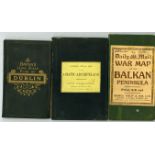
Pool (Robert) and Cash (John) Views of the Most Remarkable Public Buildings, Monuments and other Edifices, in the City of Dublin, 4to D. (J. Willi...
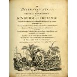
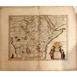
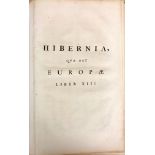
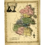
With Hand Coloured Maps Scale (Bernard) An Hibernian Atlas or General Description of the Kingdom
With Hand Coloured MapsScale (Bernard) An Hibernian Atlas or General Description of the Kingdom of Ireland, 4to, L. (Robert Sayer) 1776, First Edn...
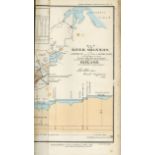
Shannon Navigation: Letter from Col. John F. Burgoyne to the Rt. Hon. Sir John Cam Hobhouse, Bart; and Further Reports to Mr. Rhodes, on the Impro...
Fold. Maps - 19th Century: Bacon (W.) New Plan of Dublin and Suburbs; W.H. Smith & Son - Plan of London; Stanford (Ed.) Asiatic Archipelago; The '...
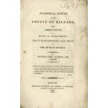
Co. Kildare: Dublin Society: Rawson (Thos. James) Statistical Survey of the County of Kildare, 8vo D. 1807. First Edn., 7 plts. some fold., 2 sing...
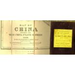
Maps: Stanford (Ed.) Map of China, Prepared for the China Inland Mission 1899. Lg. fold. linen backed map, full colour, approx. 37 1/2" x 47"; als...
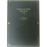
Atlas: I.M.C.: Hayes-Mc Coy (G.A.) Ulster and Other Irish Maps, c. 1600, folio D. 1964. Sole Edn, 23 cold. & other maps (some fold.) orig. gilt de...
Attractive Group of Spanish Mapsa. Bleau (W.) Utriusque Castiliae Nova descriptio, approx. 54cms x 65cms approx, Amsterdam c. 1688, with orig. han...
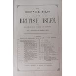
Atlas: Bacon (Geo. W.) New Ordnance Atlas of the British Isles, Lg. folio L. 1883. Printed title, 32 + 1 engd. dbl. page cold. maps & plans, all l...
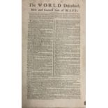
With Fine Contemporary Hand-Coloured Folding Maps Atlas: Moll (Hermann) The World Described;
With Fine Contemporary Hand-Coloured Folding MapsAtlas: Moll (Hermann) The World Described; or A New and Correct Sett of Maps, shewing the Several...
Atlas - Ordnance Survey of Ireland, Atlas containing 32 Index maps to the Counties of Ireland,
Atlas - Ordnance Survey of Ireland, Atlas containing 32 Index maps to the Counties of Ireland, updated to 1919. In various sizes, orig. wrappers, ...
Atlas: Co.
Atlas: Co. Meath: - Ordnance Survey, Atlas with Index to the Townland Survey of the County of Meath, lg. atlas folio D. May 1837. First Edn., cont...
Atlas: Co.
Atlas: Co. Dublin: - Ordnance Survey, Atlas with Index to the Townland Survey of the County of Dublin, lg. atlas folio D. 1844. Double page Map, &...
Atlas: Co. Kildare: - Ordnance Survey. Atlas, with Index to the Townland Survey of the County of Kildare, lg. atlas folio D. May 1839. First Edn.,...
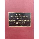
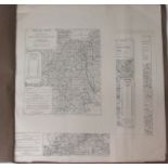
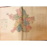
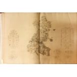
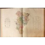
Railways: Larcom (Lieut) Atlas to Accompany 2nd Report of the Railway Commissioners, Ireland,
Railways: Larcom (Lieut) Atlas to Accompany 2nd Report of the Railway Commissioners, Ireland, 1838 V. Lg. atlas folio L. 1838., 6 lg. dble. page m...
Co. Mayo: Ordnance Survey Atlas, Westport House Estate Maps, lg. atlas folio D. c. 1855, containing 49 lg. dble. page engd. maps, some hand colou...
Rare Map of Dublin,
Rare Map of Dublin, 1717Map: A Map of ye Strand of ye North Side of ye Channel of ye River Anna Liffe as it was granted and set out in Easter Asse...
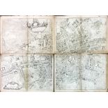
Rare Dublin MapRocque (John) An Exact Survey of the City and Suburbs of Dublin, in which is Expressed the Ground Plot of all Public Buildings, Dwe...
Map of Dublin: Faden (W.
Map of Dublin: Faden (W.) A Plan of the City of Dublin as Surveyed for the Use of the Divisional Justices, to which have been added Plans of the C...

Rare Map of the Diocese of Meath, 1816Map: Beauford (Daniel Augustus) Rector of Navan, The Diocese of Meath comprising Meath, Westmeath and part o...
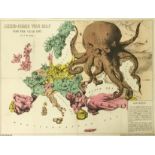
Map: Bacon (G.W.) & Co. Publishers Serio-comic War Map for the Year 1877, by F.W. Rose. A large interesting and colourful map, with 'Reference' pr...
Map: Allard (Carol) Hyberniae Regni in Provincias Ultoniam, Connach am Lageniam Momoniamq divisi Tabula Accuratissima Editore Covens et Mortier, A...
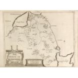
Map: Kilkenny City: Byron (Sam.) A Plan of the City of Kilkenny,.. Approved by the Dublin Society, c. 1800, approx. 32cms x 44cms (12 1/2" x 17 1/...
Map: (Wm.) Hiberniae Ireland Anglis. Yverdon Brittannis Erin incolis. Ierna Orphaeo & Arist.
Map: (Wm.) Hiberniae Ireland Anglis. Yverdon Brittannis Erin incolis. Ierna Orphaeo & Arist. Iris Diodero Siculo Ivverna Suuenali Ioyernia Pt...
Map: Irish Railways: Mac Neill (J.) Engineer, Map of the South and South West Parts of Ireland, Showing the line of the Proposed Extension of the ...
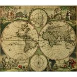
World Map: De Wit (A. Fred) Nova Orbis Tabula, in Lucem Edita, Amsterdam c. 1680. approx. 47cms x 56cms, with engd. cartouche and attractive hand-...
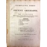
Atlas: D'Anville (Mons.) A Complete Body of Ancient Geography, lg. atlas folio L. (for Robert Sayer) c. 1765, 13 lg. dble. page maps, hd. cold. in...
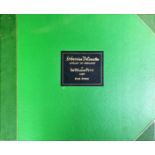
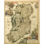
Limited Edition With Hand-Coloured MapsAtlas: Petty (Sir Wm.) Hibernia Delineatio, Atlas of Ireland. V. large oblong atlas folio Newcastle upon Ty...
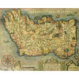
Blaeu's Hibernian AtlasBlaeu (Johannes) Atlas Hibernia, Amsterdam? c. 1662. Five dble page maps, Ireland, Mounster (Munster), Connachtia (Connacht...
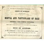
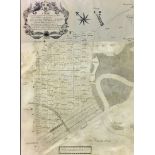
With 10 large Hand-Coloured Folding MapsCo. Tipperary: Sale of Incumbered Estates in Ireland - In the Matter of the Estate of Mathew Pennefather o...
Irish Maps: A fine group of 11 late 18th Century engd. maps of Munster, and ten of the Counties of Ireland, as follows, Tipperary, Queen Co., Mayo...
Maps: Petty (Sir Wm.
Maps: Petty (Sir Wm.) Hibernian Delineatio, Three maps from the 1685 Edition, The County of Londonderry; The County of Fermanagh, & The County of ...
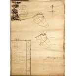
Map: Co. Down: Benn (John) Surveyor, A Map of Part of Tullylish, the Property of James Christy, Esq.
Map: Co. Down: Benn (John) Surveyor, A Map of Part of Tullylish, the Property of James Christy, Esq., situate in the County of Down, 1793, An attr...
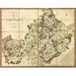
Co. Westmeath Grand Jury Map: Larkin (Wm.) A Map of the County of Westmeath, a lg. fold. hand cold.
Co. Westmeath Grand JuryMap: Larkin (Wm.) A Map of the County of Westmeath, a lg. fold. hand cold. engraved map, approx. 68cms x 86cms (27" x 34")...
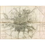
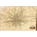
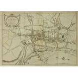
Map: Campbell (Thos.) & Taylor (Major) City of Dublin, 1811, lg. folio linen backed engd. map, approx. 77cms x 125cms (30 1/2" x 49"), a few stain...
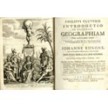
Cluverius (Philip) Introudctio in Universam Geographiam, 4to L. 1711. Ed. by J. Bunone, engd.
Cluverius (Philip) Introudctio in Universam Geographiam, 4to L. 1711. Ed. by J. Bunone, engd. frontis, 48 engd. mostly fold. maps, & 12 plts. (mos...