Filtered by:
- Category,
- Item Type
- List
- Grid
A subscription to the Price Guide is required to view results for auctions ten days or older. Click here for more information
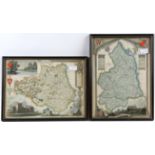

After Thomas Moule. A pair of hand coloured maps, Northumberland, 29 x 22cm and Durham 22 x 29cm.
After Thomas Moule. A pair of hand coloured maps, Northumberland, 29 x 22cm and Durham 22 x 29cm. Also after Thomas Gardner, road map from Tinmo...
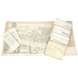
Facsimile Map of London in the Reign of Queen Elizabeth published by Cassell, various 18th and 19th
Facsimile Map of London in the Reign of Queen Elizabeth published by Cassell, various 18th and 19th century indentures and two sale catalogues for...
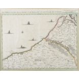
Three maps. J. Covens and C. Mortier, Amsterdam, Map of the coast of France from St. Valeri to Dieppe "Les Embouchures de la Somme et de Bresle Ri...
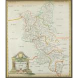
J. Ogilby, Worcestershire 'The Road from London to Montgomery North Wales' pg. 110 Campden, Evesham, Worcester, 18.5cm x 11.5cm, R. Creighton, ma...
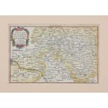
Guiljem Blaeu , Map of L'Alsace with Lothringen and the cities Strassburg, Breisach, Colmar,
Guiljem Blaeu , Map of L'Alsace with Lothringen and the cities Strassburg, Breisach, Colmar, Freiburg, Basel, etc. 40cm x 56cm framed and double g...
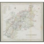
Robert Morden, map of Buckinghamshire, Sold by Abel Swale, Awnsham & John Churchill, 41cm x 34cm map of Essex without colour, 34.5cm x 40.5cm and ...
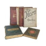
Set of books, to include 'The Works of William Hogarth, reproduced from the original engravings'
Set of books, to include 'The Works of William Hogarth, reproduced from the original engravings' (London: Bell and Daldy, 1873, two volumes), Char...