Refine your search
Filtered by:
- Sale Section,
- Item Type
- List
- Grid
A subscription to the Price Guide is required to view results for auctions ten days or older. Click here for more information
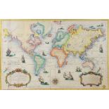

French hand-coloured map of the world showing one of the earliest depictions of Australia, 54 x
French hand-coloured map of the world showing one of the earliest depictions of Australia, 54 x 82cm,
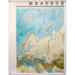
Russian Hydrographic Office submarine charts or maps World Folio, set of 8, each 119 x 91.5cm
Russian Hydrographic Office submarine charts or maps World Folio, set of 8, each 119 x 91.5cm
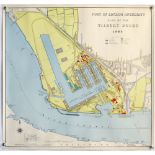
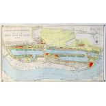
Hydrographic Office map 'Port of London Authority Plan of the Tilbury Docks 1968', Based upon the
Hydrographic Office map 'Port of London Authority Plan of the Tilbury Docks 1968', Based upon the Ordnance Survey Maps, printed by Cook, Hammond &...
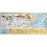
Hydrographic Office map 'Port of London - The River Thames from Teddington to The Tongue', Based
Hydrographic Office map 'Port of London - The River Thames from Teddington to The Tongue', Based upon the Ordnance Survey Maps, 49.5 x 104cm ...
Hydrographic Office map 'Port of London Authority Plan of the Royal Group of Docks 1968', Based upon
Hydrographic Office map 'Port of London Authority Plan of the Royal Group of Docks 1968', Based upon the Ordnance Survey Maps, printed by Cook, Ha...
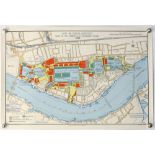
Hydrographic Office map 'Port of London Authority Plan of the Surrey Commercial Docks 1968', Based
Hydrographic Office map 'Port of London Authority Plan of the Surrey Commercial Docks 1968', Based upon the Ordnance Survey Maps, printed by Cook,...
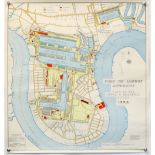
Hydrographic Office map 'Port of London Authority Plan of the India and Millwall Docks 1968',
Hydrographic Office map 'Port of London Authority Plan of the India and Millwall Docks 1968', Based upon the Ordnance Survey Maps, printed by Cook...
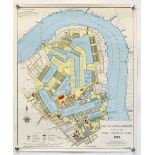
Hydrographic Office map 'Port of London Authority Plan of the London & St Katherine's Docks 1968',
Hydrographic Office map 'Port of London Authority Plan of the London & St Katherine's Docks 1968', Based upon the Ordnance Survey Maps, printed by...
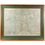
Map of London by C.W. Bacon & Co., 127 Strand, framed, 46 x 62cm ...[more]
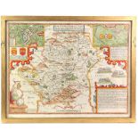
Speed J. : Hartford Shire described, The situations of Hartford and the most ancient towne S.
Speed J. : Hartford Shire described, The situations of Hartford and the most ancient towne S.Albons with such memorable actions as have happened, ...

Sussex. Norden (John & Speed, John), Sussex described and divided into Rapes with the situation of
Sussex. Norden (John & Speed, John), Sussex described and divided into Rapes with the situation of Chichester the cheife citie and the armes of su...