Filtered by:
- Category,
- Item Type
3 items
- List
- Grid
A subscription to the Price Guide is required to view results for auctions ten days or older. Click here for more information
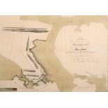

E.H. ROSS, A CHART OF THE ARCTIC REGIONS, CIRCA 1834, titled "To His Most Excellent Majesty William IVth King of Great Britain Ireland &c. this Ch...
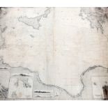
A GROUP OF EIGHT 19TH CENTURY CHARTS, including Strait of Dover, Gulf of Finland, Irish or St. Georges Sea, River Thames, etc, some pub. by Imray....
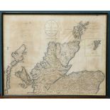
CARY (JOHN), A NEW & CORRECT MAP OF THE NORTH PART OF SCOTLAND FROM THE BEST AUTHORITIES, engraved map with hand colouring, framed. 41.5cm by 53cm...