
Filtered by:
- Lots with images only,
- Category
4 items
- List
- Grid
A subscription to the Price Guide is required to view results for auctions ten days or older. Click here for more information

Lot 14
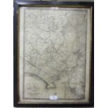
A 19th century map 'The Environs of Plymouth, Stonehouse and Devonport showing the Existing and
A 19th century map 'The Environs of Plymouth, Stonehouse and Devonport showing the Existing and Proposed Fortifications', Pub. W Wood, 52 Fore Str...
Lot 26
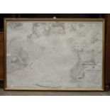
A framed Hydrographic Office Admiralty Chart 'England - South Coast Plymouth Sound', 69 x 98cm, (a/
A framed Hydrographic Office Admiralty Chart 'England - South Coast Plymouth Sound', 69 x 98cm, (a/f).
Lot 42
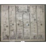
A John Ogilby road map, 'The Road from Bristol to Chester', 35 x 45cm, framed, a smaller road
A John Ogilby road map, 'The Road from Bristol to Chester', 35 x 45cm, framed, a smaller road map, 'Bristol to Chester' from Bowles's Post-chaise ...
Lot 43
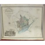
A Greenwood & Co. map of the County of Monmouth, hand-coloured, engraved Josiah Neele, published
A Greenwood & Co. map of the County of Monmouth, hand-coloured, engraved Josiah Neele, published 1831, 63 x 75cm, unframed, three other maps of Mo...