
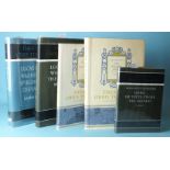
Refine your search
Estimate
Category
- Books & Periodicals (176)
- Models, Toys, Dolls & Games (133)
- Maps (115)
- Collectables (48)
- Arms, Armour & Militaria (42)
- Prints (22)
- Stamps (17)
- Cameras & Camera Equipment (14)
- Vintage Fashion (13)
- Musical Instruments & Memorabilia (11)
- Coins (10)
- Scientific Instruments (7)
- Silver & Silver-plated items (6)
- Sculpture (5)
- Sporting Memorabilia & Equipment (5)
- Drawings & Pastels (3)
- Entertainment Memorabilia (3)
- Metalware (3)
- Textiles (3)
- Bank notes (2)
- Ceramics (2)
- Jewellery (2)
- Furniture (1)
- Glassware (1)
- Japanese Works of Art (1)
- Kitchenalia (1)
- Oil, Acrylic paintings & Mixed Media (1)
- Photographs (1)
- Salvage & Architectural Antiques (1)
- Watercolours (1)
- Wines & Spirits (1)
Filtered by:
- Item Type
- List
- Grid
A subscription to the Price Guide is required to view results for auctions ten days or older. Click here for more information
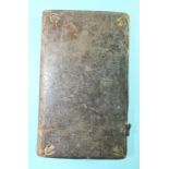

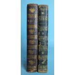
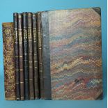
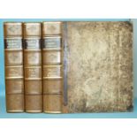
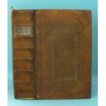
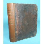
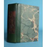
Rider (Cardanus), Riders (1694) British Merlin, printed in red and black by Edward Jones for the
Rider (Cardanus), Riders (1694) British Merlin, printed in red and black by Edward Jones for the Company of Stationers, cf gt, (two clasps missing...
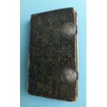
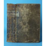
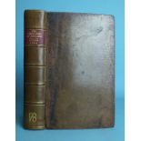
Rider (Cardanus), Riders (1735) British Merlin, printed in red and black by R Nutt for the Company
Rider (Cardanus), Riders (1735) British Merlin, printed in red and black by R Nutt for the Company of Stationers, ge, floral end papers, gt dec mo...
Rider (Cardanus), Riders British Merlin For the Year of our Lord God 1742, printed in red and
Rider (Cardanus), Riders British Merlin For the Year of our Lord God 1742, printed in red and black by R Nutt for the Company of Stationers, flora...
Rider (Cardanus), Riders British Merlin for the Year of our Lord God 1744, printed in red and
Rider (Cardanus), Riders British Merlin for the Year of our Lord God 1744, printed in red and black by R Nutt for the Company of Stationers, marbl...
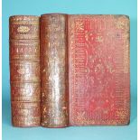
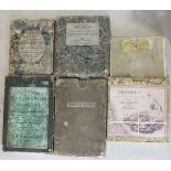
The Gentleman's Diary, The Ladies Diary and four other almanacs for the year 1805, ge, red mor gt,
The Gentleman's Diary, The Ladies Diary and four other almanacs for the year 1805, ge, red mor gt, 16mo, 1805 and another, similar, for the year 1...
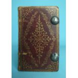
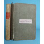
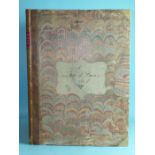
Almanacs for the year 1704 by William Cookson, William Andrews, Richard Saunder, John Wing and
Almanacs for the year 1704 by William Cookson, William Andrews, Richard Saunder, John Wing and twelve others, bound together, ge, black mor gt, wi...
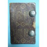
The Royal Kalendar with Rider's British Merlin for 1803, printed in red and black, ge, gt dec red
The Royal Kalendar with Rider's British Merlin for 1803, printed in red and black, ge, gt dec red mor, 18mo, 1803, (clasps lacking) and another al...
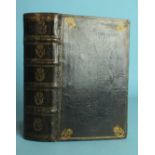
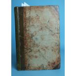
Grafton (Richard), A Briefe Treatise Containing Many Proper Tables and Easie Rules, Very Necessary
Grafton (Richard), A Briefe Treatise Containing Many Proper Tables and Easie Rules, Very Necessary and Needful for the Use and Commodity of all pe...
Almanacs for the year 1797: The Gentleman's Diary, The Ladies' Diary and six others by Francis
Almanacs for the year 1797: The Gentleman's Diary, The Ladies' Diary and six others by Francis Moors, John Partridge, Poor Robin, Henry Season, Ty...
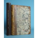
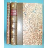
Ogilby (John) and Senex (John), The Roads Through England Delineated or, Ogilby's Survey Revised,
Ogilby (John) and Senex (John), The Roads Through England Delineated or, Ogilby's Survey Revised, Improved and Reduced to a Size portable for the ...
Gray (George Carrington), Gray's New Book of Roads, hd col fldg map, 48 engr maps, (2 fldg), hf
Gray (George Carrington), Gray's New Book of Roads, hd col fldg map, 48 engr maps, (2 fldg), hf mor gt, square 8vo, 1824.
Owen (W), Owen's New Book of Roads, fldg map, re-backed cf spine, orig bds, 12mo, 1808.
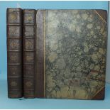
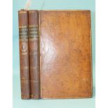
Pinkerton (John), Modern Geography, A Description of the Empires, Kingdoms, States and Colonies With
Pinkerton (John), Modern Geography, A Description of the Empires, Kingdoms, States and Colonies With the Oceans, Seas and Isles, New Edition, 3 vo...
Salmon (Thomas), A New Geographical and Historical Grammar, 9th edn, red and black tp, engr fldg
Salmon (Thomas), A New Geographical and Historical Grammar, 9th edn, red and black tp, engr fldg maps as listed and one extra of North Wales, cf g...
Keere (Pieter Van Den), England, Wales, Scotland and Ireland Described and Abridged..... 1668, tp
Keere (Pieter Van Den), England, Wales, Scotland and Ireland Described and Abridged..... 1668, tp and first 8pp all facsimiles, 61 (of 63) engr ma...
Dodsley (R & J, Publishers), England Illustrated or a Compendium of the Natural History, Geography, Topography and Antiquities Ecclesiastical and ...
Burlington (Charles) and others, The Modern Universal British Traveller, or a New Complete and
Burlington (Charles) and others, The Modern Universal British Traveller, or a New Complete and Accurate Tour Through England, Wales, Scotland and ...
Dodsley (Robert) and Cowley (John), The Geography of England Done in the Manner of Gordon's Geographical Grammar....... also a Separate Mapp of En...
Mogg (Edward), Paterson's Roads, 18th edn, fldg engr Map of England and Wales, frontis, 12 maps on 9
Mogg (Edward), Paterson's Roads, 18th edn, fldg engr Map of England and Wales, frontis, 12 maps on 9 fldg sheets, me, hf mor gt, 8vo, nd and Mogg'...
Young (Arthur), A Six Weeks Tour Through the Southern Counties of England and Wales, illus, rebound hf cf gt, 8vo, 1768, 1st edn; Webb (Daniel Car...
Ogilby (John) and Morgan (William), The Traveller's Pocket-Book or Ogilby and Morgan's Book of the
Ogilby (John) and Morgan (William), The Traveller's Pocket-Book or Ogilby and Morgan's Book of the Roads Improved and Amended in a method never be...
Wightwick (George), Nettleton's Guide to Plymouth, Stonehouse, Devonport and to the Neighbouring
Wightwick (George), Nettleton's Guide to Plymouth, Stonehouse, Devonport and to the Neighbouring Country, frontis, 3 fldg maps, 10 plts, cl with l...
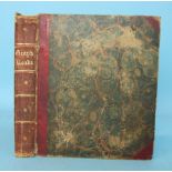
Hall (Sidney), A Travelling County Atlas: With all the Railroads Accurately Laid down and Coloured, 46 d-p maps, hd col in outline, some fldg, reb...
Botanista (Theophilus, pseud.), Rural Beauties; Or The Natural History of the Four Following Western
Botanista (Theophilus, pseud.), Rural Beauties; Or The Natural History of the Four Following Western Counties......., engr frontis, fldg map, re-b...
Butler (Samuel), An Atlas of Ancient Geography, 21 d-p map plts, mainly hd col lining, hf mor gt,
Butler (Samuel), An Atlas of Ancient Geography, 21 d-p map plts, mainly hd col lining, hf mor gt, 8vo, nd; and Capper, (Benjamin Pitts), A Topogra...

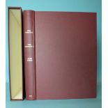
Facsimile: John Norden's Manuscript Maps of Cornwall and Its Nine Hundreds, col dp plts, cl gt, 4to,
Facsimile: John Norden's Manuscript Maps of Cornwall and Its Nine Hundreds, col dp plts, cl gt, 4to, 1972 and other modern volumes on the maps of ...
Facsimile: Ayton (Richard) and Daniel (William), A Voyage Round Great Britain, 2 vols, illus, slip
Facsimile: Ayton (Richard) and Daniel (William), A Voyage Round Great Britain, 2 vols, illus, slip case, cl gt, 4to, 1978; Domesday Book Studies:...
Desnos (Louis Charles), Senex (John) and Bellin (Jacques), Nouvel Atlas D'Angleterre 1767 bound with
Desnos (Louis Charles), Senex (John) and Bellin (Jacques), Nouvel Atlas D'Angleterre 1767 bound with The Roads Through England or, Ogilby Survey (...
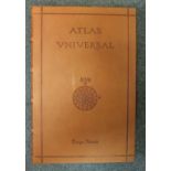
Homen (Diogo), Atlas Universal, facsimile of a medieval manuscript, no.825/987, 19 d-p maps, col and
Homen (Diogo), Atlas Universal, facsimile of a medieval manuscript, no.825/987, 19 d-p maps, col and gt, cf, in cf case, 1 ge fo, Barcelona 2000 a...
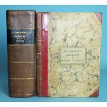
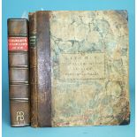
Cary's New and Correct English Atlas Being a New Set of County Maps from Actual Surveys......,
Cary's New and Correct English Atlas Being a New Set of County Maps from Actual Surveys......, engr tp, 46 hd col outlined engr maps, (complete), ...
Cary's New Itinerary, or an Accurate Delineation of the Great Roads...... England and Wales, fldg
Cary's New Itinerary, or an Accurate Delineation of the Great Roads...... England and Wales, fldg map, hf cf gt, 8vo 1798, 1st Edn, another editio...
Badeslade (Thomas) and Toms (William Henry), Chorographia Britanniae or, A New Set of Maps of all
Badeslade (Thomas) and Toms (William Henry), Chorographia Britanniae or, A New Set of Maps of all the Counties in England and Wales, 1st Edn, doub...
Blewitt (Mary), Surveys of the Seas, col plts, illus, cl gt, fo, 1957; an Anderson Auction Co, NY,
Blewitt (Mary), Surveys of the Seas, col plts, illus, cl gt, fo, 1957; an Anderson Auction Co, NY, catalogue of the Portolan Charts of the XV XVI ...
Worms (Lawrence), and Baynton-Williams (Ashley), British map engravers, illus, dwrps, cl gt, 8vo,
Worms (Lawrence), and Baynton-Williams (Ashley), British map engravers, illus, dwrps, cl gt, 8vo, 2011 and other books on maps.
Pedley (Mary Sponberg), Bel et Utile, the Work of the Robert de Vaugondy Family of Mapmakers, illus,
Pedley (Mary Sponberg), Bel et Utile, the Work of the Robert de Vaugondy Family of Mapmakers, illus, dwrps, cl gt, 4to, 1992 and other modern atla...
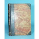
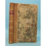
Shaw (Rev. Stebbing), A Tour to the West of England in 1788, hf cf gt, 8vo, 1789; Dunsford (Martin),
Shaw (Rev. Stebbing), A Tour to the West of England in 1788, hf cf gt, 8vo, 1789; Dunsford (Martin), Miscellaneous Observations in the Course of T...
Wallis (John), Wallis's New Pocket Edition of the English Counties or Travellers Companion, 44 hd
Wallis (John), Wallis's New Pocket Edition of the English Counties or Travellers Companion, 44 hd col maps, (including unlisted Isle of Wight), re...
Wallis (John), Wallis's Pocket Itinerary, being a New and Accurate Guide to all the Principal Direct
Wallis (John), Wallis's Pocket Itinerary, being a New and Accurate Guide to all the Principal Direct and Cross Roads Throughout England, Wales and...
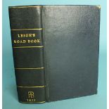
Leigh (Samuel), Leigh's New Atlas of England and Wales, engr tp only, 55 engr maps, bound with
Leigh (Samuel), Leigh's New Atlas of England and Wales, engr tp only, 55 engr maps, bound with Leigh's New Pocket Road Book of England and Wales, ...
Owen (John) and Bowen (Emanuel), Britannia Depicta, or, Ogilby Improv'd, Being a Correct Coppy of Mr
Owen (John) and Bowen (Emanuel), Britannia Depicta, or, Ogilby Improv'd, Being a Correct Coppy of Mr Ogiby's Actual Survey of all Ye Direct and Pr...
Cary (John), Cary's New Itinerary, or, An Accurate Delineation of the Great Roads.... England and
Cary (John), Cary's New Itinerary, or, An Accurate Delineation of the Great Roads.... England and Wales....Scotland, 2nd edn, fldg maps, rebacked ...
Donn (Benjamin), A Map of the County of Devon with the City and County of Devon with the City and
Donn (Benjamin), A Map of the County of Devon with the City and County of Devon with the City and County of Exeter, hd col map of Devon, 11 hd col...
Paterson (Capt. Daniel), Paterson's British Itinerary Being a New and Accurate Delineation and
Paterson (Capt. Daniel), Paterson's British Itinerary Being a New and Accurate Delineation and Description of the Direct and Principal Cross Roads...
Speed (John), The Theatre of the Empire of Great Britain with the Prospect of the Most Famous
Speed (John), The Theatre of the Empire of Great Britain with the Prospect of the Most Famous Parts of the World, 1676, facsimile edn, pub Jonatho...
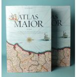
Blaeu (Joan), Atlas Major of 1665, facsimile reprint by Taschen, col illus, dwrp, bds, slip case,
Blaeu (Joan), Atlas Major of 1665, facsimile reprint by Taschen, col illus, dwrp, bds, slip case, fo, nd.
Theatrum Orbis Terrarum series of facsimile atlases: 1st series, vol IV, 1964, 3rd series, vols
Theatrum Orbis Terrarum series of facsimile atlases: 1st series, vol IV, 1964, 3rd series, vols I & II, 1966, 5th series, vols I and III, 1969-70...
Cary (John), Cary's Traveller's Companion or a Delineation of the Turnpike Roads of England and
Cary (John), Cary's Traveller's Companion or a Delineation of the Turnpike Roads of England and Wales, engr tp, hd col engr fldg map of Yorkshire,...
Owen (W), Owen's New Book of Roads or a Description of the Roads of Great Britain, 2nd edn, facsimile map, rebound hf cf gt, 12mo, 1779; also Owen...
Kitchin (Thomas), The Traveller's Guide Through England and Wales, engr hd col map in pocket at rear
Kitchin (Thomas), The Traveller's Guide Through England and Wales, engr hd col map in pocket at rear dated 1783, (repaired), hf cf gt, 15.5 x 19.5...
Laurie (Robert) and Whittle (James), New Traveller's Companion: Exhibiting A Complete and Correct
Laurie (Robert) and Whittle (James), New Traveller's Companion: Exhibiting A Complete and Correct Survey of all the Direct and Principal Cross Roa...
Morden (Robert), The New Description and State of England Containing the Maps of the Counties of
Morden (Robert), The New Description and State of England Containing the Maps of the Counties of England and Wales, 2nd edn, no frontis, pp 97-112...
Antoninus (Augustus), Antonini Iter Britanniarum Commentariis Illustratum Thomae Gale, fldg map, 2
Antoninus (Augustus), Antonini Iter Britanniarum Commentariis Illustratum Thomae Gale, fldg map, 2 plts, text illus, re-backed, cf gt, 4to, 1709.
Ogilby (John), The Traveller's Guide: or A Most Exact Description of the Roads of England.... fldg
Ogilby (John), The Traveller's Guide: or A Most Exact Description of the Roads of England.... fldg engr 'New Mapp of the Roads', 2nd pt titled 'Ta...
A New and Accurate Description of the Present Great Roads and the Principal Cross Roads of England
A New and Accurate Description of the Present Great Roads and the Principal Cross Roads of England and Wales, Commencing at London...... fldg engr...
Oulton (W C), The Traveller's Guide or English Itinerary, 2 vols, 66 views on 22 plts, re-backed
Oulton (W C), The Traveller's Guide or English Itinerary, 2 vols, 66 views on 22 plts, re-backed cf gt, orig bds, 12mo, 1805.
Paterson (Daniel), A New and Accurate Description of all the Direct and Principal Cross Roads in
Paterson (Daniel), A New and Accurate Description of all the Direct and Principal Cross Roads in Great Britain, fldg engr map, 12mo, 1772.
Cary (John), Cary's New Itinerary: or An Accurate Delineation of the Great Roads.... England and
Cary (John), Cary's New Itinerary: or An Accurate Delineation of the Great Roads.... England and Wales, 5 fldg engr maps, re-backed, hf cf gt, ori...
Cary (G & J), maps of Devon and Cornwall from The New Map of England, sheets 1-3, 8-10, 16 & 17, now
Cary (G & J), maps of Devon and Cornwall from The New Map of England, sheets 1-3, 8-10, 16 & 17, now rebound together with Explanation Sheet, all ...
Chauchard (Capt Jean Baptiste Hippolyte) A General Map of the Empire of Germany, Holland, the
Chauchard (Capt Jean Baptiste Hippolyte) A General Map of the Empire of Germany, Holland, the Netherlands, Switzerland, The Grisons, Italy, Sicily...
Five late-18th/early-19th century road maps of England and Wales: Bowle's Road Director 1803; Cary's
Five late-18th/early-19th century road maps of England and Wales: Bowle's Road Director 1803; Cary's Pocket Companion 1791; W Fadon to accompany P...