
Filtered by:
- Lots with images only,
- Category
- List
- Grid
A subscription to the Price Guide is required to view results for auctions ten days or older. Click here for more information
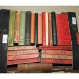

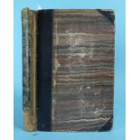
Besley (Henry), Pub, The Route Book of Devon, new edn, fldg maps, plts, pic cl gt, 12mo, n.d and
Besley (Henry), Pub, The Route Book of Devon, new edn, fldg maps, plts, pic cl gt, 12mo, n.d and other guides to Devon.
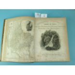
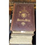
Britton (J) & Brayley (EW), Devonshire Illustrated in a Series of Views of Cities, Towns, Public
Britton (J) & Brayley (EW), Devonshire Illustrated in a Series of Views of Cities, Towns, Public Buildings........., and, Cornwall Illustrated in ...
Britton (J) & Brayley (EW), Devonshire Illustrated in a Series of Views........., and, Cornwall
Britton (J) & Brayley (EW), Devonshire Illustrated in a Series of Views........., and, Cornwall Illustrated in a Series of Views........, 2 engr m...
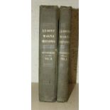
Lysons (Rev Daniel & Samuel), Magna Britannia, Volume the Sixth, Devonshire, plts 1 + 2, 34 plts and
Lysons (Rev Daniel & Samuel), Magna Britannia, Volume the Sixth, Devonshire, plts 1 + 2, 34 plts and maps, cl gt, 4to, 1822.
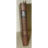
Rowe (Samuel), A Perambulation of the Ancient & Royal Forest of Dartmoor, litho frontis, tp and 9
Rowe (Samuel), A Perambulation of the Ancient & Royal Forest of Dartmoor, litho frontis, tp and 9 plts, fldg map, hf mor gt (a/f), 8vo, 1848.
The Imperial Gazetteer and Atlas-Map of England & Wales, 6 vols, (plts and plans removed), index
The Imperial Gazetteer and Atlas-Map of England & Wales, 6 vols, (plts and plans removed), index volume and map in 18 linen-backed sectionalised p...
Bacon's Excelsior Map of Devon & Cornwall, sectionalised on linen, cl gt, 8vo, n.d; Cary (John),
Bacon's Excelsior Map of Devon & Cornwall, sectionalised on linen, cl gt, 8vo, n.d; Cary (John), Cary's Traveller's Companion or a Delineation of ...

Psalmanaazaar (George) (Pseud.), An Historical and Geographical Description of Formosa, fldg map,
Psalmanaazaar (George) (Pseud.), An Historical and Geographical Description of Formosa, fldg map, fldg alphabet and 16 plts, (1 un-numbered, fig. ...
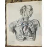
Quain (Richard), The Anatomy of the Arteries of the Human Body with its Applications to Pathology
Quain (Richard), The Anatomy of the Arteries of the Human Body with its Applications to Pathology and Operative Surgery, (atlas vol only, no text ...
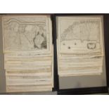
A folio containing approximately twenty-six mid-18th century unframed engraved maps of mainly
A folio containing approximately twenty-six mid-18th century unframed engraved maps of mainly military installations and battle plans, with troop ...
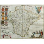
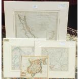
Two 18th century unframed hand-coloured maps of Devonia, together with coats of arms and Royal
Two 18th century unframed hand-coloured maps of Devonia, together with coats of arms and Royal standards, 39 x 50cm, a John Speed uncoloured map '...
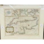
An unframed hand-coloured map, 'A Correct Chart of the Bay of Biscay...... from Morlaix to Valencia for Mr Tindal's Continuation of Mr Rapin's His...
An unframed 'Correct Chart of the English Channel from No. Foreland to the Lands End on the coast of
An unframed 'Correct Chart of the English Channel from No. Foreland to the Lands End on the coast of England and from Calais to Brest opn the coas...
An unframed hand-coloured engraved map, 'Arabian Gulf or Red Sea', from D'Anvilles Atlas eng. for
An unframed hand-coloured engraved map, 'Arabian Gulf or Red Sea', from D'Anvilles Atlas eng. for John Harrison, 47 x 34cm and three other unframe...
A large collection of coloured unframed world atlas maps.
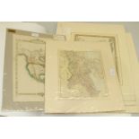
A collection of unframed mounted coloured world atlas maps.
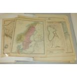
A collection of fifteen mounted unframed hand-coloured maps, 'Dugdale's England and Wales' and
A collection of fifteen mounted unframed hand-coloured maps, 'Dugdale's England and Wales' and others, together with a collection of book plate ma...
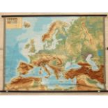
A large school wall map of Europe by Relief-Technik, 150 x 215cm.
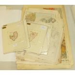
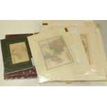
Various Parliamentary boundary maps, Ordnance Geological Survey map of Great Britain and other
Various Parliamentary boundary maps, Ordnance Geological Survey map of Great Britain and other mainly early-20th century maps, together with atlas...
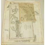
An uncoloured map 'Asia Minor for Dr Playflairs Geography', 48 x 56cm, another, 'Libyae Vel Africae for Dr Playfair's Geography', 29 x 48cm and on...
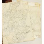
An early-19th century map of Scotland, 'A Travelling Map of Scotland', copied from a map accompanying the reports of a Parliamentary Commission fo...