Refine your search
Filtered by:
- Category,
- Item Type
4 items
- List
- Grid
A subscription to the Price Guide is required to view results for auctions ten days or older. Click here for more information
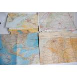

A large collection of maps to include Ordnance surver Carmarthenshire and other surrounding areas. Also hand held Ordnance survey and similar all ...
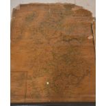
A collection of vintage roll up maps dating from the 19th and early 20th century to include a map of Bridgewater Bay, Somerset. Also, Cruchleys ma...
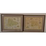
Local Interest - Two framed and glazed antique style maps to include a map of Pucklechurch 1844 and the other of Bitton 1843. Both measure 49cm ta...
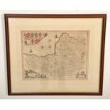
Johannes Blaeu (1599-1673) ‘Somerset Tensis – Somerset Shire’ – 17th century engraved and hand coloured map of Somerset. Framed. Measures 51cm tal...