Filtered by:
- Category,
- Item Type
- List
- Grid
A subscription to the Price Guide is required to view results for auctions ten days or older. Click here for more information
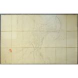

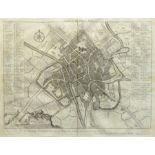
Large Victorian Ordnance Survey map of Scarborough surveyed 1850, pub. 1852, comprising twenty-one 6
Large Victorian Ordnance Survey map of Scarborough surveyed 1850, pub. 1852, comprising twenty-one 64cm x 44cm sheets joined on three lengths of l...
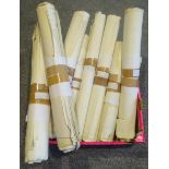
Large quantity of Ordnance Survey maps of North Yorkshire, c.1940s-1960s, including Scarborough, Sea
Large quantity of Ordnance Survey maps of North Yorkshire, c.1940s-1960s, including Scarborough, Seamer, Ayton, Driffield, Whitby, Robin Hood's Ba...
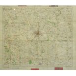
York District Ordnance Survey early 'Motoring' map pub. 1919, 65cm x 76cm - Condition Report ...[more]
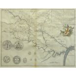
18th century Francis Drake (1696-1771) map of York and its Boundaries with Seals, from the History a
18th century Francis Drake (1696-1771) map of York and its Boundaries with Seals, from the History and Antiquities of the City of York pub.1736, h...
18th century Francis Drake (1696-1771) Plan of the City of York, from the History and Antiquities of
18th century Francis Drake (1696-1771) Plan of the City of York, from the History and Antiquities of the City of York pub.1736, 32cm x 41.5cm - Co...
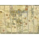
17th century John Ogilby (1600-1676) strip map 'The Roads from York to Whitby and Scarborough' pub.
17th century John Ogilby (1600-1676) strip map 'The Roads from York to Whitby and Scarborough' pub. 1675, hand coloured 33cm x 44cm - Condition Re...
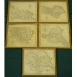
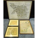
After John Cary (British c.1754-1835): Set five maps of Yorkshire, comprising 'North Riding', 'East
After John Cary (British c.1754-1835): Set five maps of Yorkshire, comprising 'North Riding', 'East Riding', 'West Riding I & II', and an overall ...
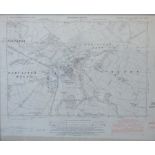
Ordnance Survey map of Tadcaster pub. Chessington 1953, provisional edition 42cm x 52cm - Condition Report ...[more]
After Christopher Saxton (British c.1540-c.1610): 'Anglesey Mona Insula', hand-coloured map pub. 163
After Christopher Saxton (British c.1540-c.1610): 'Anglesey Mona Insula', hand-coloured map pub. 1637, After Robert Morden (British c.1650-1703): ...