Filtered by:
- Category,
- Item Type
- List
- Grid
A subscription to the Price Guide is required to view results for auctions ten days or older. Click here for more information
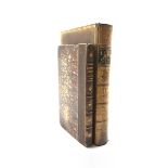

James Mountain 'The History of Selby' printed by Edward Peck 1800 with folding map and plate, bound
James Mountain 'The History of Selby' printed by Edward Peck 1800 with folding map and plate, bound with 'History of Cawood' half morocco and W ...
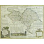
After Emanuel Bowen (Welsh 1694-1767): 'An Accurate Map of the North Riding of Yorkshire Divided in
After Emanuel Bowen (Welsh 1694-1767): 'An Accurate Map of the North Riding of Yorkshire Divided into its Wapontakes', hand-coloured map 54cm x 7...
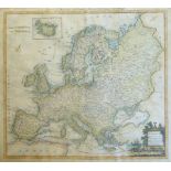
Thomas Conder (British 1747-1831): 'Europe Agreeable to the Most Approved Maps and Charts', 18th/19
Thomas Conder (British 1747-1831): 'Europe Agreeable to the Most Approved Maps and Charts', 18th/19th century hand-coloured map engraved for Geor...
After William Heather (British 1764-1812): 'Captain Hammond's North Sea with Additions & Improvemen
After William Heather (British 1764-1812): 'Captain Hammond's North Sea with Additions & Improvements', sea chart pub. 1st August 1801, Navigatio...
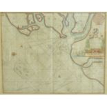
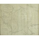
After Greenvile Collins (British 1643-1694): 'Harwich Woodbridge and Handfordwater with the Sands f
After Greenvile Collins (British 1643-1694): 'Harwich Woodbridge and Handfordwater with the Sands from the Nazeland and to Hosely Bay', hand-colo...