Filtered by:
- Category
- List
- Grid
A subscription to the Price Guide is required to view results for auctions ten days or older. Click here for more information
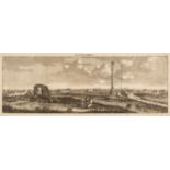

Bruyn (Cornelius de). 11 engraved plates from various works, including from Reizen over Moskovie, door Persie en Indie... c.1700, 11 copper-engrav...
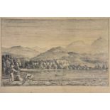
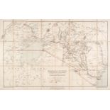
* Mexico & North America. San Blas from the river (West coast of Mexico), circa 1850, & 2 others
* Mexico & North America. San Blas from the river (West Coast of Mexico), circa 1850, pencil landscape on thin cream card, titled to lower margin,...
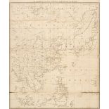
Pennant (Thomas). View of India..., China, & Japan (Outlines of the Globe, vol. 3 only), 1800
Pennant (Thomas). The View of India Extra Gangem, China, and Japan (Outlines of the Globe, volume III only), London: printed by Luke Hansard, sold...
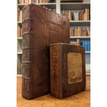
Stow (John). The Survey of London: contayning the original, increase, moderne estate, and government of that city, 4th edition, London: printed by...
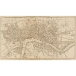
Thornton (William). The New, Complete and Universal History, Description, and Survey of the Cities of London and Westminster, The Borough of South...
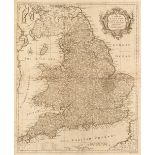
Walpoole (George Augustus). The New British Traveller; or, a complete modern universal display of Great-Britain and Ireland, London: printed for A...
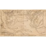
Abernethie (Thomas). A Sketch of Charleston Harbour shewing the disposition of the British Fleet under the Command of Vice Adml. Mariot Arbuthnot ...
Africa. Stanford (Edward publisher). Mombasa-Victoria (Uganda) Railway and Busoga Railway, Printed by the Ordnance Survey office for the War Offic...
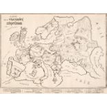
Allegorical Maps. Le Charivari (publisher), Carte de la Fraternité Européene, circa 1880, uncoloured allegorical map of Europe by Draner, very sli...
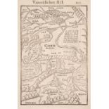
Asia Minor. Munster (Sebastian), Untitled map, Basle, circa 1555, uncoloured woodblock map, with a woodblock design and French text on the verso, ...
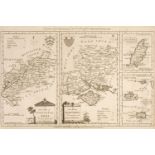
* Bedfordshire. Speed (John), Bedfordshire and the Situation of Bedford described..., circa 1710
* Bedfordshire. Speed (John), Bedford Shire and the Situation of Bedford described with the armes of those Honorable Familyes that have borne ye t...
British County Maps. A mixed collection of approximately 260 maps, 17th - 19th century, engraved and lithographic county and regional maps, town p...
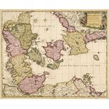
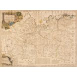
Denmark. Schenk (Petrus), Dania Regnum Ducatus Holsatia. et Slesvicum Insulae Danicae et Provinciae Jutia Scania etc. Amsterdam, 1706, engraved re...
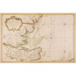
English Channel. De Hooghe (R.), Carte Maritime de L'Angleterre depuis les Sorlingues jusques a Portland..., Pierre Mortier, Amsterdam, 1693, larg...
Folding Maps. Seven Folding Maps, late 19th & early 20th century, including, Juta (J. C.). Juta's Map of South Africa from the Cape to the Zambesi...
Foreign Maps. A mixed collection of approximately 65 overseas maps, mostly 17th - 19th century
Foreign Maps. A mixed collection of approximately 65 overseas maps, 17th - 19th century, engraved and lithographic maps, many with contemporary ou...
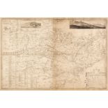
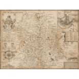
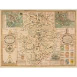
Hampshire & Dorset. Kitchin (Thomas & Bowen Emanuel). A New Improved Map of Hampshire from the best Surveys & Intelligences, Divided into its Hund...
Kent. Symonson (Philip), A New Description of Kent ... the tractes of Ryuers, Rylles and creeks, with the trendinge of the sea-shore be more natur...
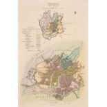
London. Cole (B.), A collection of 6 ward plans, circa 1760, engraved maps, 3 with later hand-colouring, 2 trimmed to plate mark and laid on later...
* Madagascar. Bellin (Jacques Nicolas), Carte de l'Isle de Madagascar dressée au Depost des Cartes, Plans et Journaux de la Marine..., Depot de la...
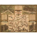
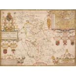
Middlesex. Speed (John), Midle-Sex described with the most famous Cities of London and Westminster, 1st edition, George Humble, 1611, hand-coloure...
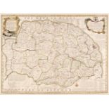
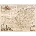
Norfolk. & Suffolk. Bowen (Emanuel), An Accurate Map of the County of Norfolk Divided into Hundreds and drawn from Surveys..., 1st edition, J. Tin...
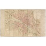
Paris. Picquet (Charles), Plan Routier de la Ville de Paris Divisé en XII Arrondissements ou Mairies et en 48 Quartiers..., Paris, 1814, large sca...
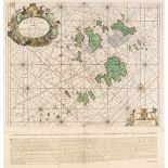
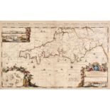
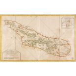
Scilly Isles. Collins (Capt. Greenville), The Islands of Scilly..., circa 1700, hand-coloured engraved sea chart, large decorative cartouche, comp...
Seale (R. W.). A collection of 13 maps, circa 1745, uncoloured engraved double-page maps, charts and town plans, slight spotting, each approximate...
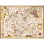
* Shropshire. Speed (John), Shropshyre described. The Sittuation of Shrowesbury shewed with the Armes of those Earles and other memorable things o...
Somerset & Gloucestershire. Bowen (Emanuel), An Improved Map of the County of Somerset Divided into its Hundreds..., [and] An Accurate Map of the ...
* Staffordshire. Speed (John), Stafford Countie and Towne with the ancient Citie Lichfeild described, Thomas Bassett & Richard Chiswell [1676], un...
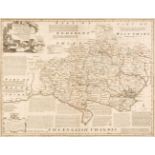
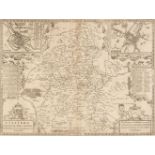
Surrey & Kent. Bowen (Emanuel), An Accurate Map of the County of Surrey Divided into its Hundreds..., Carington Bowles & Robert Sayer, circa 1765 ...
Thames Estuary. Bellin (Jacques Nicolas), Carte des Entrees de la Tamise..., Paris, 1759, hand-coloured engraved sea chart, large strapwork cartou...
* Warwickshire. Speed (J.), The Counti of Warwick..., Thomas Bassett & Richard Chiswell, 1676
* Warwickshire. Speed (John), The Counti of Warwick. The Shire Towne and City of Coventre described, Thomas Bassett & Richard Chiswell [1676], han...
Worcestershire. Speed (John), Worcestershire Described, J. Sudbury & G. Humble, circa 1627 - 32
Worcestershire. Speed (John), Worcestershire Described, John Sudbury & George Humble [1627 - 32], hand-coloured engraved map, an inset town plan o...
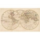
World. Carington Bowles (publisher), A New and Accurate Map of the World from the latest Surveys, circa 1770, engraved map on a hemispheral projec...
* Honervogt (Jacques). Pourtraicts de Tous les Roys D'Angleterre, de puis Brutus Ivsques AV Roy Jacques Premier DV nom a present Regnant, Paris, c...