Filtered by:
- Sale Section
- List
- Grid
A subscription to the Price Guide is required to view results for auctions ten days or older. Click here for more information
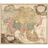

Asia. Homann (Johann Baptist), Asiae Recentissima Delineatio qua Status et Imperia Totius Orientis Unacum Orientalibus Indiis Exhibentur, Nurember...
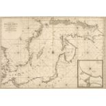
* Baltic Sea. Jaillot (Alexis Hubert), Carte de la Mer Baltique Contenant les Bancs, Isles et Costes Comprises entre l'Isle de Zelande et l'Extrem...
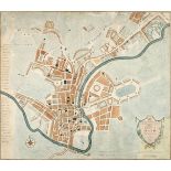
Bath. Hancock (Robert, 1730/31-1817). A New and Accurate Plan of the City of Bath to the Present Year, Bath, A. Taylor and W. Meyler, 1795, hand-c...
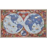
Boucher (Lucien, 1889 - 1971). Air France. Sur les Ailes d'Air France Decouvrez le Monde a Votre Tour, printed by Perceval, Paris, circa 1950, col...
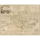
Bowen (Emanuel). An Accurate Map of Dorsetshire divided into Hundreds. Drawn from the best authorities..., An Accurate Map of Cambridgeshire divid...
British maps. A mixed collection of approximately 175 country, county, regional, road and railways maps and town plans, 18th & 19th century, engra...
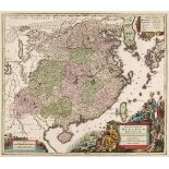
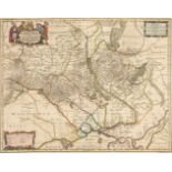
China. Seutter (George Matthaus), Opulentissimum Sinarum Imperium..., Augsburg, circa 1740, engraved map with contemporary hand colouring and some...
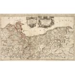
* Danzig/Gdansk. Wolff (Johann Peter), Dantzig, circa 1730, engraving with contemporary hand colouring, key below image identifying 42 locations, ...
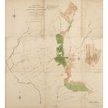
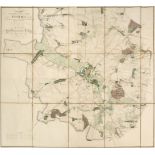
Epping Forest. Plan of Waste Lands in the Northern Portion of Epping Forest in the County of Essex [and] Plan of Waste Lands in the Southern Porti...
Ewing (Thomas). Ewing's New General Atlas; containing Distinct Maps of all the Principal States and Kingdoms throughout the World; A New edition i...
Folding Maps. A collection of fourteen maps, atlases and guide books, mostly 19th century, including Bowen (Emanuel). An Accurate Map of the Count...
Forest of Dean. Atkinson (John), Plan of Her Majesty's Forest of Dean, in the County of Gloucestershire, with High Meadow and Great Doward Woods b...
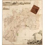
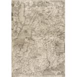
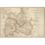
Gloucestershire. Taylor (Isaac), To the Subscribers in General and more Particularly to those Noblemen and Gentlemen who honoured me with their As...
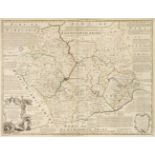
Leicestershire. Bowen (Emanuel), An Accurate Map of the Counties of Leicester and Rutland divided into their respective Hundreds..., R. Sayer & Ca...
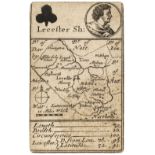
Leicestershire. Morden (Robert), Lecester Sh: Playing card map, circa 1676, uncoloured engraved 'playing card map' with the suit mark of clubs and...
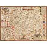
* Leicestershire. Speed (John), Leicester both Countye and Citie described, The Honorable Famylies that have had the titles of Earls thereof. With...
* Lithuania. Hondius (Henricus). Magni Ducatus Lithuaniae..., Amsterdam, circa 1640, engraved map with contemporary outline colouring, inset map o...
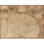
* Norfolk. Speed (John), Norfolk a Countie florishing & populous described and devided with the armes of such noble familes as have borne the titl...
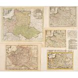
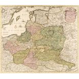
Poland. A collection of ten maps, 18th century, ten hand-coloured engraved maps, including Weigel (Christopher). Poloniae & Lithuania accurante cu...
* Poland. Braun (Georg & Hogenberg Franz). Cracovia Metropolis Regni Poloniae, Cologne, [1617 or later], hand coloured large engraved city panoram...
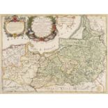
* Poland. Cluver (Philip), Prussiae Nova Tabula, Amsterdam, circa 1697 - 1729, hand coloured map, engraved by John Harris, with another five versi...
* Poland. D'Avignon (Francais Ferdinand), Plan des Environs de Kalisz levé sous les ordres du Capitaine en Second de l'Etat, Major Bergenstrole, P...
* Poland. De Wit (Frederick), Reipublicae et Status Generalis Poloniae Nova Tabula, Comprehendens Maioris et Minoris Poloniae Regni, Magni Ducatus...
* Poland. Gastaldi (G.), Il Disegno de Geografia Moderna del Regno di Polonia, e Parte del Ducado di Moscovia, con parte della Scandia, e parte de...
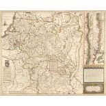
* Poland. Homann (Johann Baptiste, heirs of), Comitatus Glaciensis tabula..., Nuremberg, 1747, engraved map with contemporary hand colouring and s...
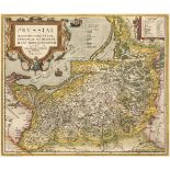
* Poland. Homann (Johann Baptist), Regnum Borussiae..., Nuremberg, circa 1710, engraved map with contemporary hand colouring and some later enhanc...
Poland. Hondius (Jodocus & Purchas, Samuel), Polonia et Silesia, circa 1625, hand-coloured engraved map, English text below and on verso, addition...
* Poland. Jaillot (Alexis Hubert), Estats de Pologne Subdivisés suivant l'estendue des Palatinats par le Sr. Sanson...., Paris,1692, large engrave...
* Poland. Jaillot (Alexis), Le Duche de Pomeranie Divise en ses Principales Parties..., 1696
* Poland. Jaillot (Alexis Hubert), Le Duche de Pomeranie Divise en ses Principales Parties..., Paris, 1696, large engraved map on two conjoined sh...
* Poland/Pomerania. Ortelius (Abraham), Pomeraniae Wandalicae Regionis Typ, [on sheet with] Livoniae Nova Descriptio [and] Ducatus Oswieczensis, e...
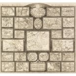
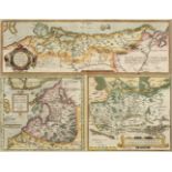
* Poland. Tableau des Guerres de Frederic Le Grand, Berlin, 1788, engraved tableau showing 27 maps depicting the battles of Frederic the Great, ea...
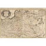
* Poland. Von Reilly (Joseph). Karte von Polen nach Sotzmann, Wein, 1796, large engraved map with contemporary hand colouring, old folds, 575 x 71...
* Prussia. Cantelli da Vignola (Giacomo), La Prussia Divisa in Reale che Appartiene al Re di Polonia et in Ducale che Spetta all'Elettore di Brand...
* Prussia. Ortelius (Abraham), Prussiae Regionis Sarmatiae Europae Nobiliss. Vera et Nova Descriptio, circa 1595, hand-coloured engraved map after...
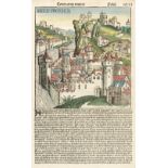
Schedel (Hartmann). Anglie Provincia, [1493], hand coloured woodblock of an imaginary view of an English town, Latin text below image, the verso h...
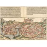
Schedel (Hartmann). Cracovia, 1493, hand-coloured double-page woodblock plan with Latin text above the image, with additional text and a view of L...
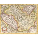
* Silesia. Cantelli da Vignola (Giacomo), Il Ducato di Silesia et il Marchesato di Moravia descritti su L'Esemplare delli Carte migliori, e con la...
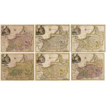
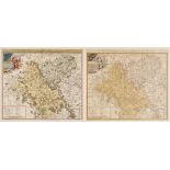
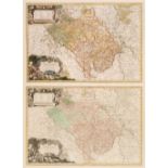
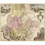
Silesia. Homann (Johann Baptist & Sotzmann D. F.), Das Fürstenthum Liegnitz oder der Liegnitzsche Lübensche und Goldberg-Haynauische Kreis..., Das...
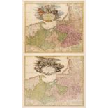
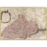
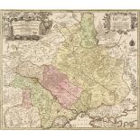
* Silesia. Homann (Johann Baptist, heirs of), Principatus Silesiae Oppaviensis novissima tabula geographica, Nuremberg, circa 1750, large engraved...
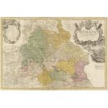
Silesia. Homann (Johann Baptist, heirs of), Principatus Silesiae Oppoliensis exactissima Tabula geographica..., Nuremberg, circa 1750, engraved ma...
* Silesia. Schenk (Petrus), Ducatus Silesiae Lauranus Aut: Frid Khunovio, Amsterdam, circa 1700, engraved map with contemporary hand colouring and...
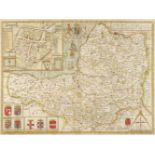
Somerset. Speed (John), Somerset-Shire described: and into Hundreds devided with the plott of the famous and most wholsom waters and citie of the ...
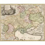
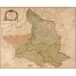
* Ukraine. Homann (Johann Baptist), Ukrania quae et Terra Cosaccorum cum Vicinis Walachiae, Moldaviae, Minorisq, Tartariae Provinciis Exhibita, Nu...
* Ukraine. Lotter (T. C.), Amplissima Ucraniae Regio, Palatinatus Kioviensem et Braclaviensem Complectens, Augsburg, circa 1740, engraved map with...
* Ukraine. Pitt (Moses), Typus Generalis Ukrainae sive Palatinatuum Podoliae, Kioviensis et Braczlaviensis terras nova delineatione exhibens circa...
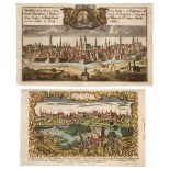
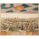
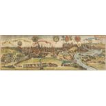
Warsaw. (Muller Gottfried, publisher), Warschau, circa 1799, hand-coloured engraved panorama, German text below image, 180 x 265 mm, together with...