Refine your search
Sale Section
- Antiquarian Literature and History (65)
- Art Reference (20)
- Autographs and Association Items (57)
- British Topography (The David Wilson Library Part III) (18)
- Civil Engineering, Transport and Topographical Panoramas from the Davi (59)
- Decorative Prints (82)
- General Literature (25)
- General Stock (53)
- Historical Documents and Ephemera (17)
- Maps (85)
- Modern Chess Books: A Private Collection (14)
- Natural History (21)
- Nelson and the Age of Revolution (17)
- Scotland, Highlands and Islands (50)
- Travel & Exploration (17)
Estimate
Category
- Books & Periodicals (313)
- Prints (151)
- Maps (84)
- Arms, Armour & Militaria (21)
- Photographs (5)
- Watercolours (5)
- Collectables (4)
- Sporting Memorabilia & Equipment (4)
- Bank notes (2)
- Chinese Works of Art (1)
- Classic Cars, Motorcycles & Automobilia (1)
- Coins (1)
- Furniture (1)
- Islamic Works of Art (1)
- Kitchenalia (1)
- Models, Toys, Dolls & Games (1)
- Musical Instruments & Memorabilia (1)
- Russian Works of Art (1)
- Sculpture (1)
- Silver & Silver-plated items (1)
Filtered by:
- Item Type
- List
- Grid
A subscription to the Price Guide is required to view results for auctions ten days or older. Click here for more information
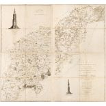

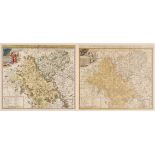
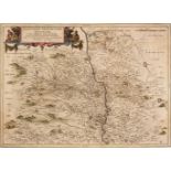
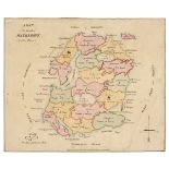
Northamptonshire. Faden (Robert), The County of Northampton as Surveyed and Planned by the late Mr Thomas Eyre of Kettering, Revised by the late M...
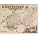
Northamptonshire. Greenwood (C & J), Map of the County of Northampton, from an actual survey made in the years 1825 & 1826..., Greenwood, Pringle ...
* Northern Europe. Du Val (Pierre), Les Royaumes du Nort c'est a Dire le Danemarq la Suede et la Pologne..., Paris, circa 1660, engraved map with ...
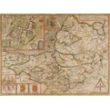
Nottinghamshire. Speed (John), The Countie of Nottingham described, The Shire Townes situation and the Earls thereof observed, John Sudbury & Geor...
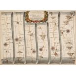
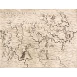
Ogilby (John). The Continuation of the Road from London to St. Davids, commencing at Abington com. Berks and extending to Monmouth, circa 1675, ha...
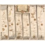
Ogilby (John). The Road from Bristol com. Gloc. to West Chester [and] The Road from the City of Salisbury com. Wilts to Campden com Gloc, circa 16...
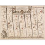
Ogilby (John). The Road from London to Buckingham Continued to Banbury in Com. Oxon. circa 1675, hand-coloured engraved strip road map, commencing...
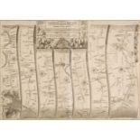
Ogilby (John). The Road from London to the City of Bristol, circa 1675, uncoloured engraved strip road map, some fraying to the vertical margins, ...
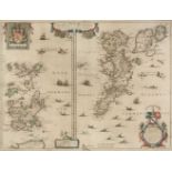
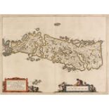
* Orkney & Shetland Islands. Blaeu (Willem Janszoon), Orcadum et Schetlandiae Insularum accuratissima descriptio, Amsterdam, circa 1650, two engra...
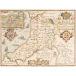
* Oxfordshire. Speed (John), Oxfordshire described with ye Citie and the Armes of the Colledges of yt famous University..., circa 1627, hand-colou...
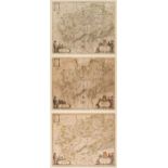
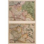
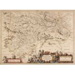
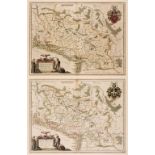
* Poland. Blaeu (Guillaume & Joan), Comitatus Glatz authore Jona Sculteto, Amsterdam, circa 1640, three engraved maps with contemporary outline co...
* Poland. De Fer (N.), Les Etats de la Couronne de Pologne sous les quels sont Compris la Grande et la Petite Pologne, le Grand Duche de Lithuanie...
* Poland. Homann (Johann Baptiste, heirs of), Comitatus Glaciensis tabula..., Nuremberg, 1747, engraved map with contemporary hand colouring and s...
* Poland. Ortelius (Abraham), Poloniae Finitimarumque Locorum Descriptio Auctore Wenceslao Godreccio Polono, [1581], engraved map with contemporar...
Pomerania. De Jode (Cornelis), Pomeraniae utriusq Continentis..., [on sheet with] Thietmarsorum Simbricae Schersonesi Populorum ... [and] Prussiae...
Pomerania. Mercator (G.), Marca Brandenburgensis & Pomerania, circa 1595, engraved map of North-East Germany with contemporary hand-colouring heig...
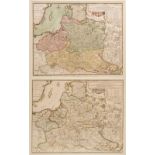
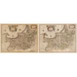
Prussia. A collection of seven maps, 17th century, seven engraved maps including examples by Mercator/Pufendorf, Eickovius (Quad), Mercator/Hondiu...
* Prussia. Blaeu (W. J.), Prussia Accurate Descripta a Gasparo Henneberg Erlichensi, circa 1645
* Prussia. Blaeu (Willem Janszoon), Prussia Accurate Descripta a Gasparo Henneberg Erlichensi, Amsterdam, circa 1645, engraved map with contempora...
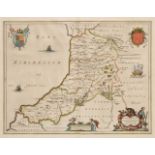
* Radnorshire. Speed (John), The Countie of Radnor described and the Shyre Townes sittuatione, John Sudbury & George Humble, circa 1627, hand-colo...
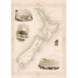
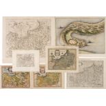
Rapkin (J. engraver). Nine maps, New Zealand, Europe, France, United States, Spain and Portugal, Russia in Europe, Nova Scotia and Newfoundland, B...
Scotland. Blaeu (Johannes & Pont Timothy), Scotiae Provinciae Mediterraneae inter Taum Flumen et Cararis Aestuarium: Sunt autem Braid-Allaban, Ath...
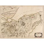
Scotland. Blaeu (Johannes & Pont Timothy), Moravia Scotiae Provincia..., Amsterdam, circa 1654, engraved map with contemporary outline colouring, ...
Scotland. Blaeu (Johannes & Pont Timothy), Glottiana Praefectura Superior, The Upper Ward of Clyds-Dale, Amsterdam [1654 - 62], engraved map with ...
Scotland. Blaeu (Johannes & Pont Timothy), Lidalia vel Lidisdalia Regio, Lidisdall, Amsterdam, circa 1654, engraved map with contemporary outline ...
Scotland. Blaeu (Johannes), Glottiana Praefectura Inferior cum Baronia Glascuensi. The Nether Warde of Clyds-Dail and Baronie of Glasco, Amsterdam...
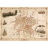
Scotland. Tallis (John), Edinburgh [and] Glasgow, 1851, two hand-coloured engraved decorative city plans, each with a closed marginal tear, each a...
Scottish Islands. Blaeu (Johannes & Pont Timothy), Leogus et Haraia insulae ex Aebudarum numero quae quamquam isthmo cohaereant pro diversis haben...
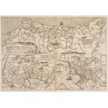
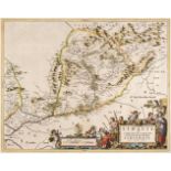
Silesia. A collection of eleven maps, 17th century, engraved maps, including examples by Eichovius (Quad), Bertius, Mercator/Hondius, Boisseau (pu...
* Silesia. Blaeu (Willem Janszoon), Silesia Ducatus, Amsterdam, circa 1640, engraved map with contemporary hand colouring, slight toning to centra...
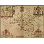
Somerset. Speed (John), Somerset-Shire described and into Hundreds devided. With the plott of the famous and most wholsom waters and citie of Bath...
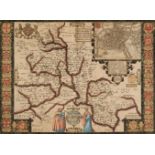
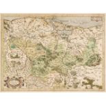
Staffordshire. Drayton (Michael), Allegorical map of Staffordshire and part of Shropshire, 1613 or later, uncoloured engraved allegorical map, sli...
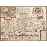
Sussex. Speed (John), Sussex described and divided into Rapes with the situation of Chichester the cheife Citie thereof, and the armes of such Nob...
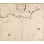
Sussex. van Keulen (Gerard), A new gradually encreasing Compass- Map of part of the Sea Coasts of England in which is contined the Coasts of Susse...
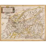
Switzerland. A collection of 12 maps, 16th - 18th century, engraved and woodblock maps, including examples by De Fer, Bertius, Mercator/Hondius, M...
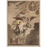
Thomson (John, publisher). A Map of the Island of Matrimony, circa 1820, engraved allegorical map with contemporary outline colouring, two repaire...
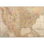
United States. Rand, McNally & Co's New Official Railroad map of the United States with portions of The Dominion of Canada, The Republic of Mexico...
Wales. Blaeu (Johannes). Penbrochia Comitatus et Comitatus Caermaridunum, Amsterdam, circa 1648, engraved map with contemporary outline colouring,...
Wales. Blaeu (Johannes), Ceretica sive Cardiganensis comitatus Anglis Cardiganshire, Comitatus Brechiniae Breknoke, Radnoria Comitaus Radnor Shire...
Wales. Speed (John), Cardigan Shyre Described with the due forme of the Shire town as it was surveyed..., Thomas Bassett & Richard Chiswell, [1676...
* Adams (Douglas). [Deer Stalking], Stephen J. Gooden, March 1st 1892, uncoloured photogravure, proof before title, signed by the artist in pencil...
* Adams (Douglas). [Salmon Fishing], Thomas McLean, April 22nd, 1892, uncoloured photogravure, proof before title, signed in pencil by the artist ...
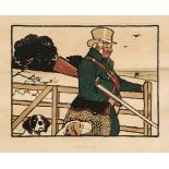
* Aldin (Cecil, 1870 - 1935). Shooting [and] Racing, Lawrence and Bullen, 1901, two chromolithographs, some staining and spotting, each approximat...
* Aldin (Cecil, 1870 - 1935). The Bell at Stilton, The White Hart at Hook, The Angel at Henley, The Bull at Dartford [and] The Maiden's Head at Uc...
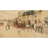
* Aldin (Cecil, 1870 - 1935). Nine prints from the 'Old Coaching Inns' series, The Angel at Henley-on-Thames (2), The Talbot at Ripley, The Pickwi...
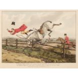
Alken (Henry). Qualified Horses and Unqualified Riders, or the Reverse of Sporting Phrases Taken from the Work Entitled Indispensible Accomplishme...
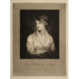
* Annis (William T., active 1798-1811). Mary Wollstonescraft Godwin, Author of Vindication of the Rights of Woman, 1802, fine mezzotint portrait b...
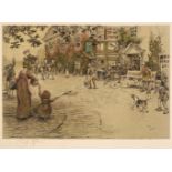
* Architecture & topography. A mixed collection of approximately 200 prints, mostly 19th & 20th century, engravings, lithographs and photomechanic...
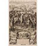
* Battle of Fraustadt (Wschowa). Les Glorieuses Conquestes de Charles I, Roy de Suede et la Grande Bataille de Frawstadt Gagnée Contre Le Roy Augu...
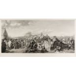
* Blanchard (Auguste). The Derby Day, E. Gambart & Co. March 2nd 1863, uncoloured engraving on India wove after William Powell Frith, proof before...
* Bristol. Clark (John Heaviside & Dubourg Matthew), The Black Rock near the Hotwells Bristol, View from Durham Down near Bristol [and] View from ...
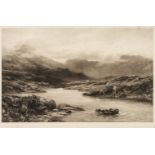
* British & Scottish topographical views. A collection of 36 views, mostly 19th century, lithographs and engravings, including Clark (T.). Stirlin...
* British topographical views. A collection of 11 engravings, mostly 18th century, etchings and engravings, including Kip (J.). Lambeth, His Grace...
* British topographical views. A collection of 23 prints & engravings, mostly 19th century, engravings and lithographs, including Bourne (J. C.). ...
* British topographical prints. A large collection of approximately 1100 prints, mostly 19th century, engravings and lithographs, mostly uncoloure...
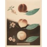
* Brookshaw (George). Five plates from 'Pomona Brittanica - A Collection of Most Esteemed Fruits', plate numbers 31, 56, 58 (2 copies) & 59, publi...
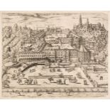
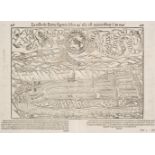
* Brussels. De Jode (Cornelis), Le Koert de Bruxelles, Antwerp, circa 1580, uncoloured etched view after Bartholomeus de Momper, trimmed to image ...
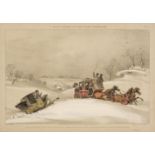
* Campion (George Bryant, 1796 - 1870). Scenes During the Snow Storm, December 1836, plates 1 - 4 (complete), Ackermann & Co., 1837, set of four l...
* Caricatures. A collection of 22 cartoons & caricatures, 18th & 19th century, etched, engraved and lithographic caricatures including Gillray (Ja...
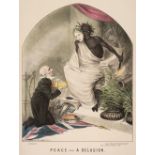
* Cartoons & caricatures. A collection of approximately 130 cartoons, late 19th century, including Simpson (V. Graham). Peace - A Delusion, Reynol...
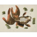
Chinese pith paintings. An album of twelve paintings of fish, circa 1850, twelve watercolour drawings of various species of fish, each tipped on t...